The Salkantay Trek is a unique four-day hike through extremely diverse scenery with destination Machu Picchu. This post covers what to expect on each day of the trekking, practical details and our overall experience.
Practical Details
- The Salkantay Trek is an amazing alternative to the famous Inca Trail. As opposed to the Inca Trail, there is no permit needed for the Salkantay Trek and therefore no limitation on the number of people.
- Even though no permit is needed, you can rest assured that the crowds on the Salkantay Trek are limited. Thanks to the natural challenges, this hike is not for everyone.
- The trail covers roughly 70 kilometers and 3,600 meters of total elevation gain, with the Salkantay Pass as the highest altitude point at 4,650 meters.
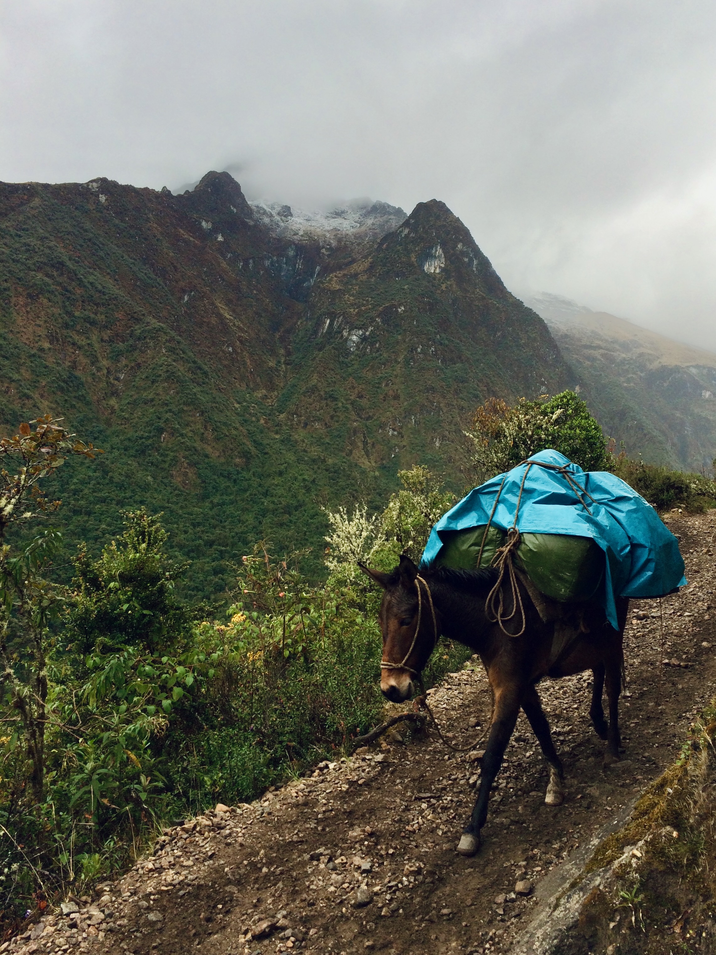
- The trek can theoretically be done without a guide, but most people opt for a tour agency to arrange lodging, food and equipment transport on the trail. We booked our trek with American Inca Trail, a professional company with good pricing ($375 USD per person in 2025).
- You can do this trekking in 4 days and 3 nights, or opt for the longer version of 5 days and 4 nights. We picked the shorter version and considered it a perfect mix between hiking and relaxing at the campsites.
- The Salkantay Trek does not arrive directly to Machu Picchu. You will sleep in Aguas Calientes the night before and hike up (or take a bus) to Machu Picchu.

Salkantay Trek by Day
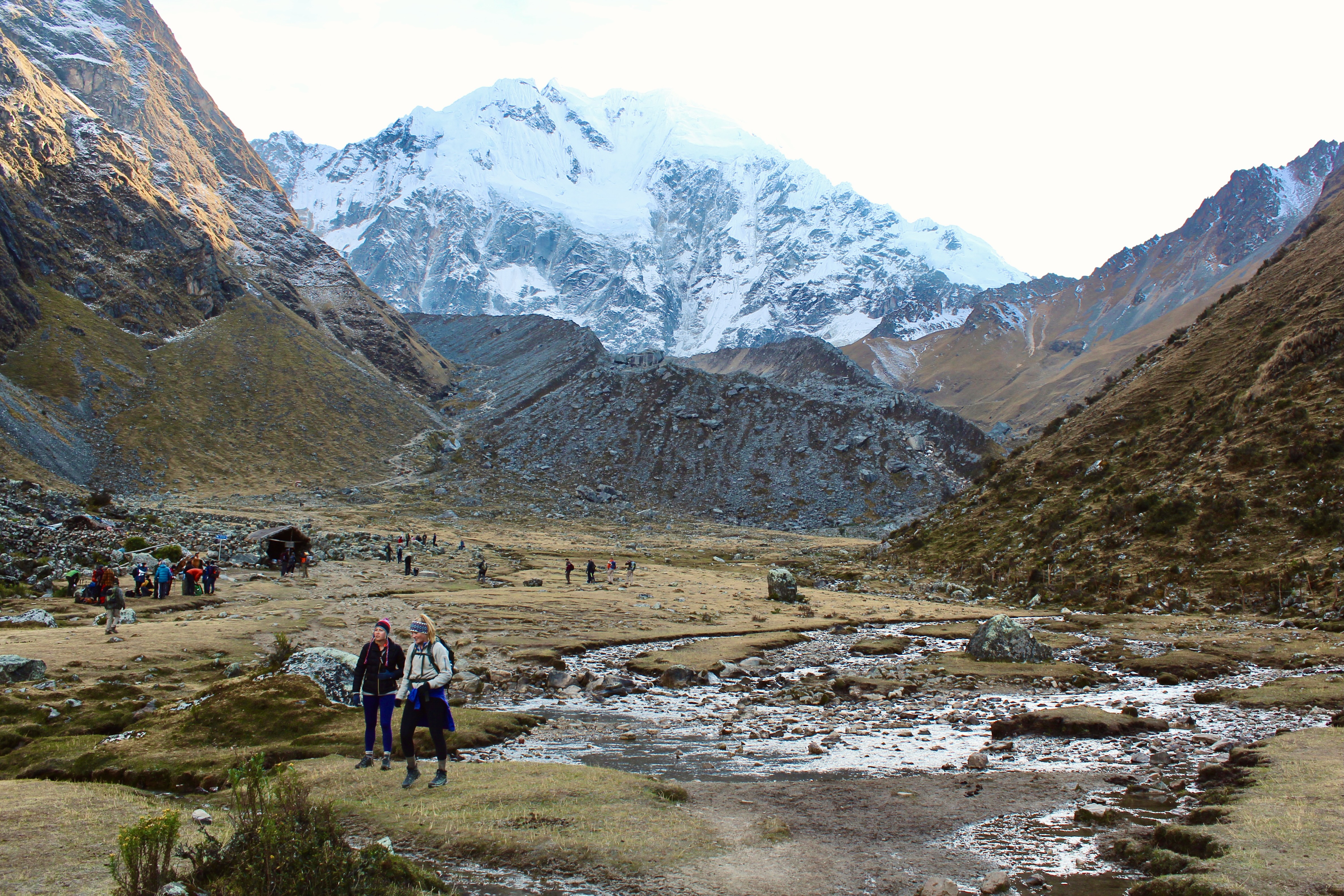
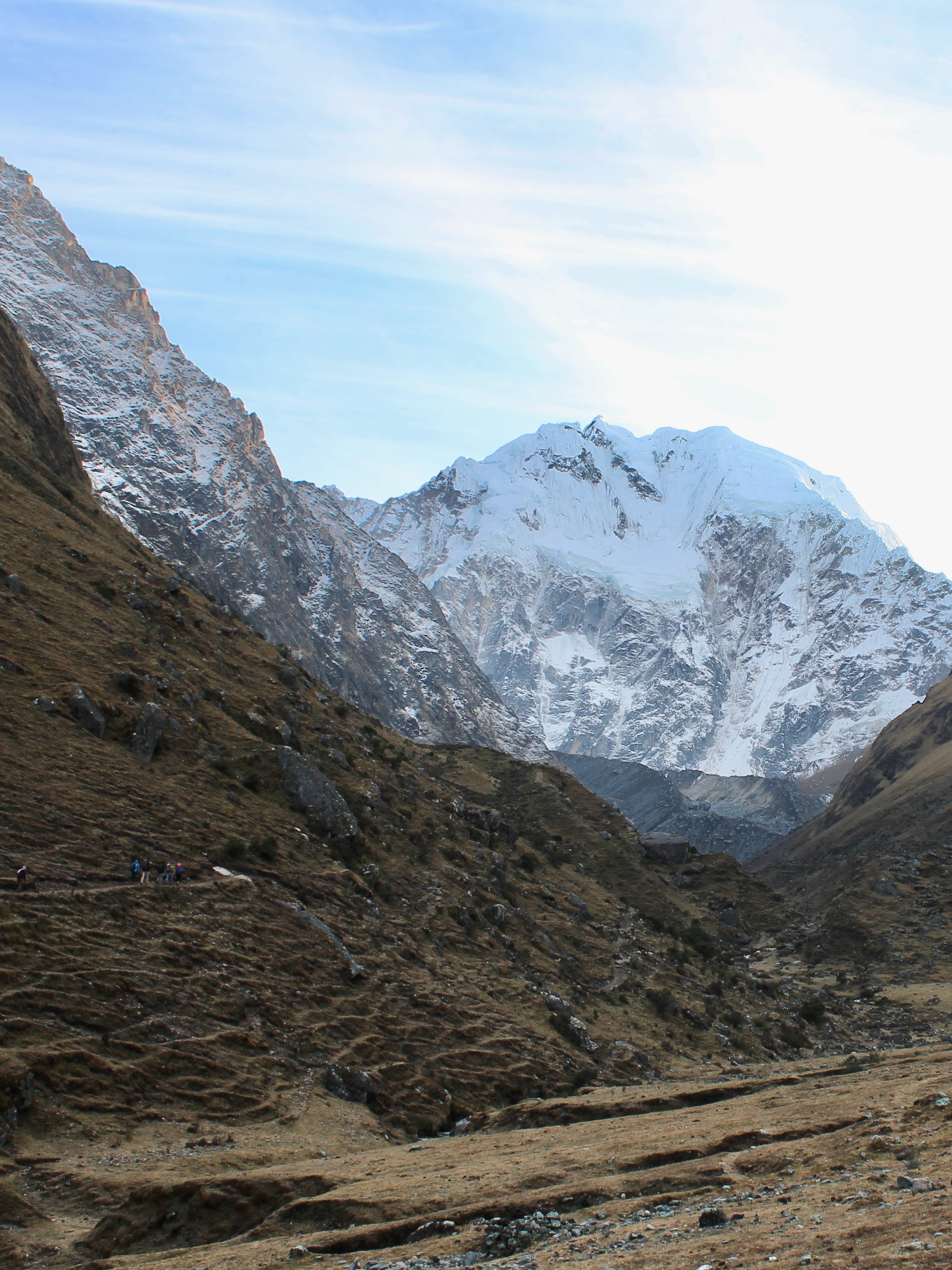
Day 1: Cusco – Chacllacancha – Soraypampa
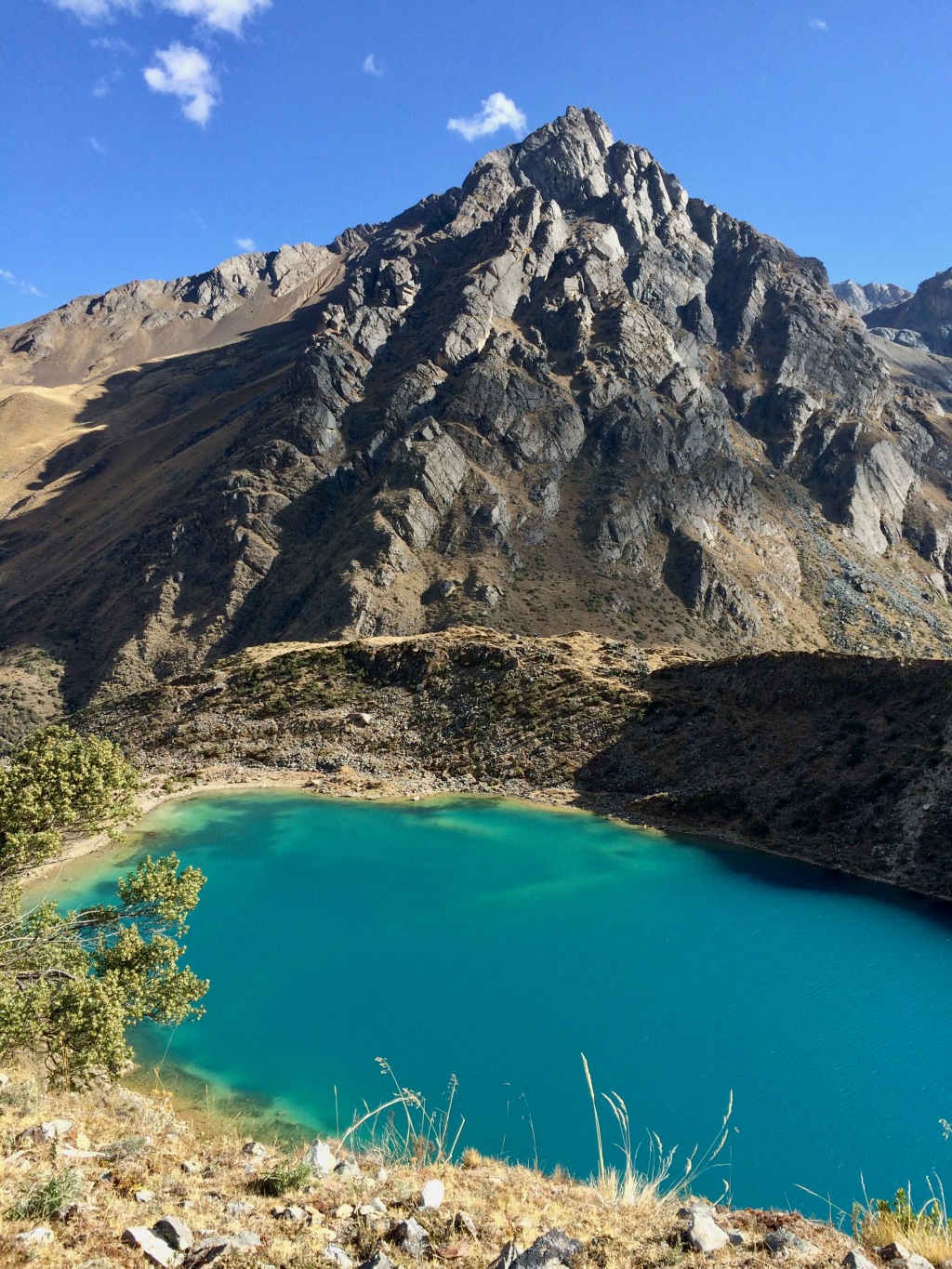
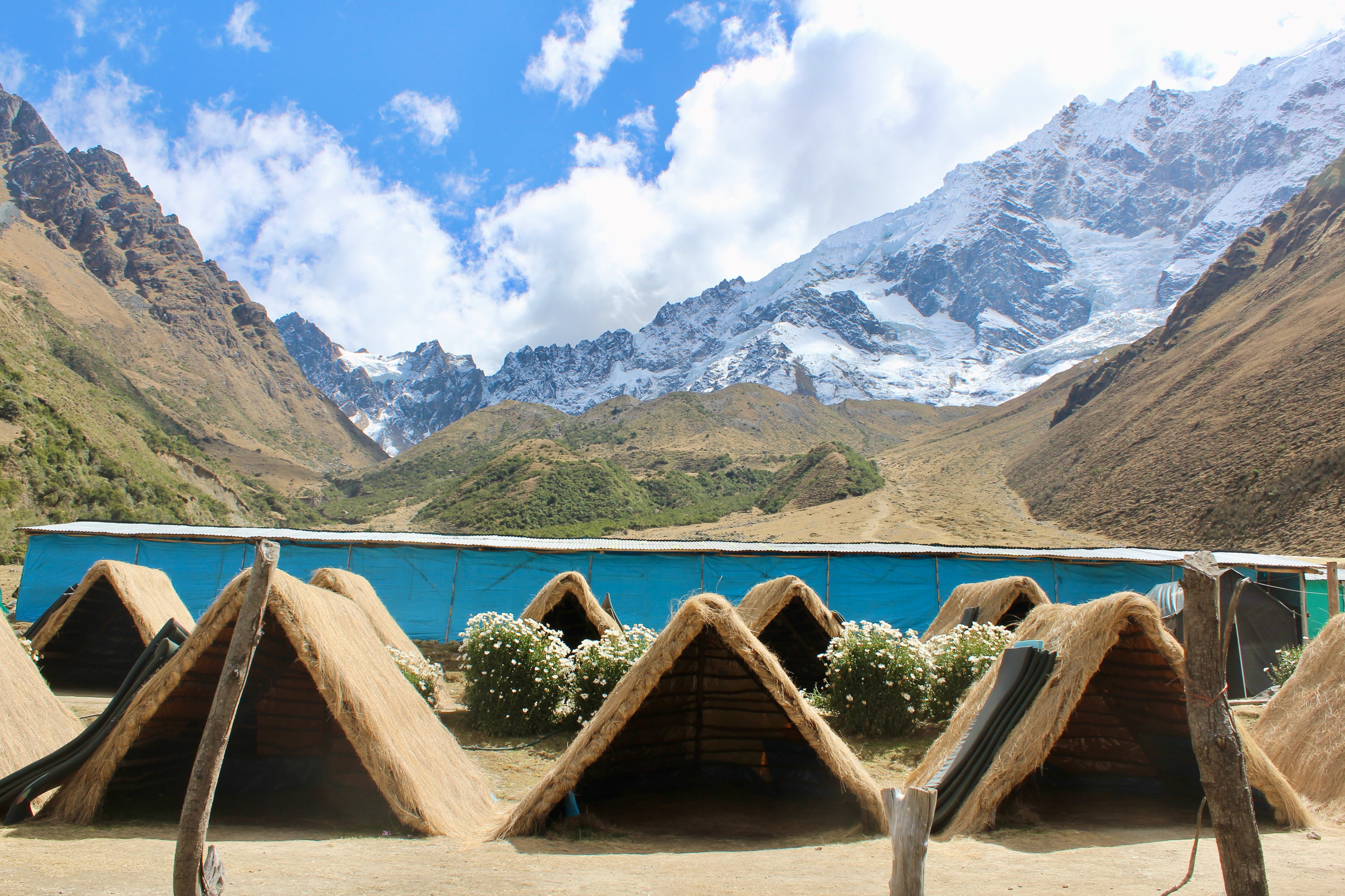
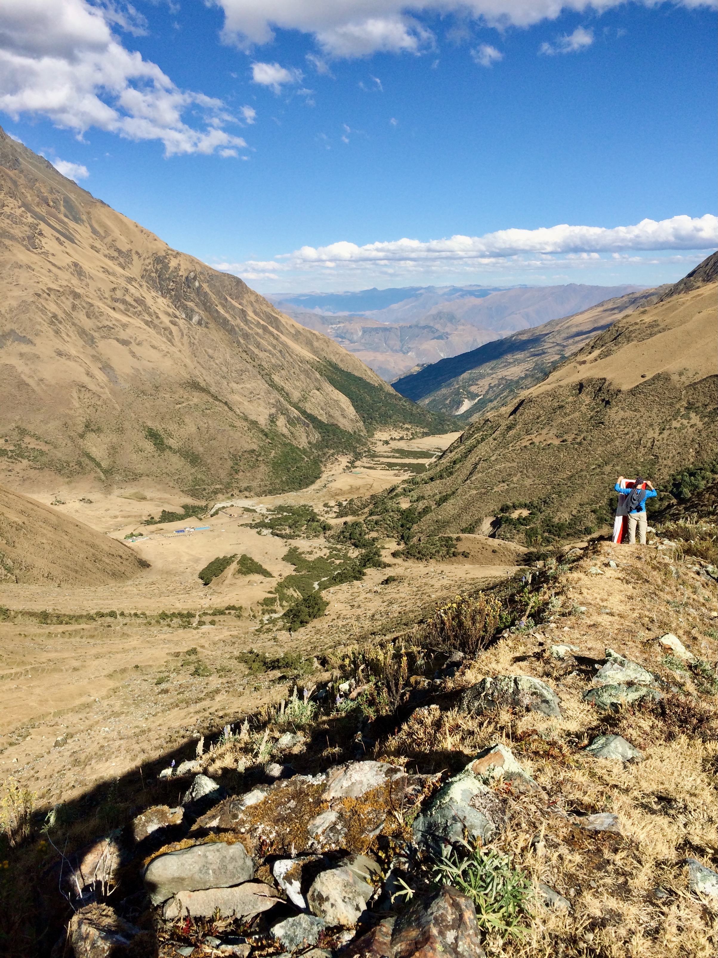
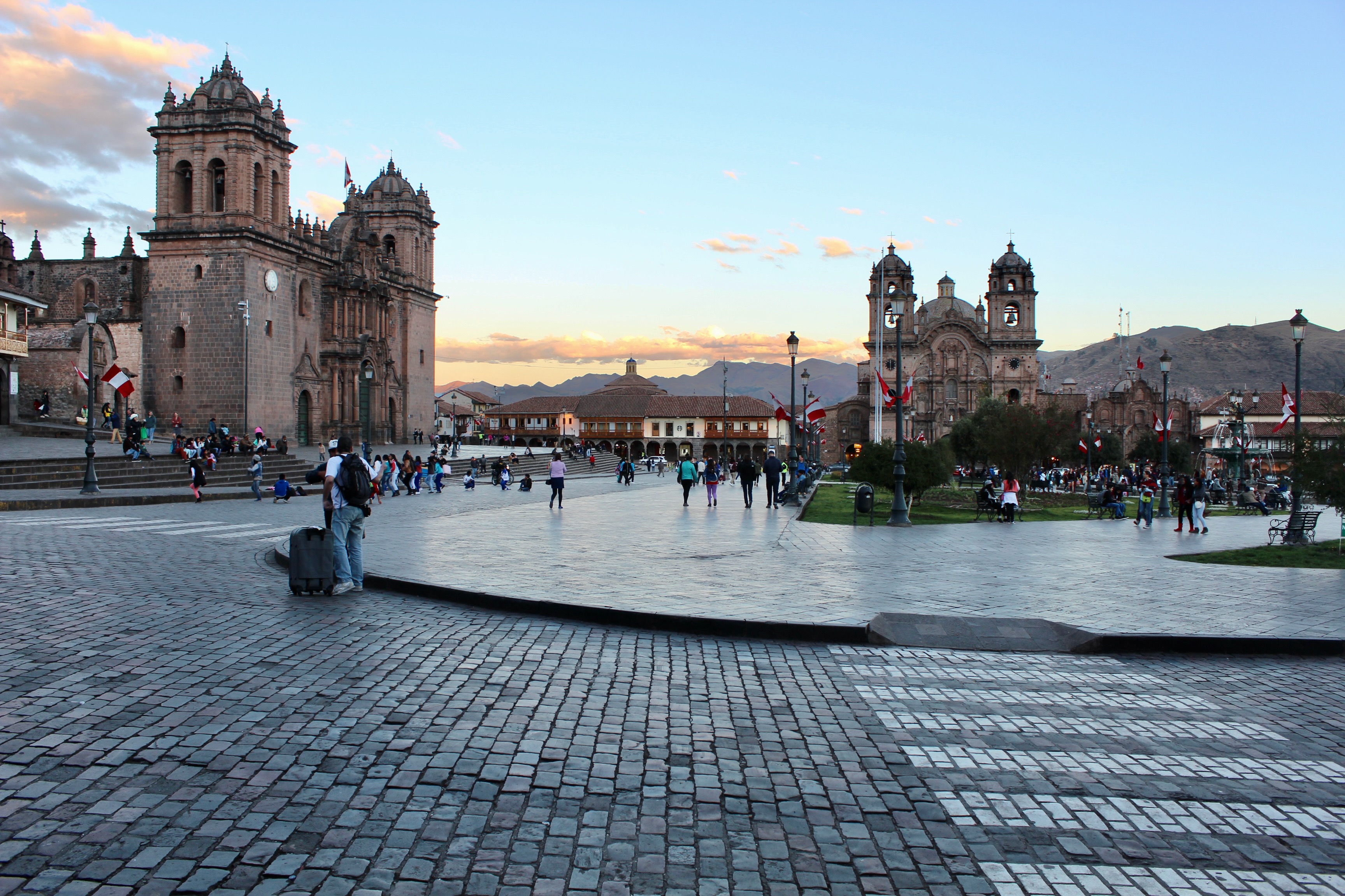
We were picked up from the Plaza de Armas in Cusco before dawn. A bumpy three-hour ride leads to the trailhead in Chacllacancha, where backpacks are loaded onto the mules and the Salkantay trek officially starts. The first campsite in Soraypampa is reached after a leisurely three-hour hike through the valley, with glimpses of the majestic Salkantay on the way. This is the only night we slept in tents, set up against a stunning mountain backdrop.
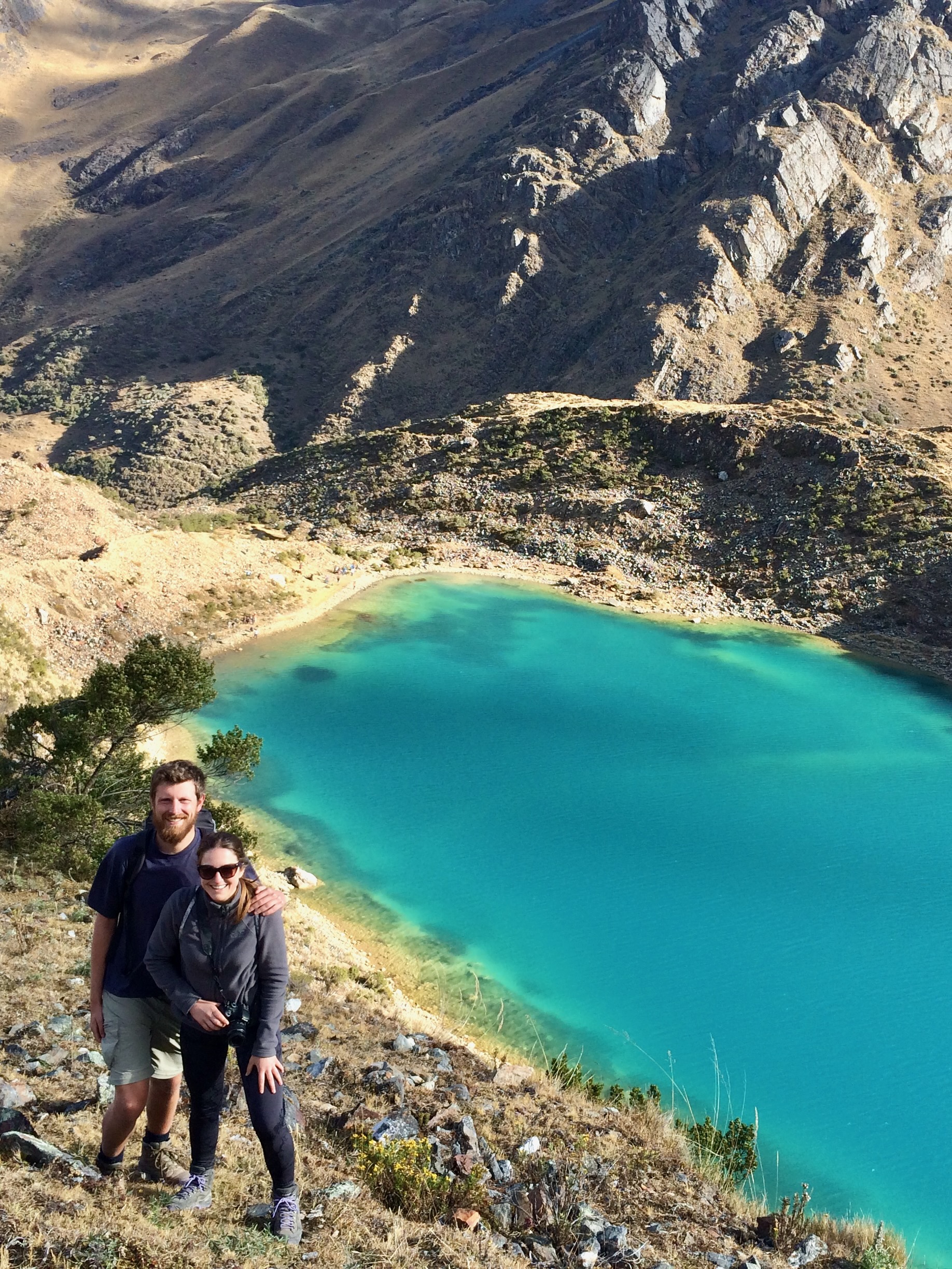
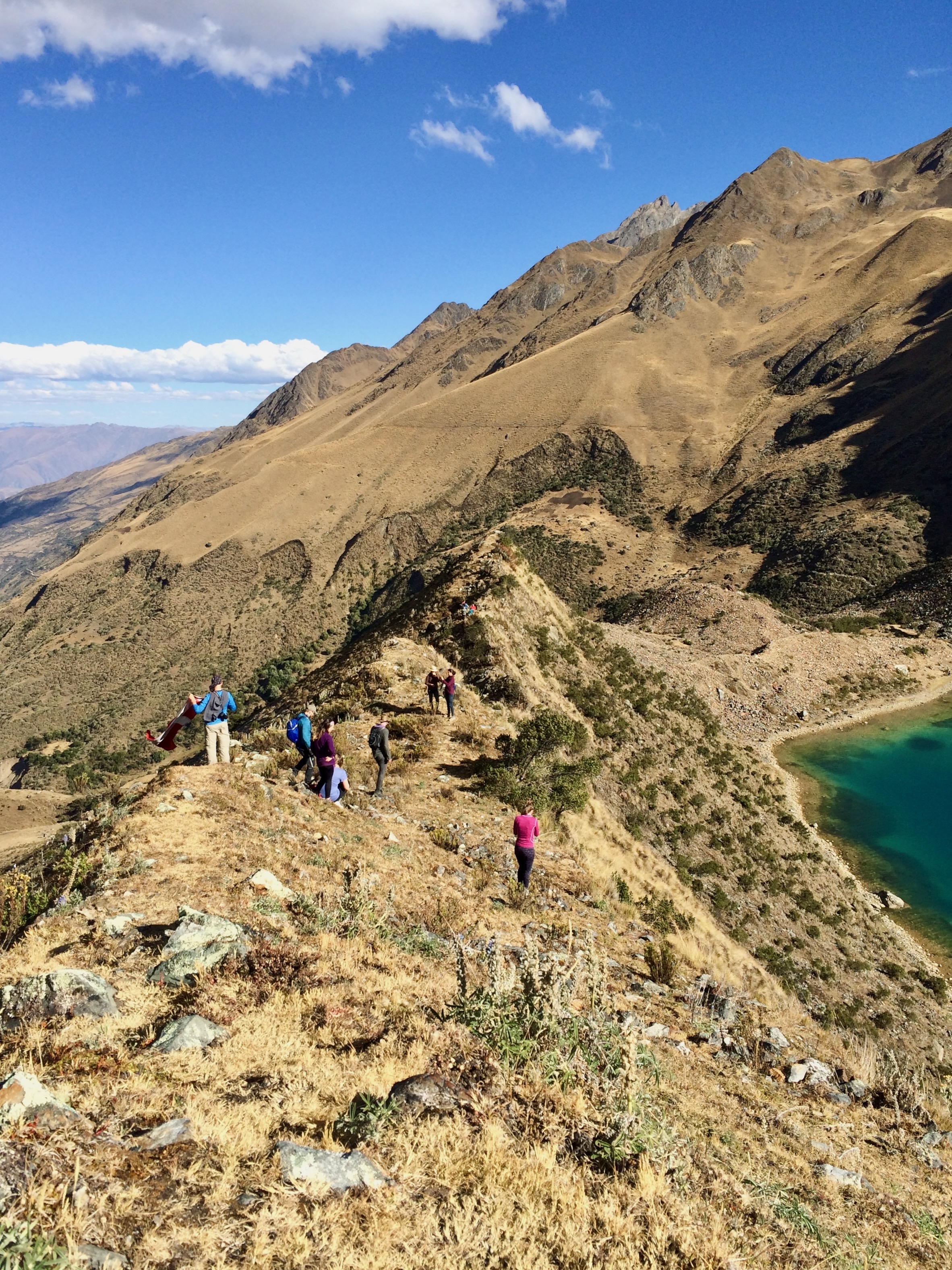
The real challenge of the day still lay ahead: an optional trail to the turquoise Humantay Lagoon starts right behind the campsite. The trail climbs to the top of a ridge that reveals the lagoon on the other side. The way down to the lagoon is through a steep slope with no marked path. This invented trail is not for the faint-hearted, but the spectacular views from above are worth it. There is a real trail that arrives directly at the bottom of the lagoon, which we followed to return to camp.
Day 2: Soraypampa – Salkantay Pass – Collpapampa
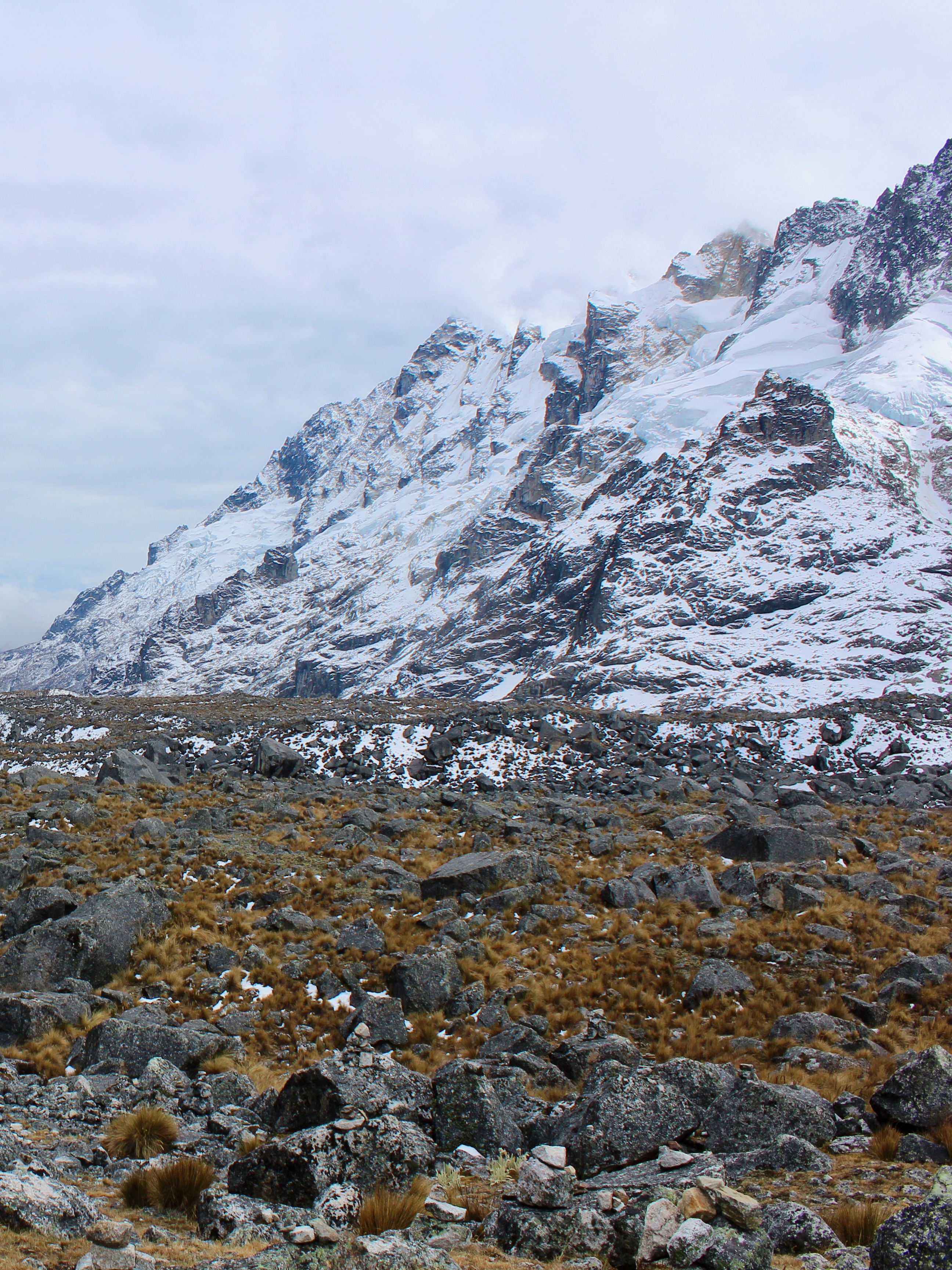
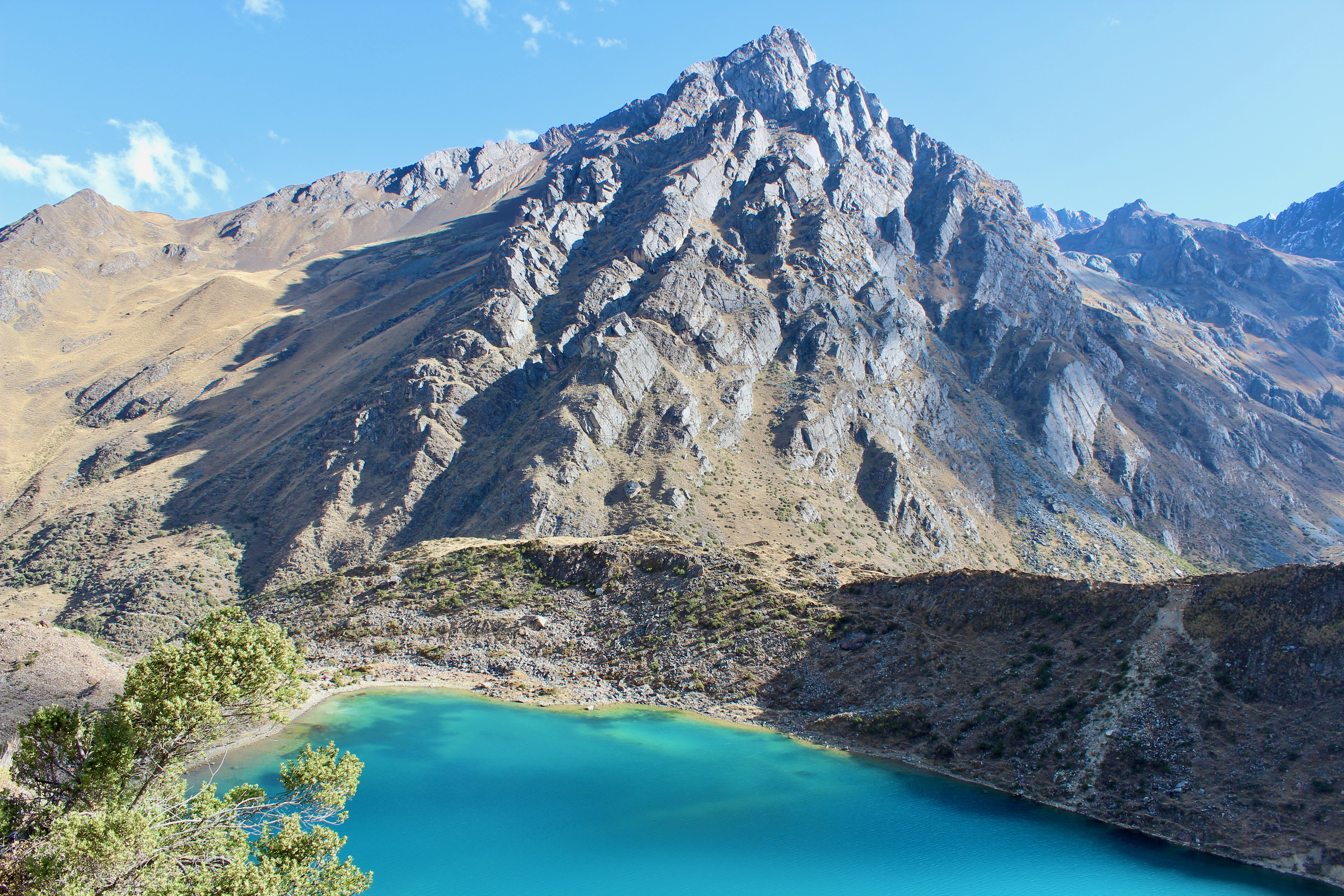
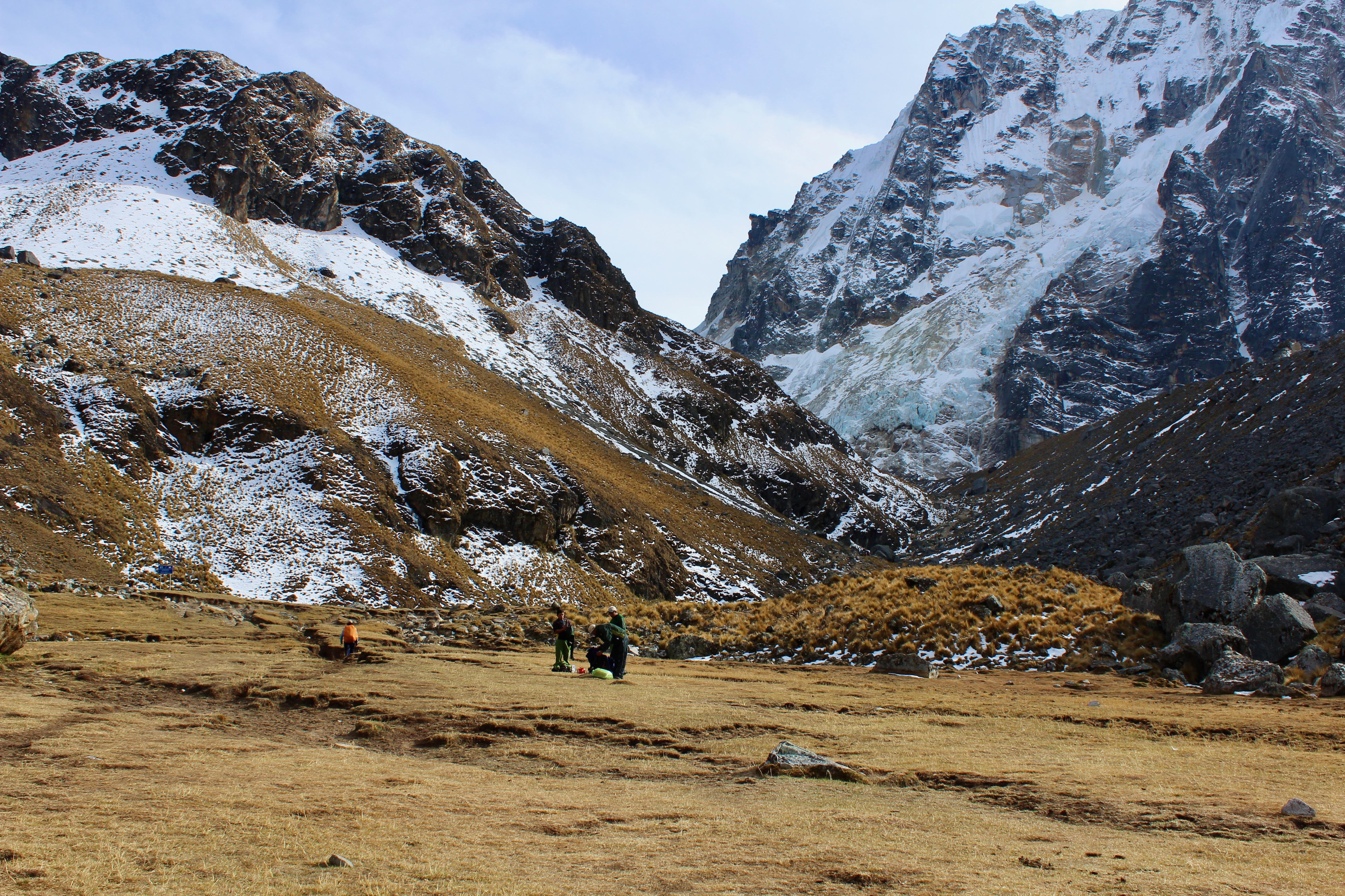
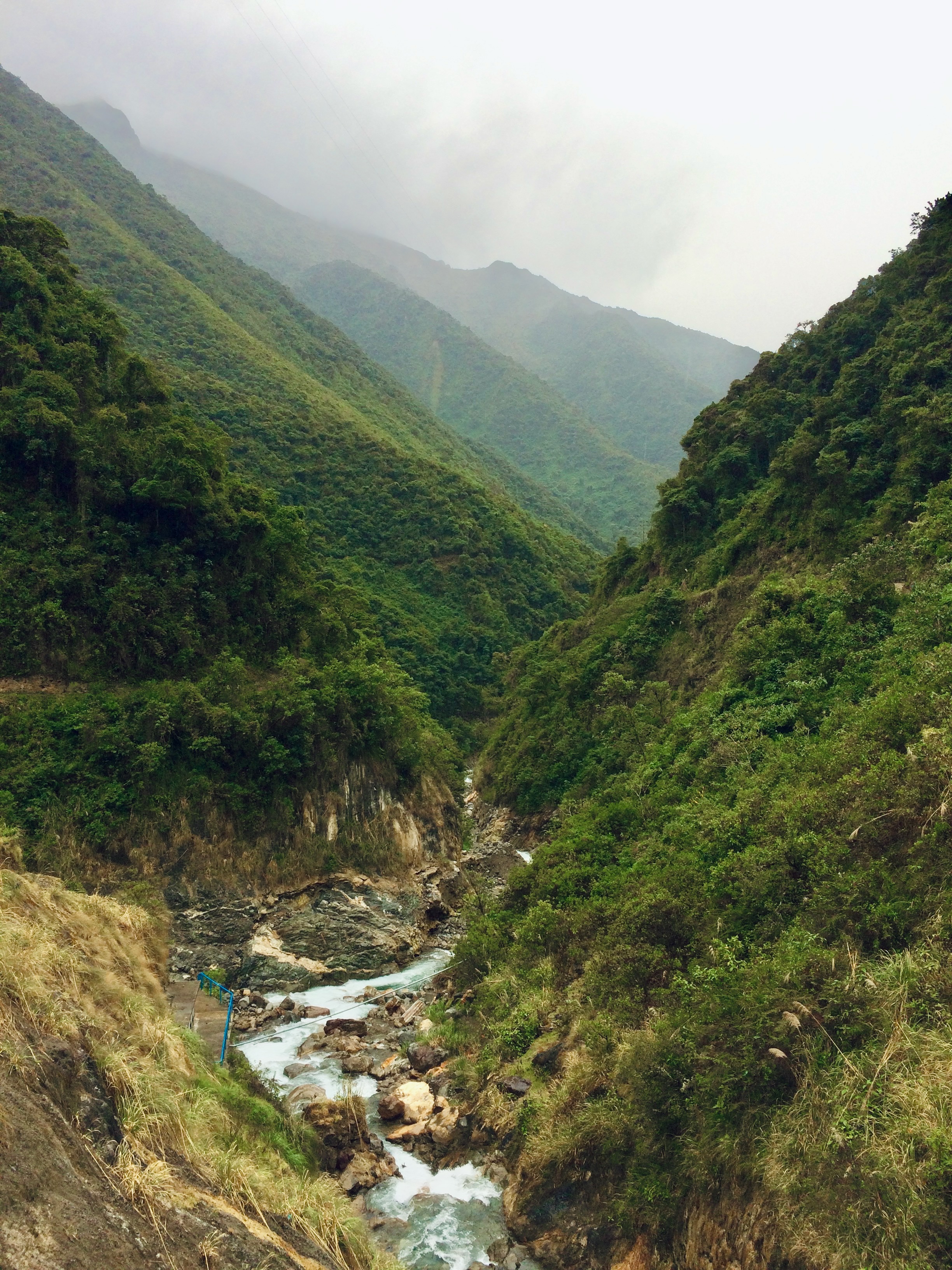
From the first campsite, the trail ascends for 800 meters to its highest point at 4,630 meters above sea level. The climb to the Salkantay Pass is steady and sometimes steep, but my modest fear of heights was never activated. It is also an option to go up by horse. From the Salkantay Pass, a short sidetrack leads to views of Humantay Lake (not the same as the lagoon from day 1). We made it to the viewpoint just before fog started rolling in and covered the lake completely.

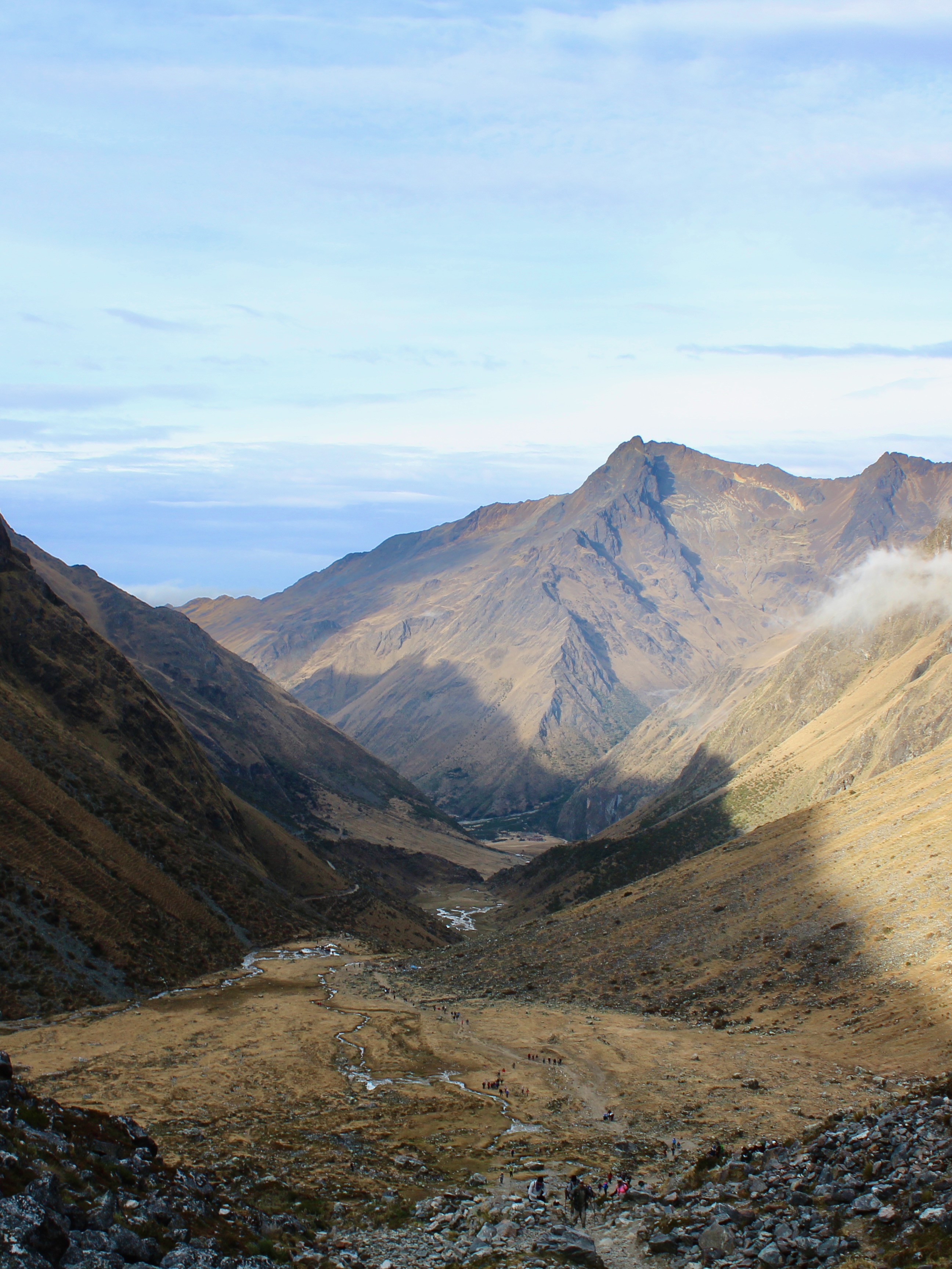

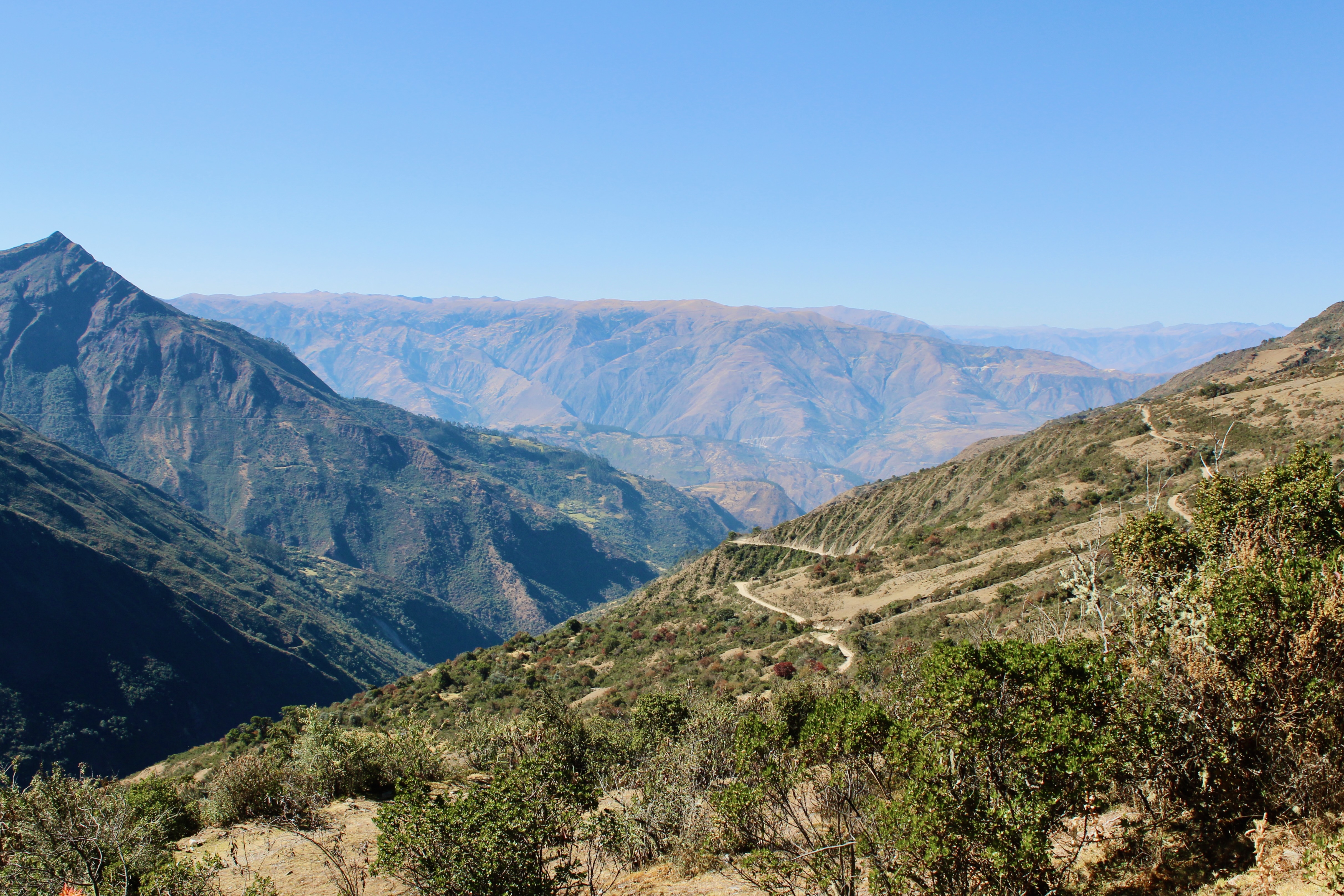
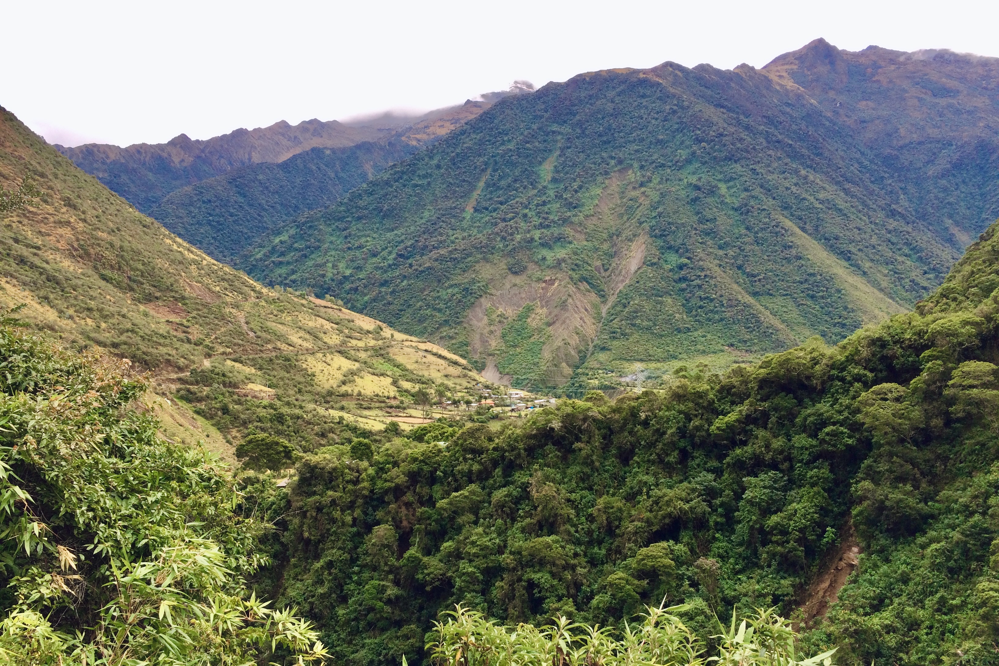
By the time we started the descent, we put to use all our cold weather gear. The spectacular views coming down the valley were a distraction from the pouring rain, until we made it to the kitchen tent for coffee and lunch. On the final stretch of the day, the snow-covered peaks and arid valley make way for lush green vegetation. In just a few hours time, the scenery changes several times. From the Salkantay Pass, it took us six hours to descend 1,700 meters and reach the hostel in Collpapampa.


Day 3: Collpapampa – Aguas Calientes
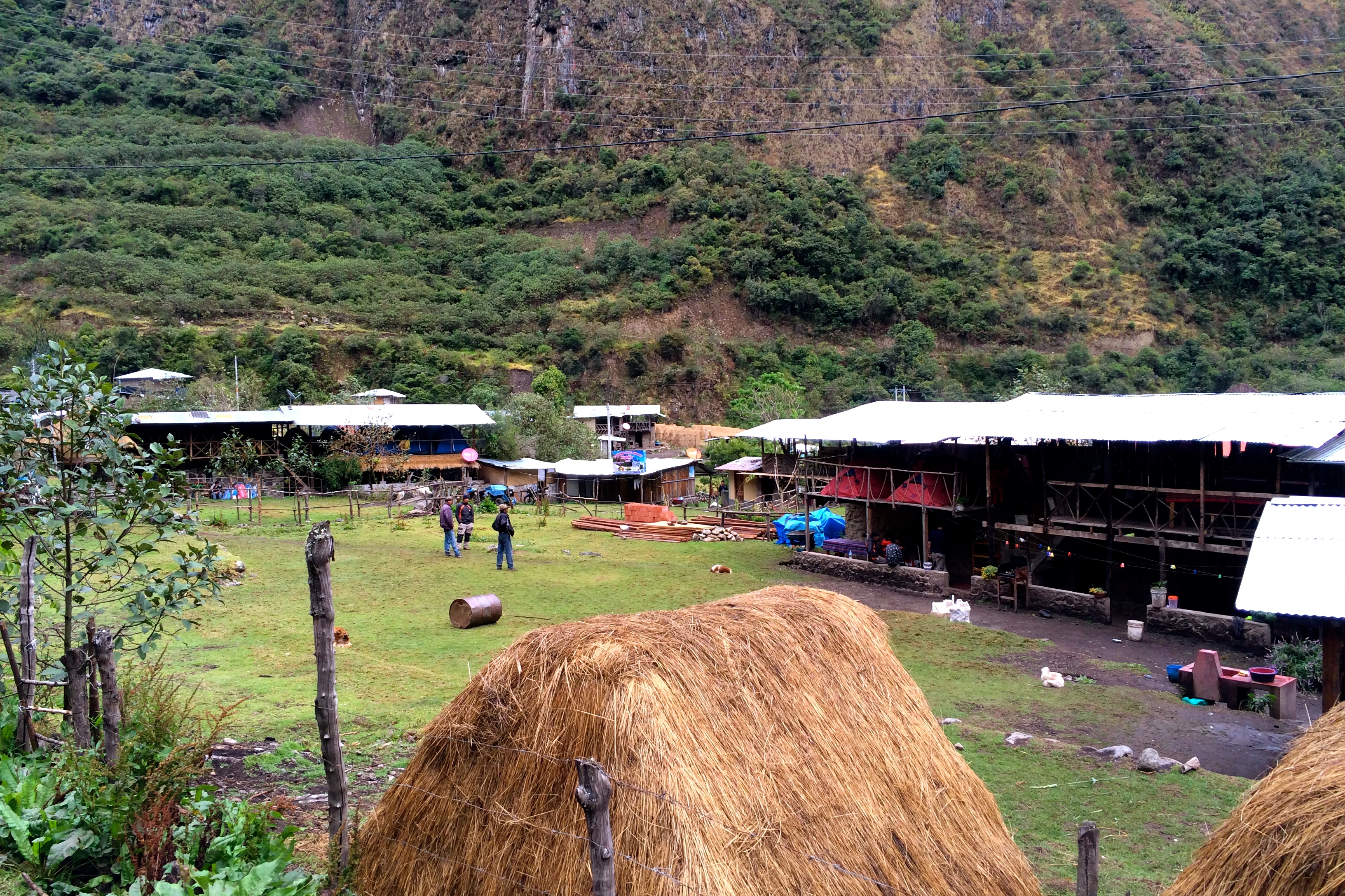
The downpour on day 2 turned out to be just a warm-up for the weather on day 3. The most strenuous part of the entire trek was going up and down through the jungle while getting more soaked by the minute. This lush area is home to tropical fruit and coffee plantations. We picked passion fruit from a local garden and fueled up with fresh roasted coffee at an improvised coffee shop.


Following lunch, we boarded a mini-bus to the Hydroelectric Train Station. The bus makes a stop at the scenic hot springs of Cocalmayo. After this relaxing dip, we were in no mood to walk another three hours in the pouring rain next to the railroad. We opted to skip this monotonous part of the trail and pay for the train instead. The hot shower at the hostel in Aguas Calientes continues to be a vivid memory.

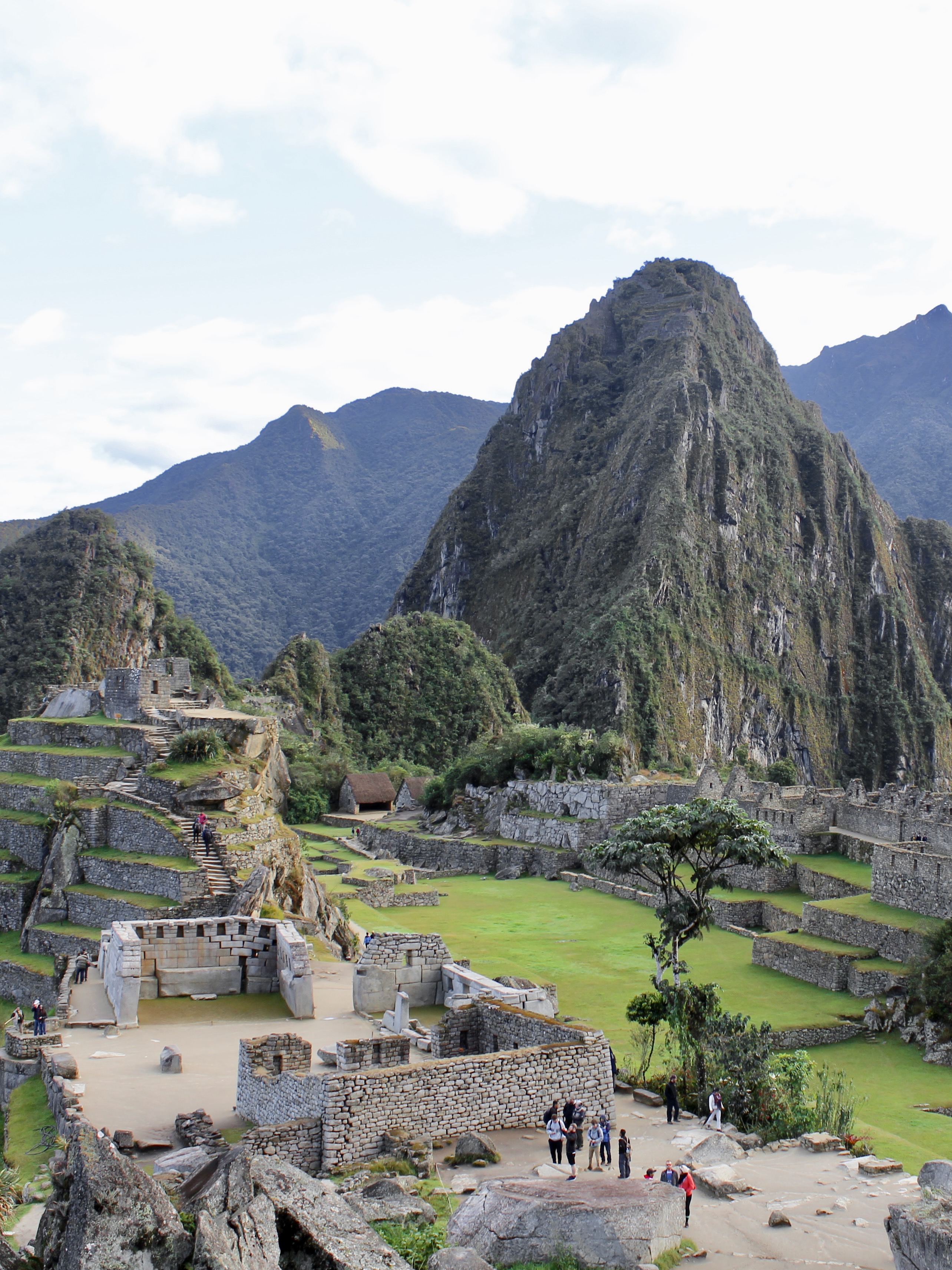
Day 4: Aguas Calientes – Machu Picchu – Cusco
The final day of the Salkantay Trek is spent visiting Machu Picchu. We woke up before dawn to start hiking to Peru’s Wonder of the World. The trail to Machu Picchu from Aguas Calientes is a strenuous one-hour hike along a series of stairs. An easier but much less rewarding option is taking the bus to the entrance of Machu Picchu.

We made it to the entrance at 6 AM, right at opening time and just before sunrise in July. By arriving early, we got to enjoy Machu Picchu without the crowds for two hours. Our visit was prior to the introduction of timed entry tickets, but even in the new system it pays off to reserve the first time slot. We got a guided tour of the citadel before being left to explore on our own.
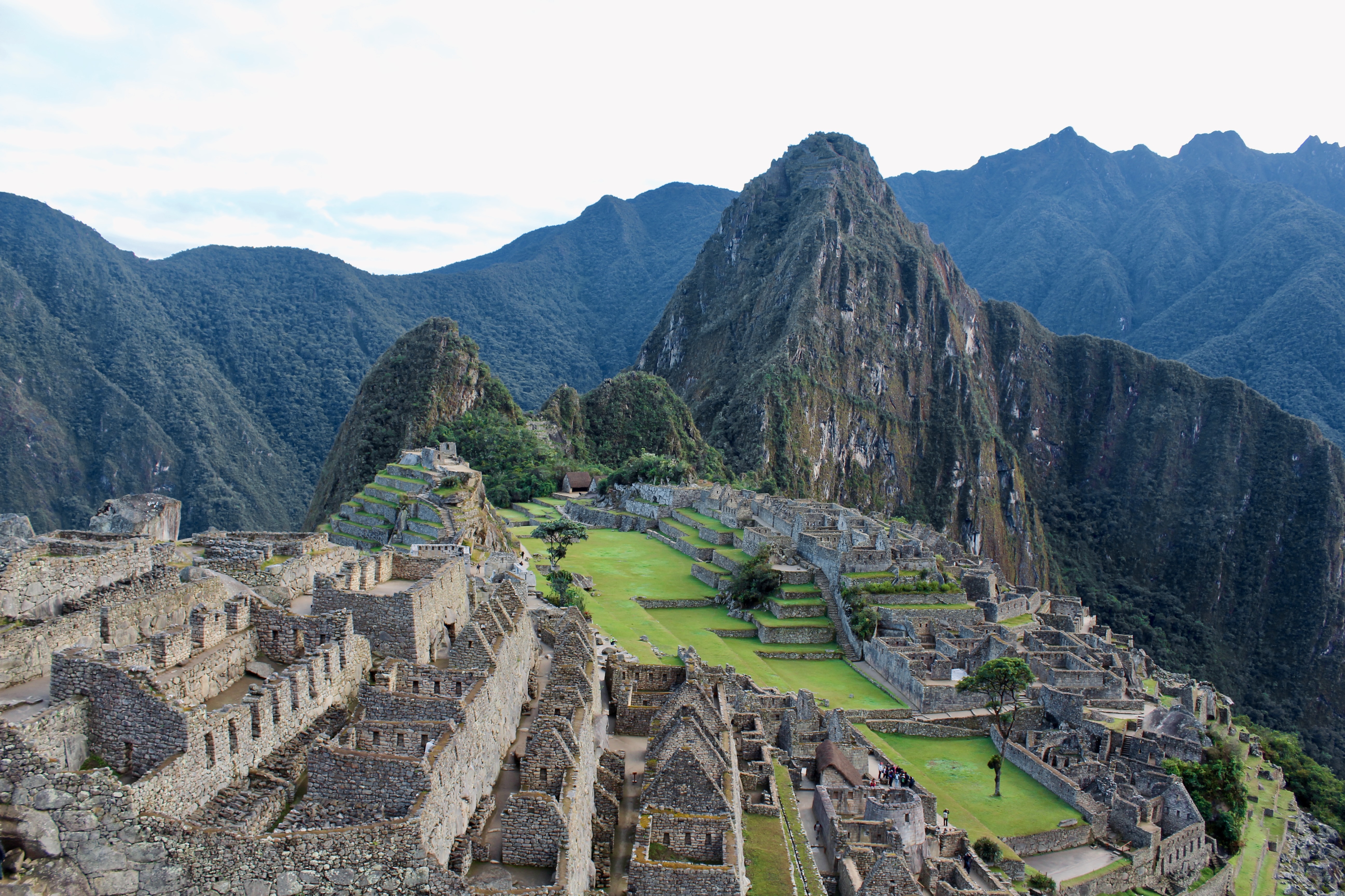

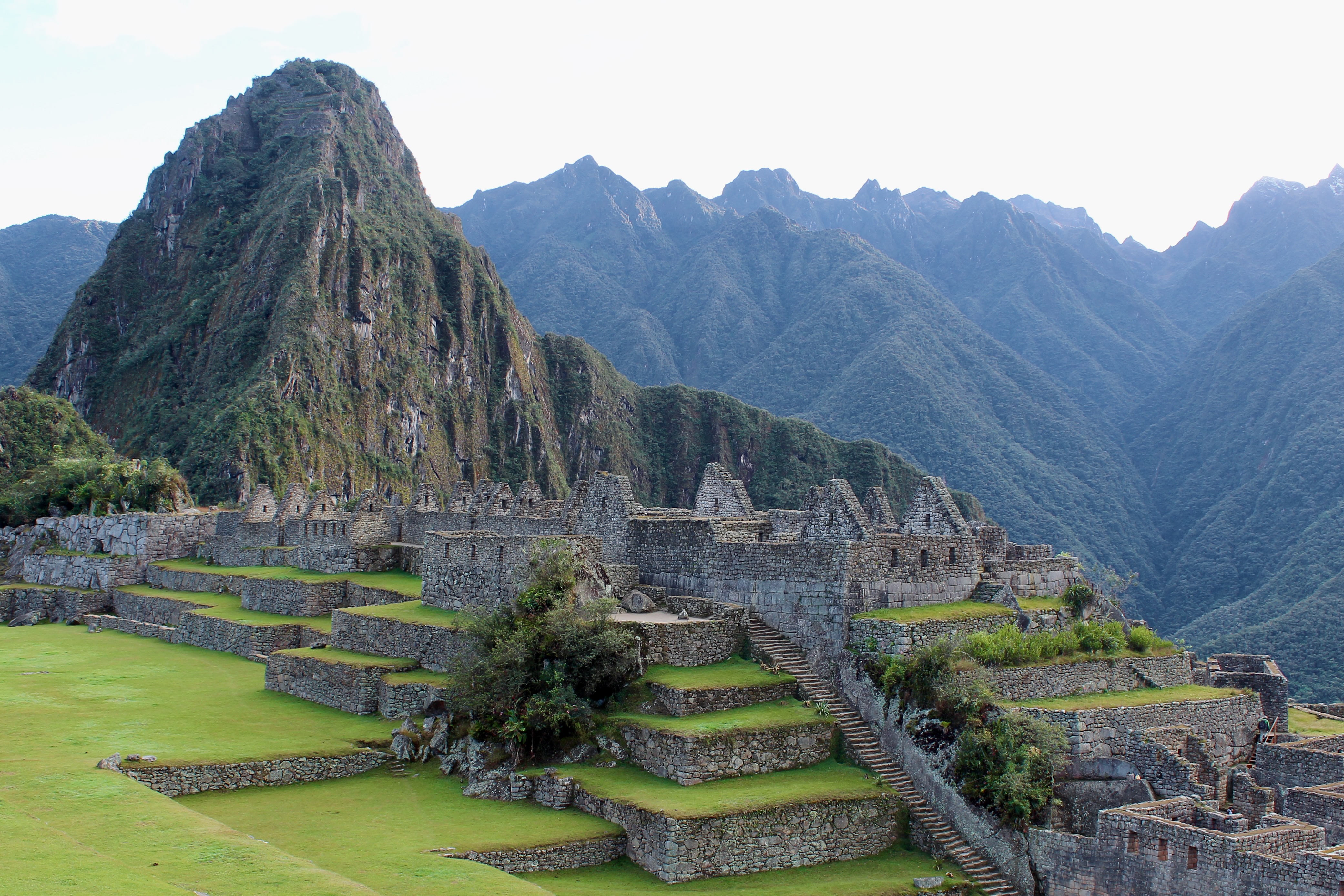
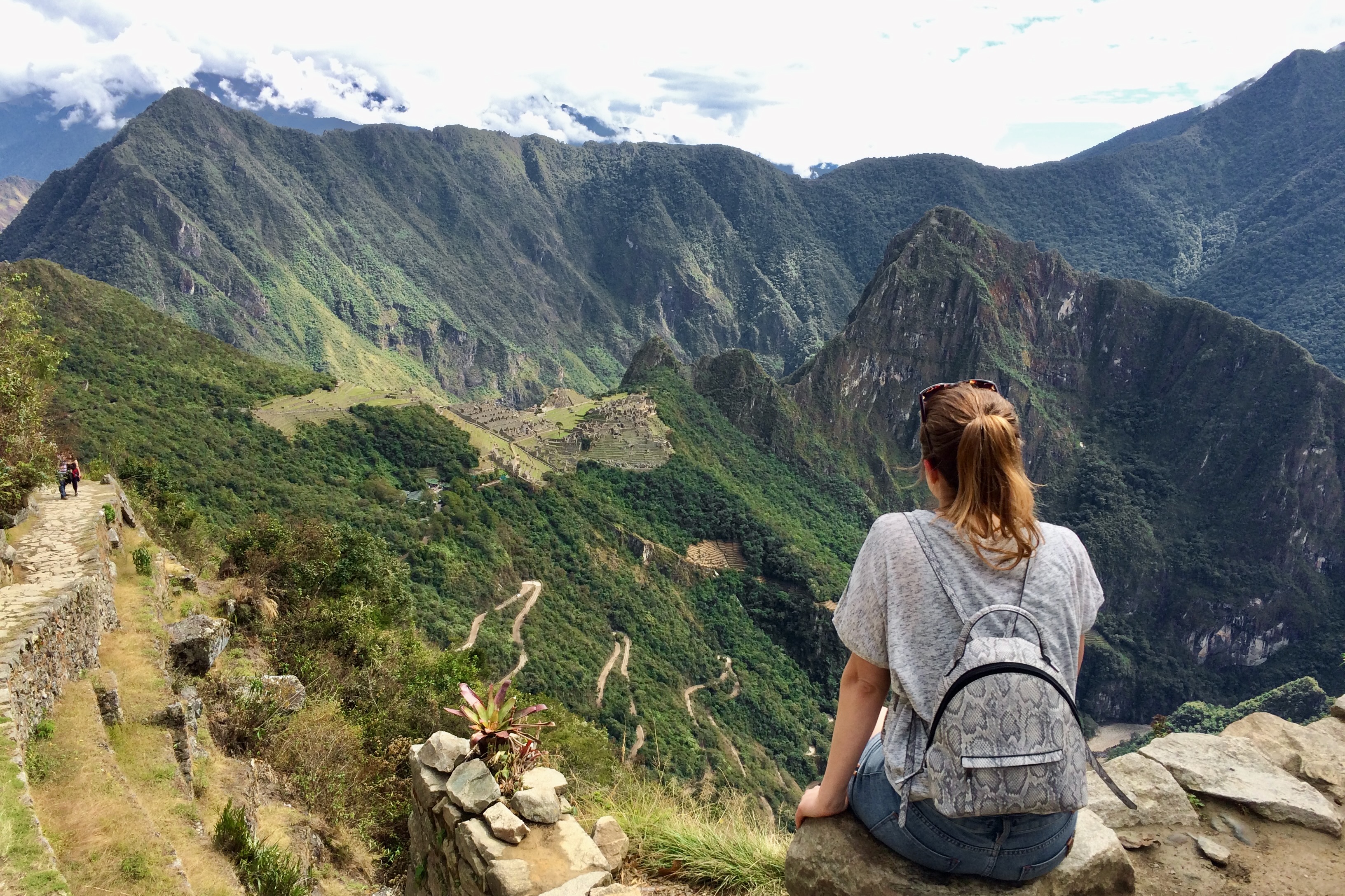
The trail to Machu Picchu Mountain climbs 600 meters over a 2-km span, with 360-degree views over Machu Picchu and the mountain range at the top. After this spectacular hike, we walked out to the Sun Gate. This used to be the main entrance to the ancient city and is still the end point of the Inca Trail. We spent a total of 6 hours at Machu Picchu, starting our hike back down around noon.


The return from Aguas Calientes to Cusco is done in two parts. The first stretch is a two-hour train ride to the city of Ollantaytambo, followed by a two-hour bus ride back to Cusco. We opted to stay the night in Ollantaytambo, exploring this beautiful valley the next day.
Conclusion
The Salkantay Trek is much more than an alternative to the Inca Trail. The extremely diverse scenery on this hike is truly unique, as you cross a variety of landscapes in just three days. Although the main itinerary remains the same, the exact logistics depend on the tour agency you book with. We were happy with our pick for American Inca Trail as everything ran smoothly and their pricing is on the lower end.

Leave a comment