
Embark on an epic road trip in the Golden State with this 10-day itinerary, camping in 5 stunning national parks, driving Route 66 and cruising down the iconic Pacific Coast Highway.
10-Day California Camping Itinerary
- Day 1: Joshua Tree National Park
- Day 2: Los Angeles & Malibu
- Day 3: Los Angeles & Drive to Sequoia
- Day 4: Sequoia National Park
- Day 5: Paso Robles
- Day 6: California Highway 1
- Day 7: Pinnacles National Park & Drive to Yosemite
- Day 8: Yosemite National Park
- Day 9: Yosemite National Park via Tioga Pass
- Day 10: Death Valley National Park
Day 1: Joshua Tree National Park
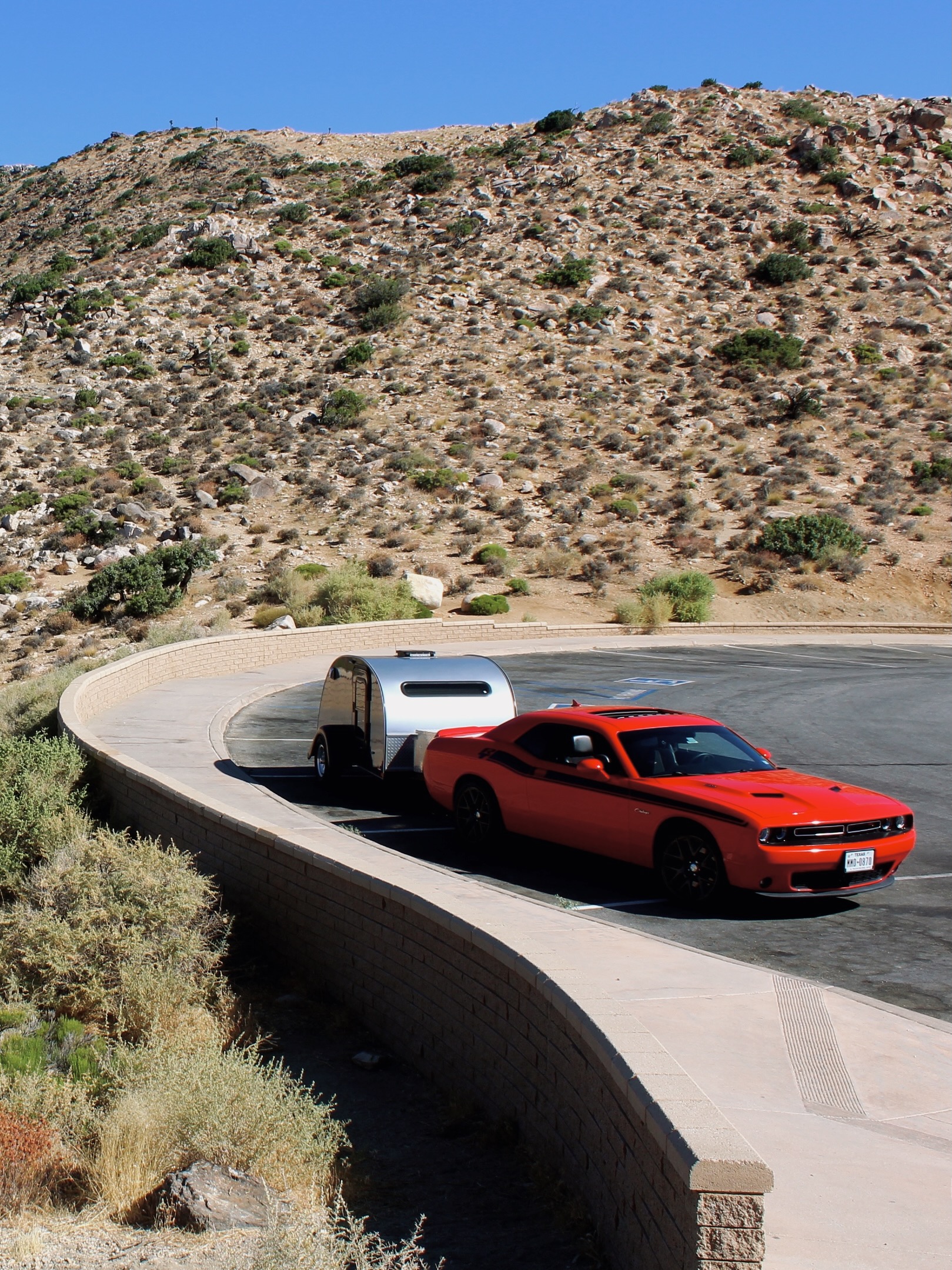
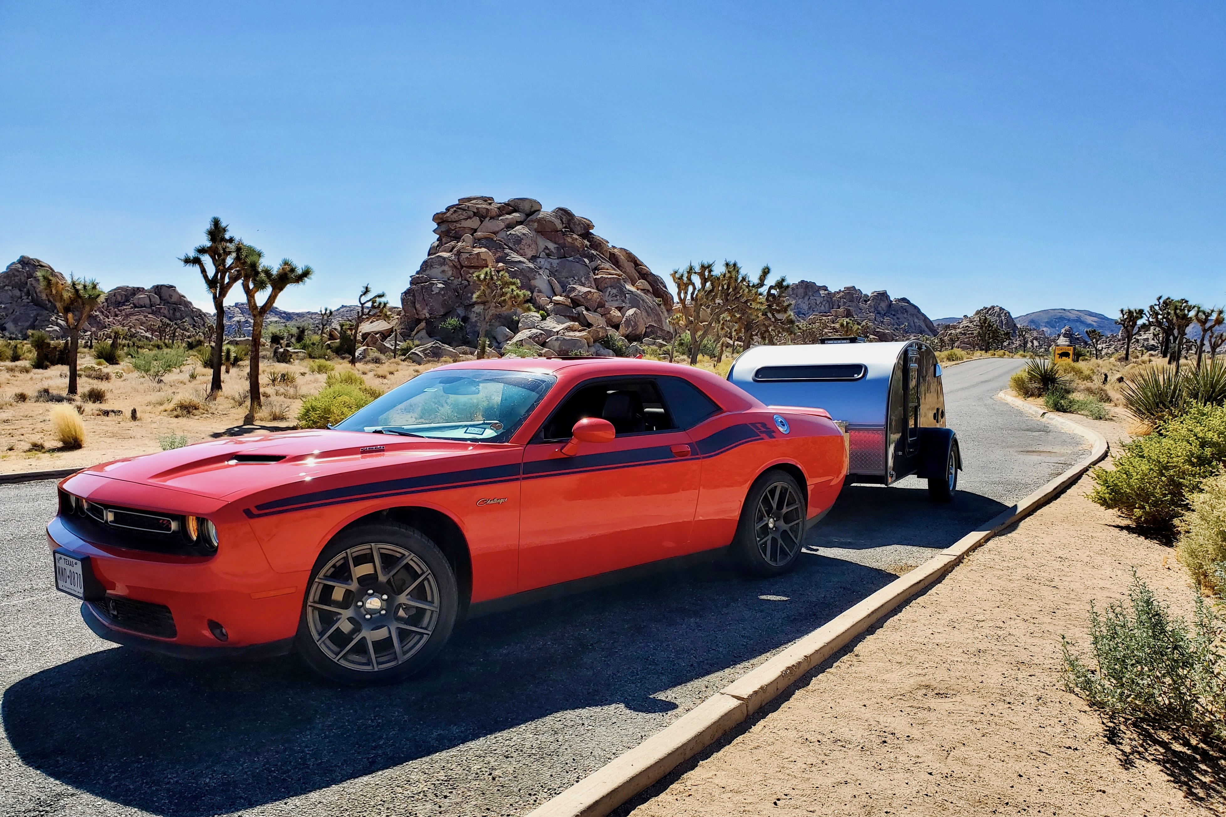
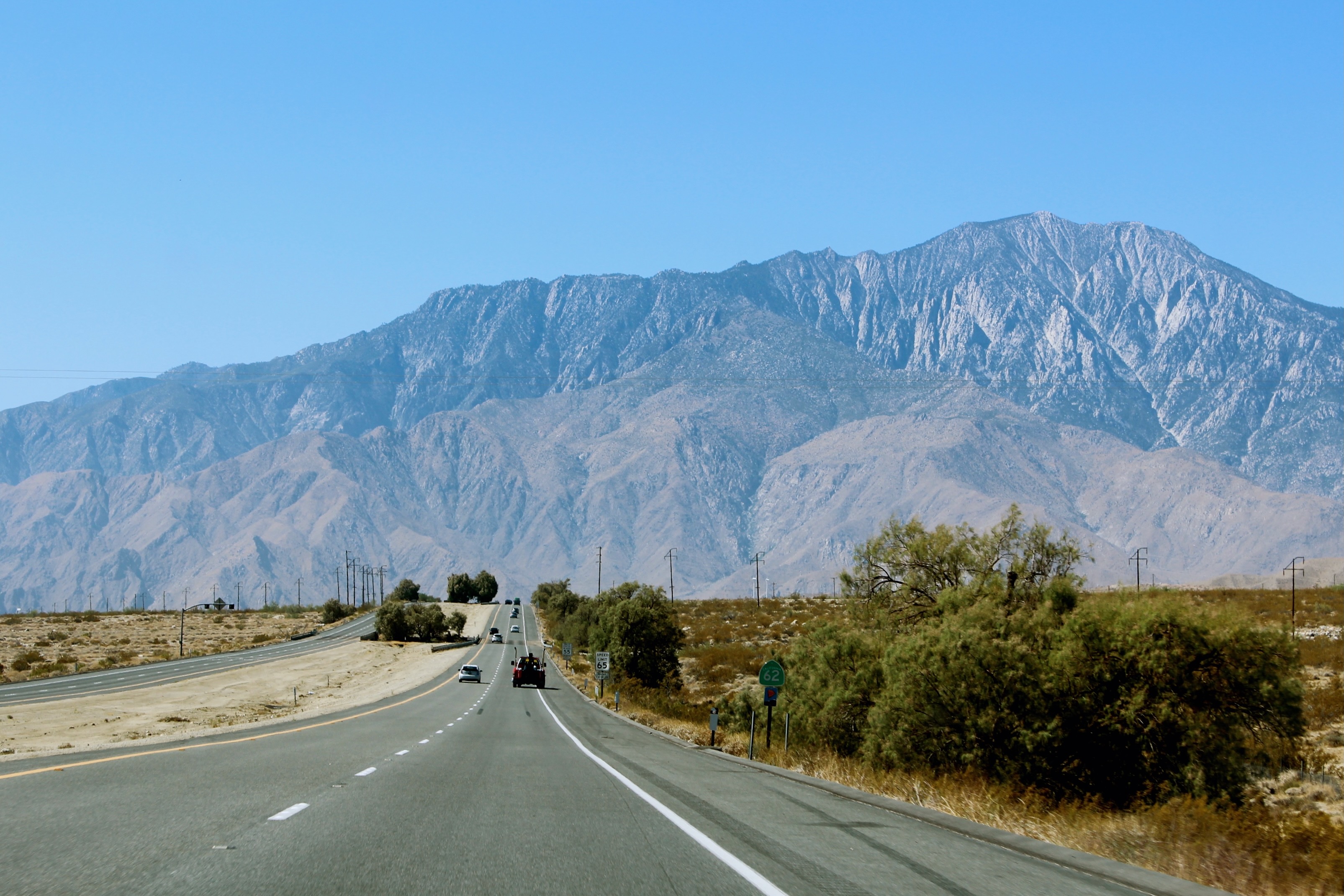
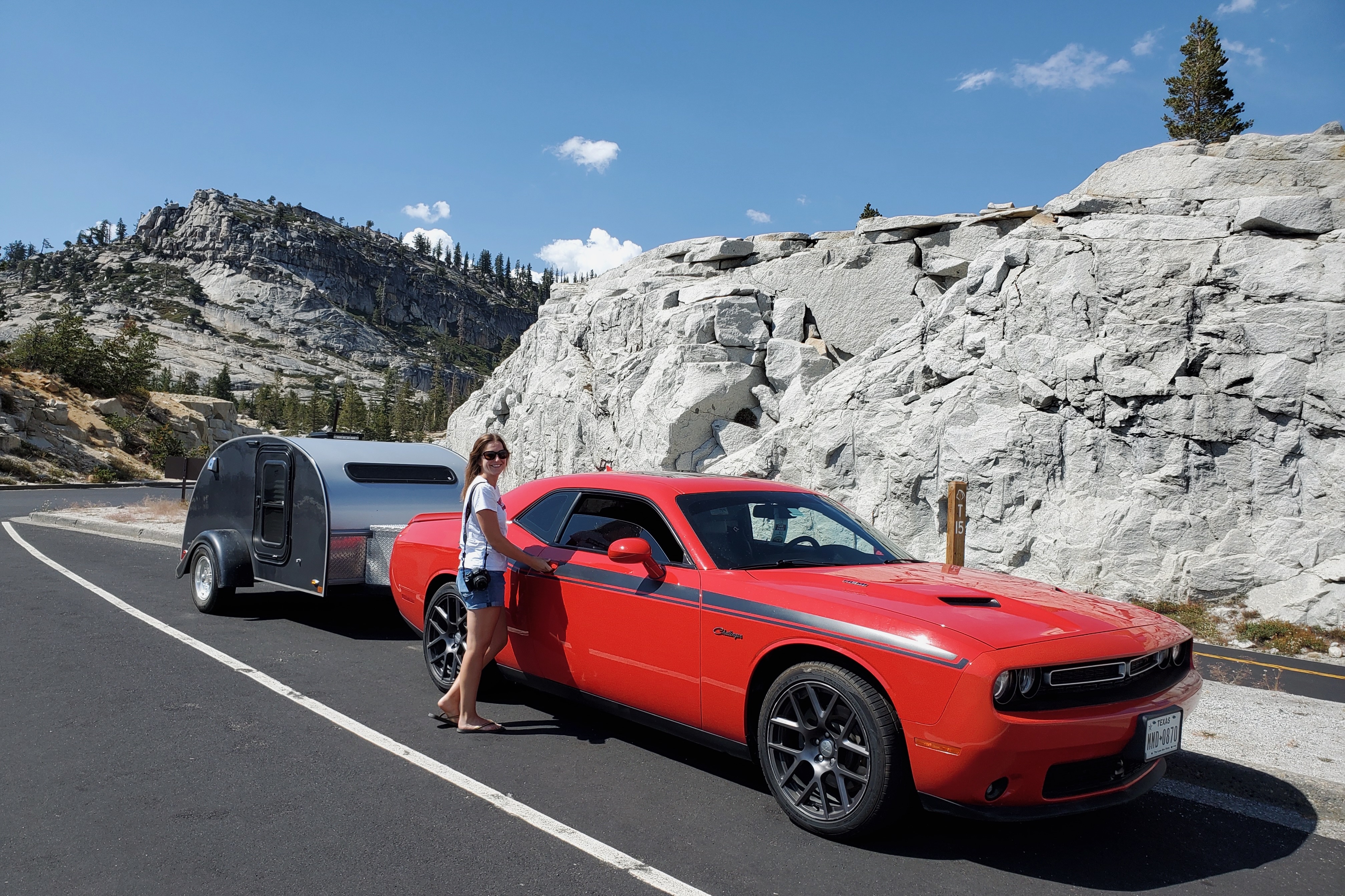
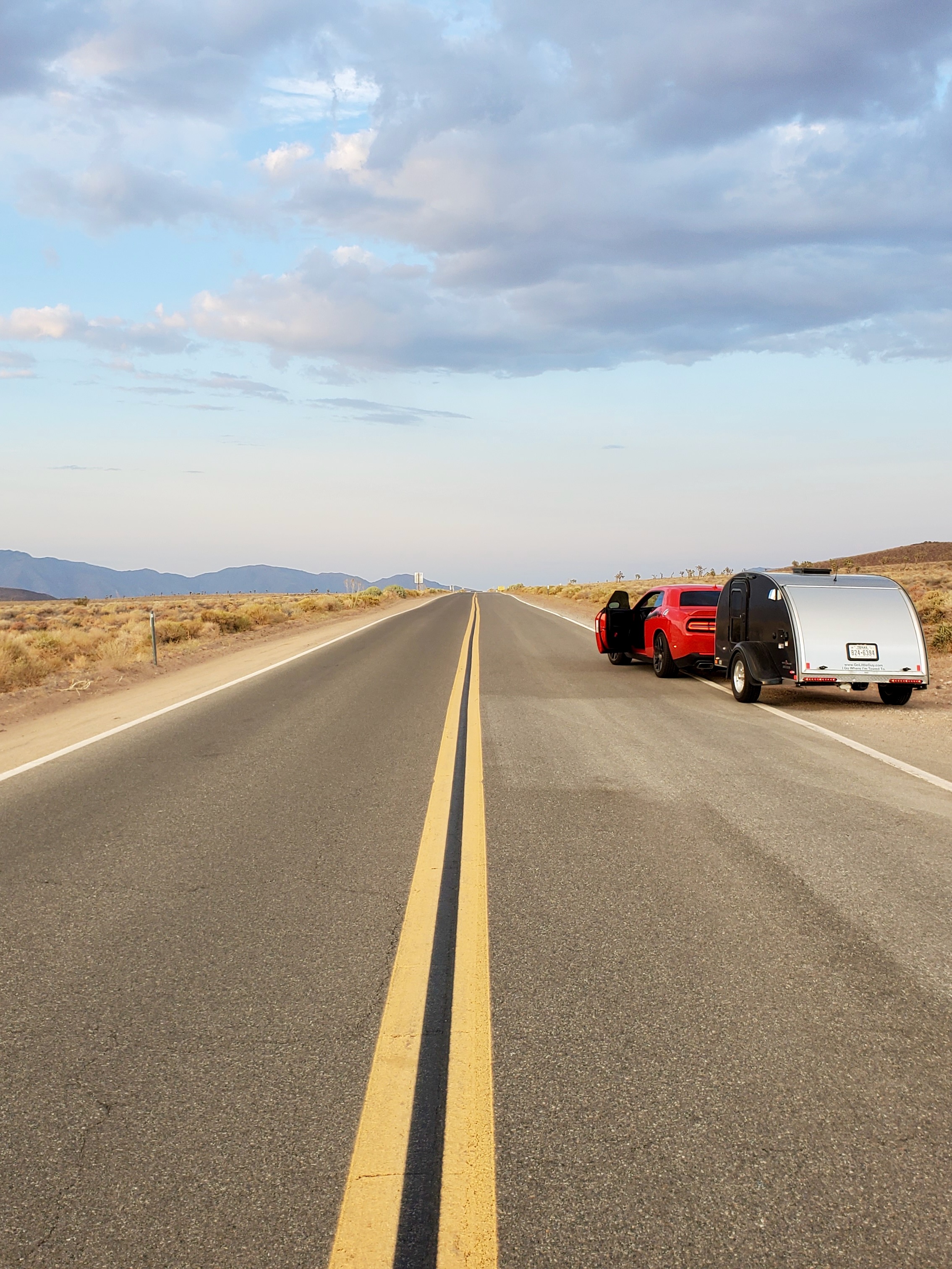
We started our epic road trip adventure in Texas, by following Route 66 with our teardrop trailer in tow. Joshua Tree National Park is just a short detour from America’s most iconic drive and the first stop on this California itinerary. Inland California can get excruciating hot in the summer months, but the upside is less visitors in many national parks.
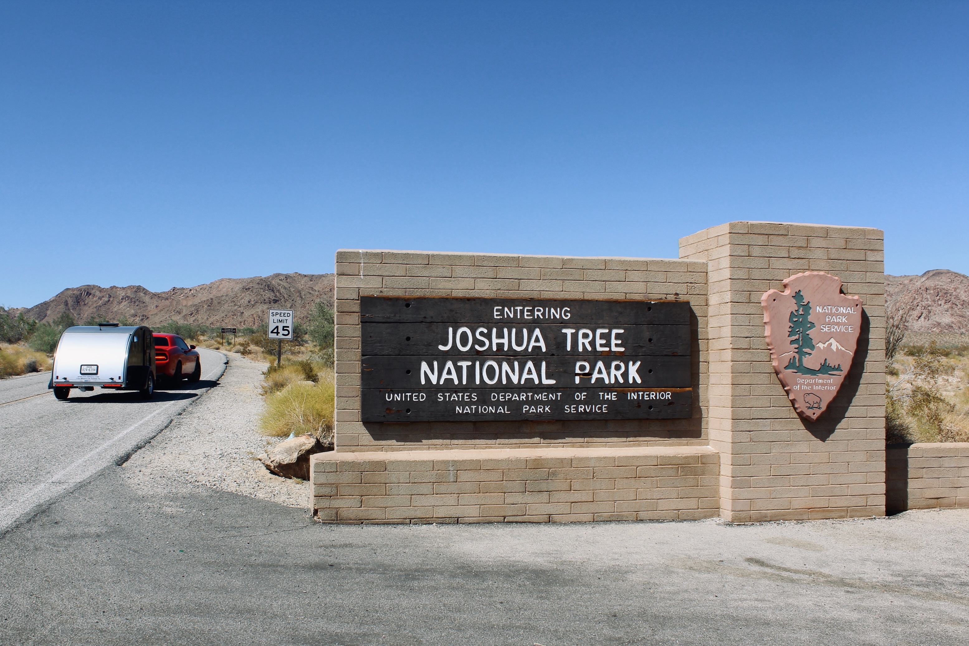
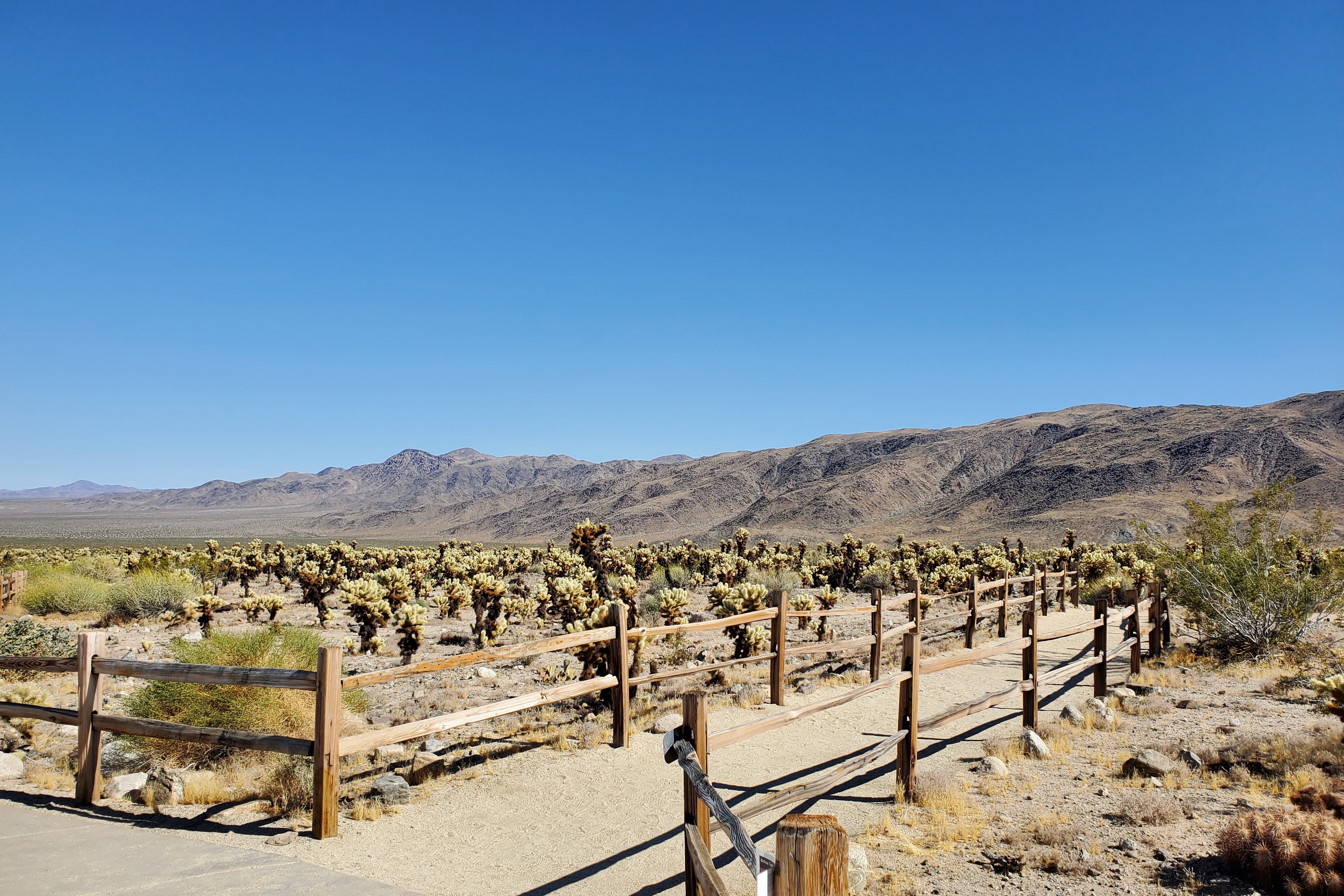
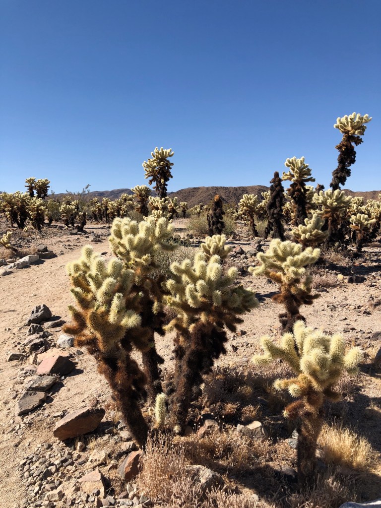
After entering Joshua Tree National Park through the South Entrance, we braved the California heat for the first time at Cholla Cactus Garden. A little down the road, the first Joshua trees start to appear. The 1.4-mile Arch Rock Nature Trail is a great introduction to the park’s unique desert landscapes.
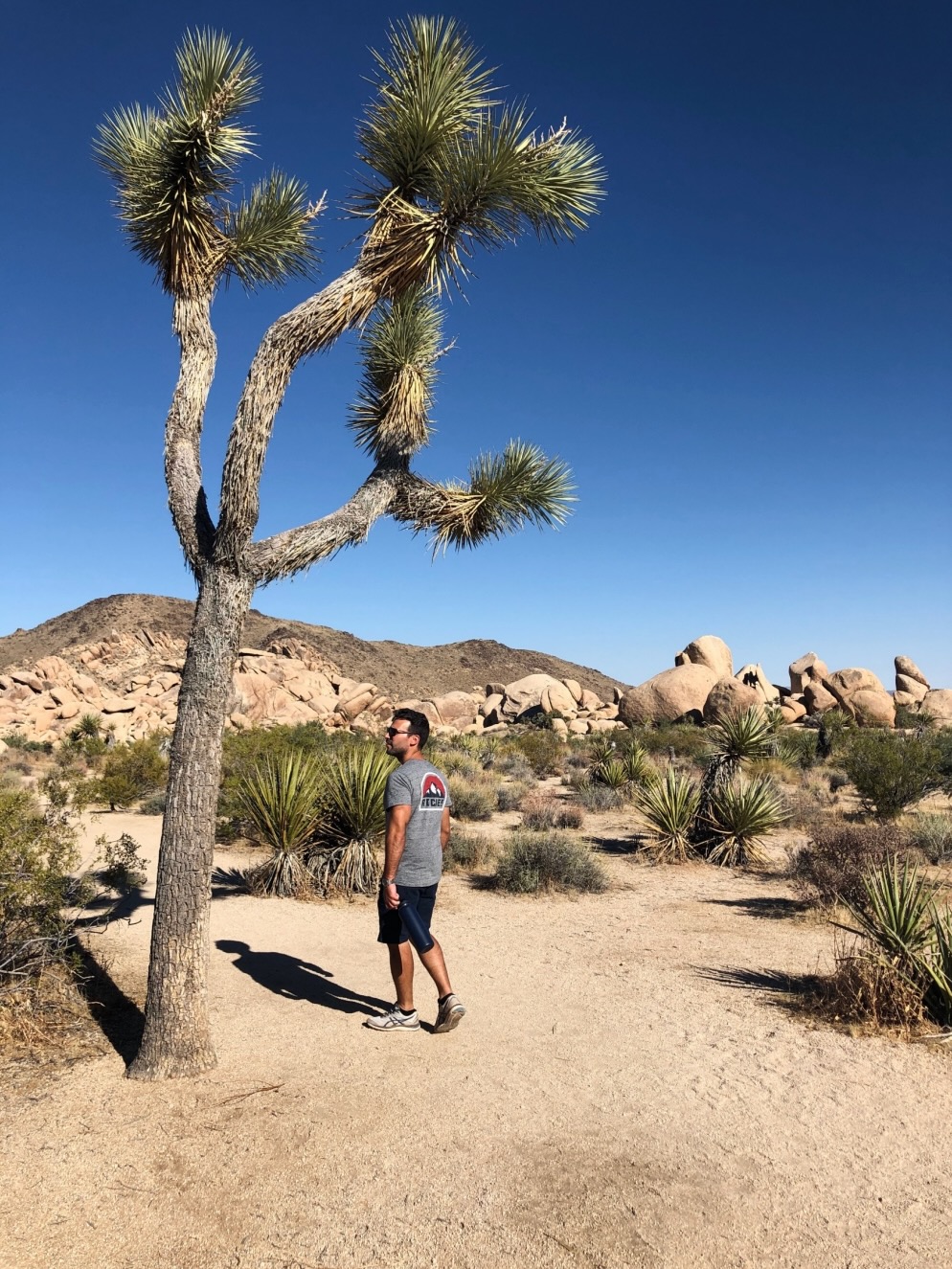
The best way to take in Joshua Tree’s scenery is by driving Park Boulevard, the main east-west park road. After staying overnight at Jumbo Rocks Campground, you can continue the drive west the following morning while exiting the park. A 20-minute detour to the highest point in the park, Keys View, reveals sweeping views of the Mojave desert.


Camp: Jumbo Rocks Campground, Joshua Tree National Park
Campsites at Jumbo Rocks Campground are available by reservation only, but summer is the off-season. Combine dry desert heat with dry camping, and candidates are fairly limited. This is dry camping at its most extreme: no hookups, no drinking water and no flush toilets or showers. You can climb the jumbo rocks for a spectacular sunset.


Day 2: Los Angeles & Malibu
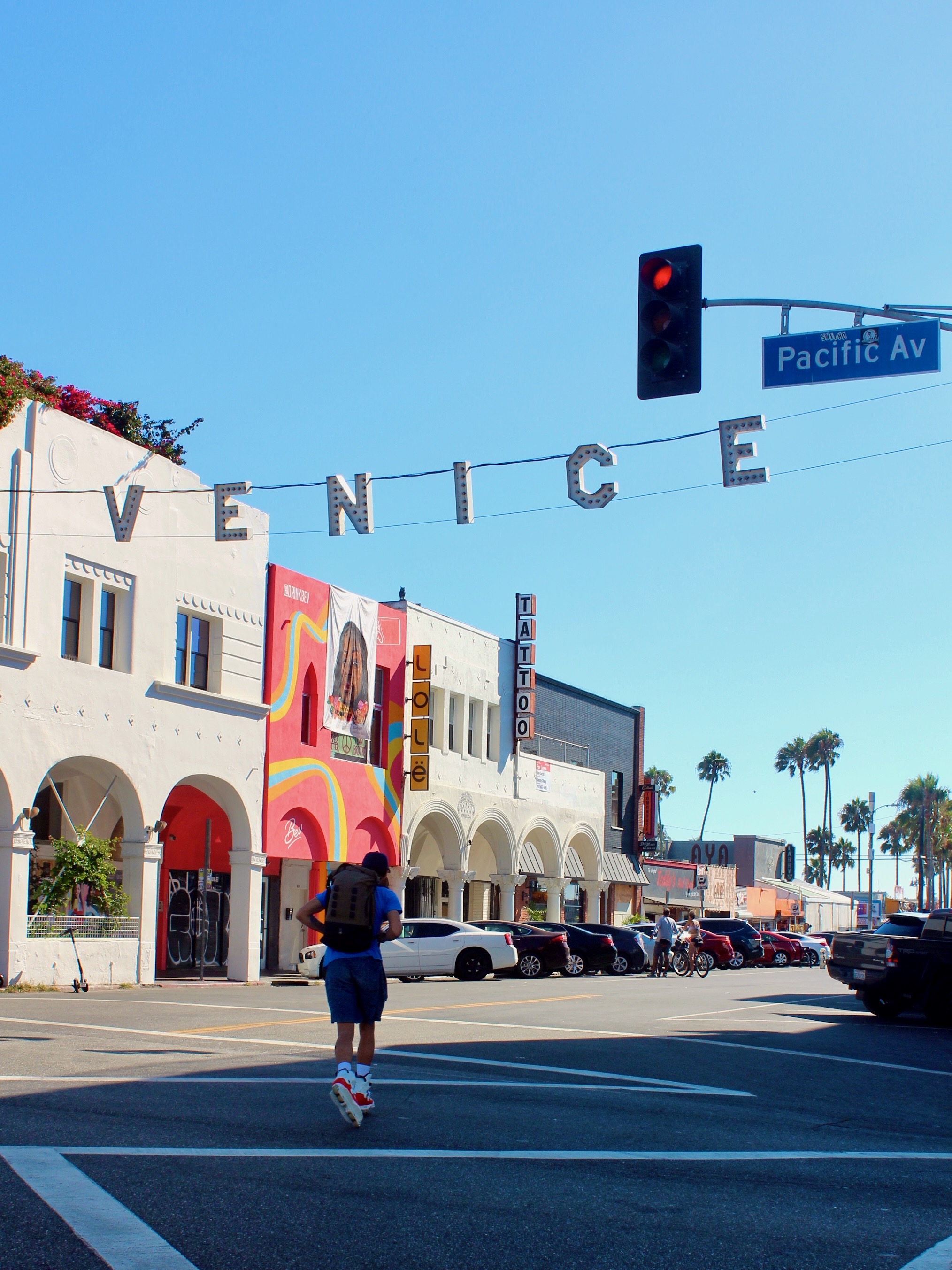
After exiting Joshua Tree through the West Entrance, a partly scenic, partly stressful three-hour drive to Los Angeles follows. With just 24 hours in the city, we divided the major highlights over two half days of sightseeing. In the afternoon, we explored Santa Monica and Venice Beach, with dinner in Malibu. The next morning, we visited Hollywood before exiting through the L.A. hills. The Route 66 sign on the Santa Monica Pier was our first mandatory stop, marking the end of Route 66.

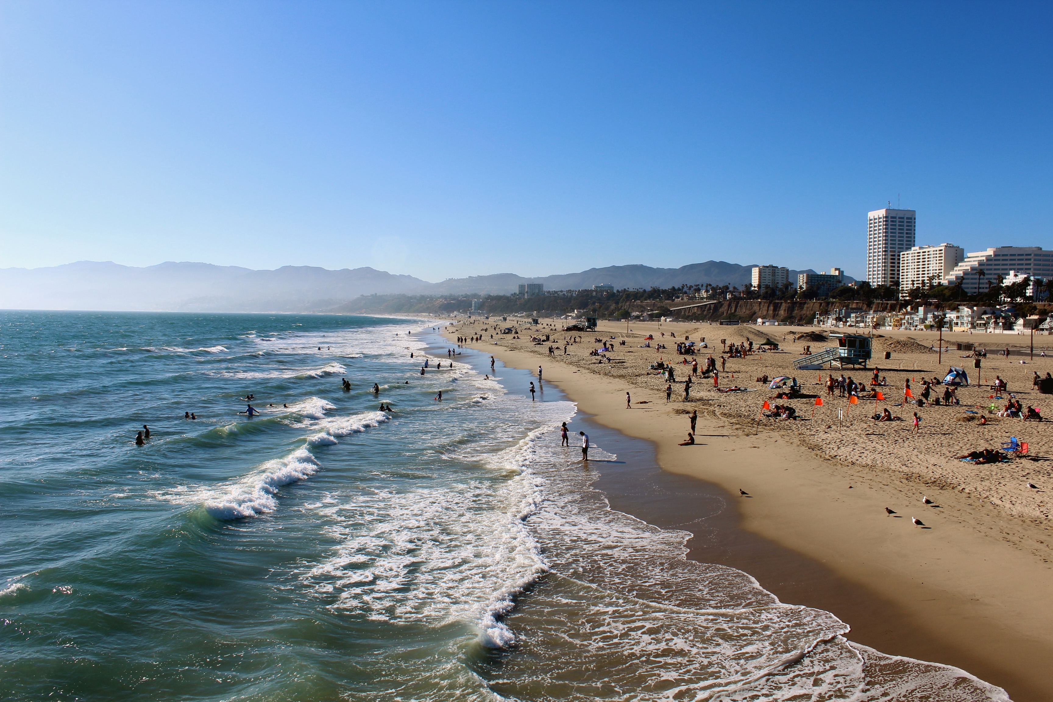
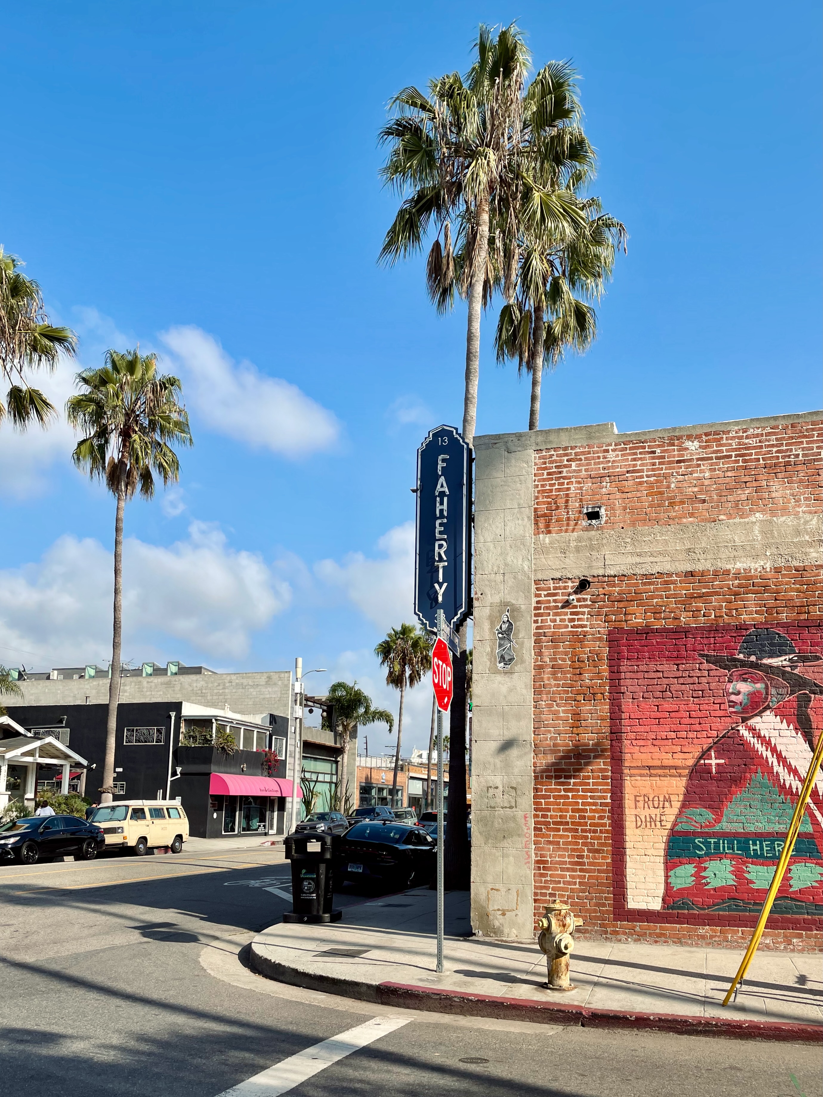
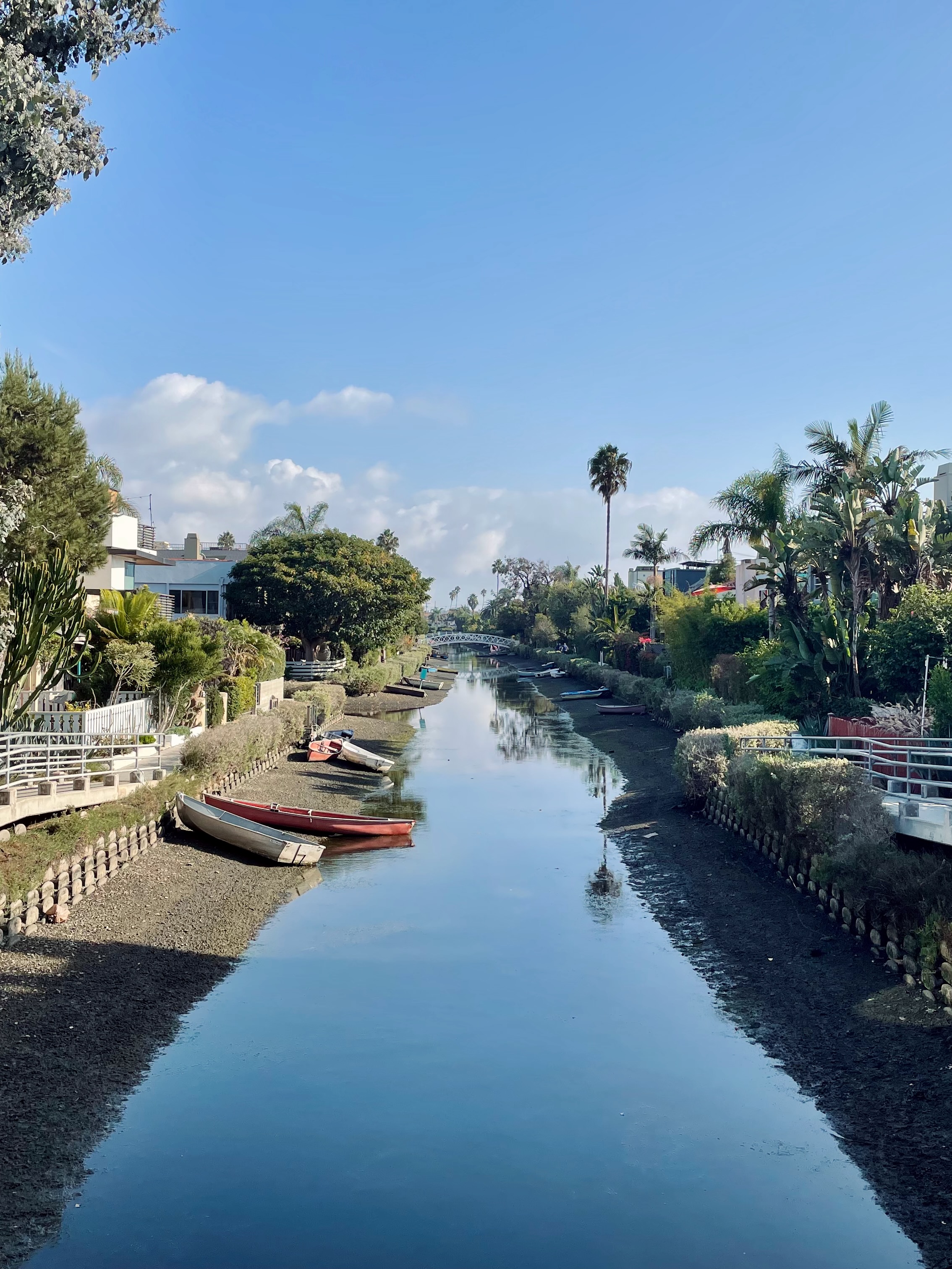
We parked at the large public lot next to the pier and explored Santa Monica and Venice on foot. From the pier, a scenic boardwalk runs along the beach all the way to Venice Beach. You can take a walking tour of Venice by following hip Abbot Kinney Boulevard, crossing the canals at Venice Canals Historic District and strolling back via the Venice Beach Boardwalk. The High Rooftop Lounge at Hotel Erwin is the perfect spot for toasting to a Pacific sunset.


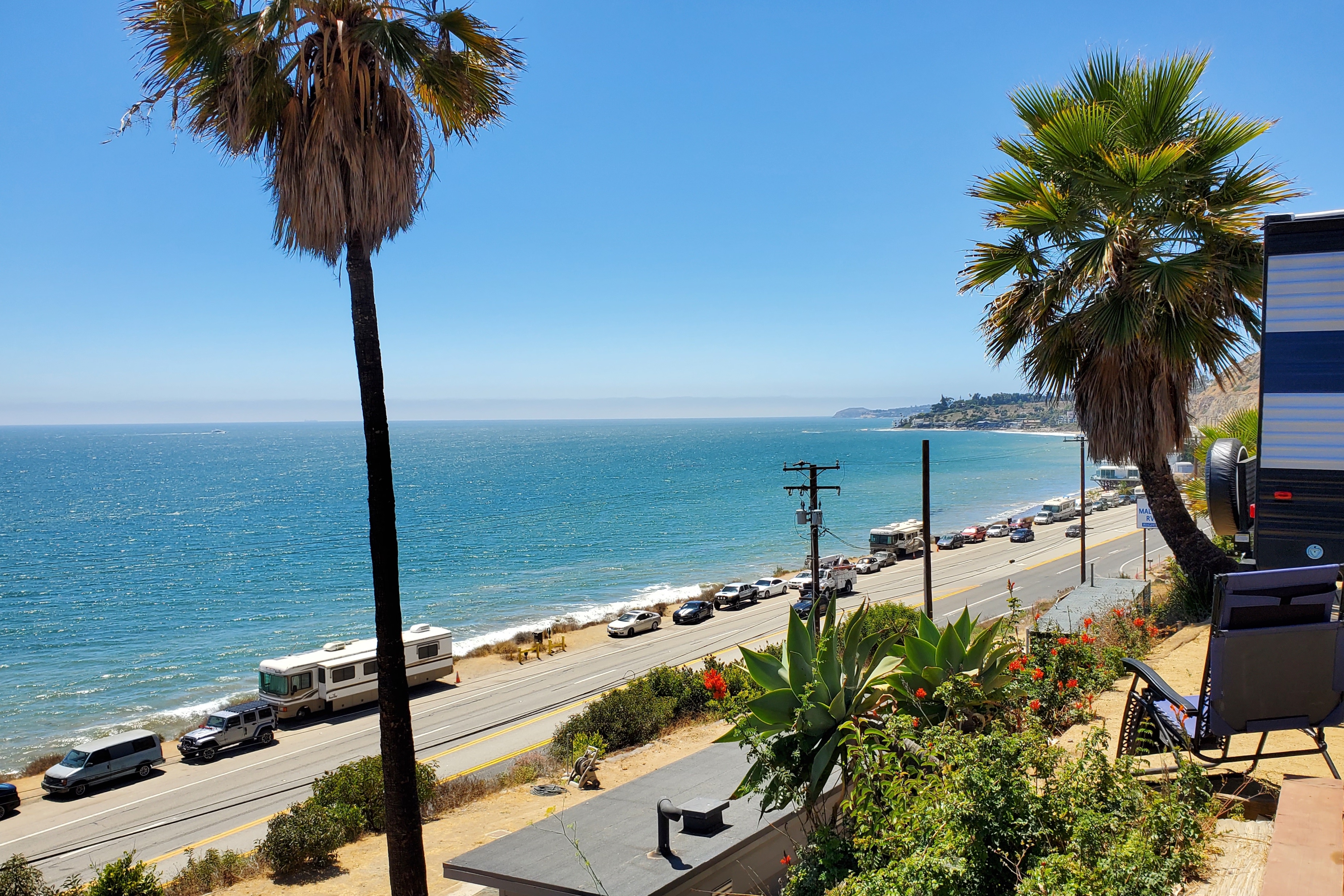
Camp: Malibu Beach RV Park, Malibu
Malibu Beach RV Park is located along the Pacific Coast Highway, on a bluff overlooking the ocean. Not surprisingly, the rates are high and privacy between sites is non-existent. In return, you can see the Pacific Ocean from most spots, with ocean view sites offering unobstructed views.
Day 3: Los Angeles & Drive to Sequoia
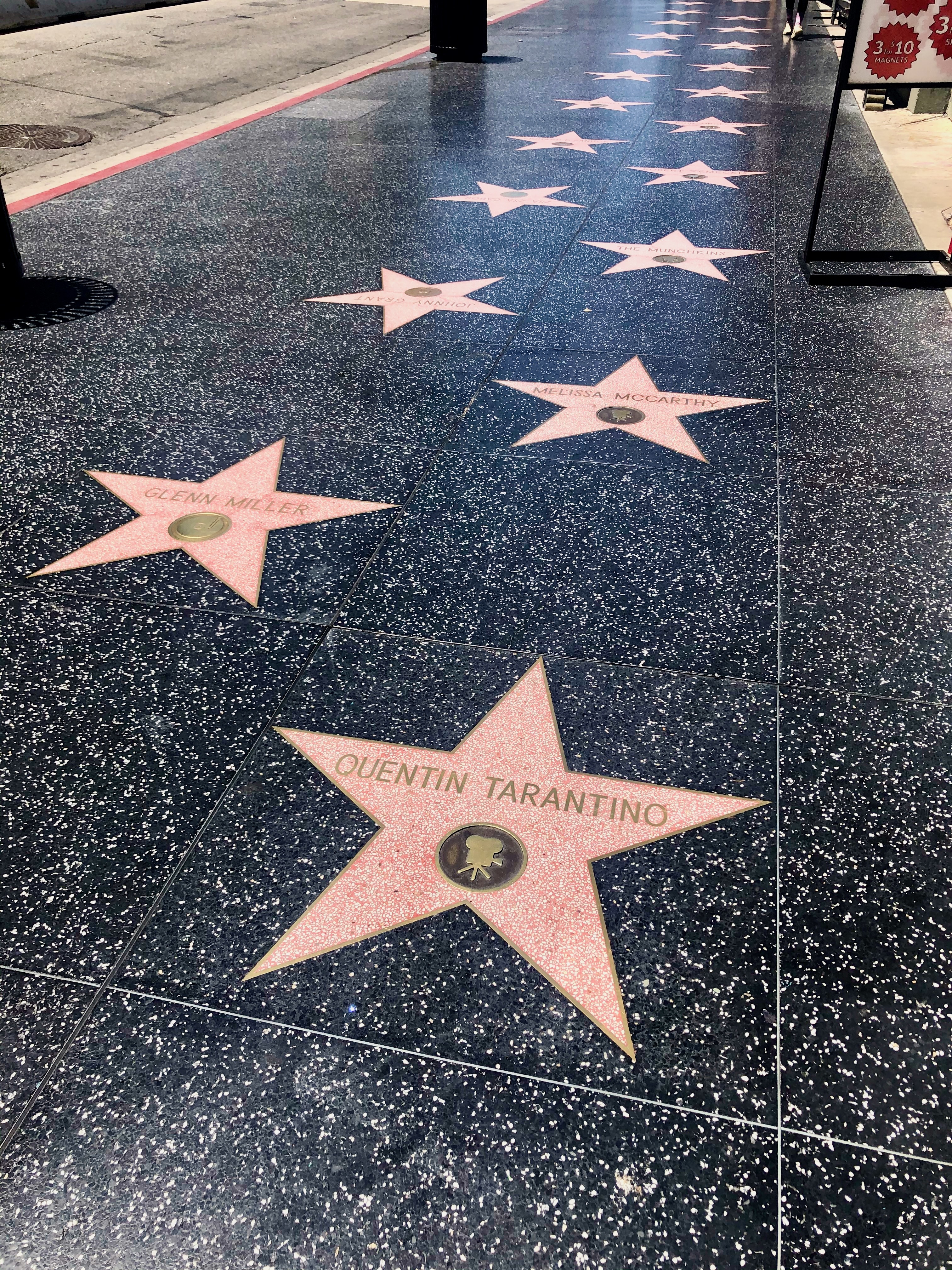
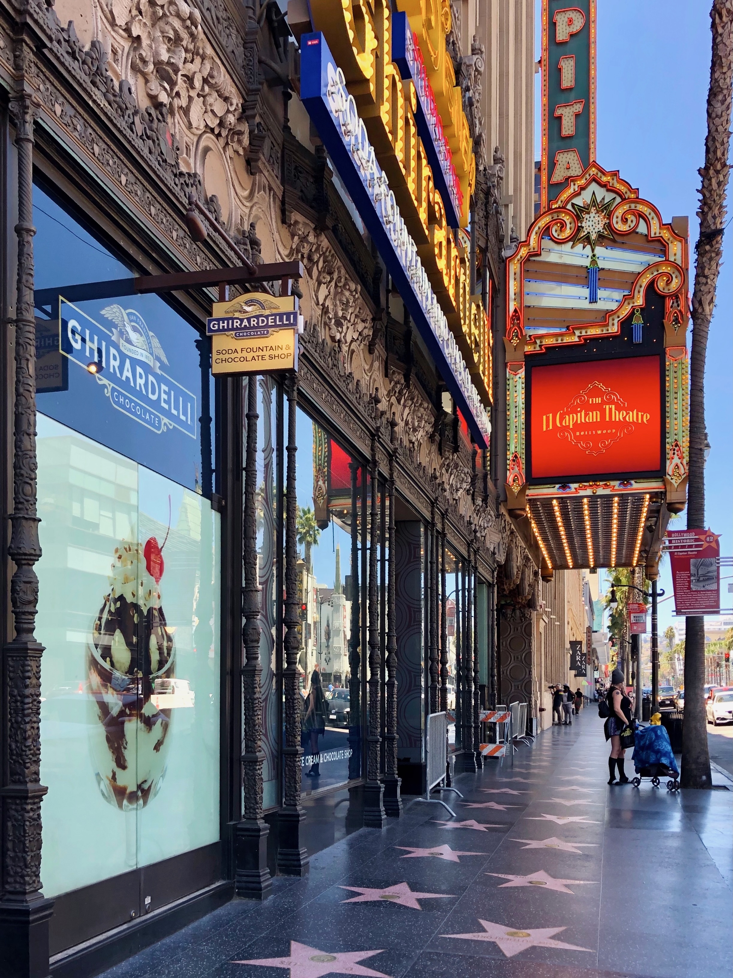
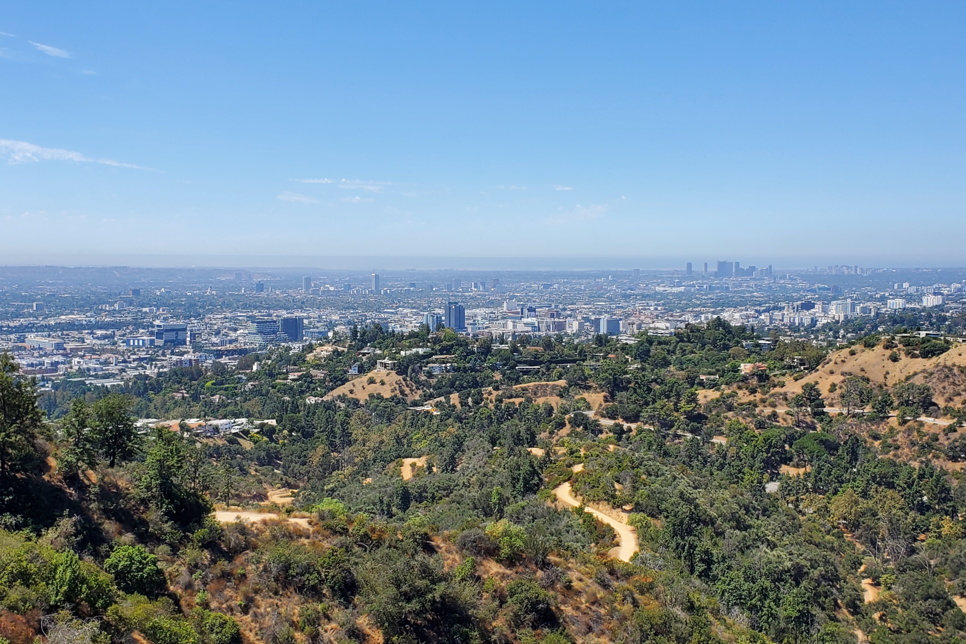
In the morning, we visited Hollywood with our trailer in tow. From Hollywood Boulevard and the Walk of Fame, we headed to Griffith Observatory for a picture of the Hollywood sign and panoramic views over Los Angeles.


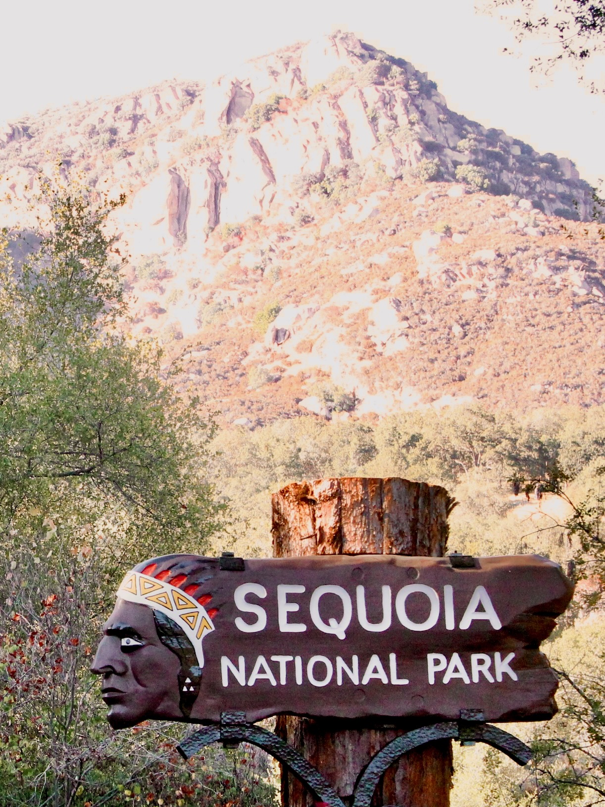
After this 24-hour speed date with L.A, we left the city behind to head back into nature. From Los Angeles, it takes about four hours to reach the Sequoia National Park entrance via Highway 198. Visiting Sequoia entails a considerable detour from any road trip itinerary, but the unique scenery is entirely worth it.
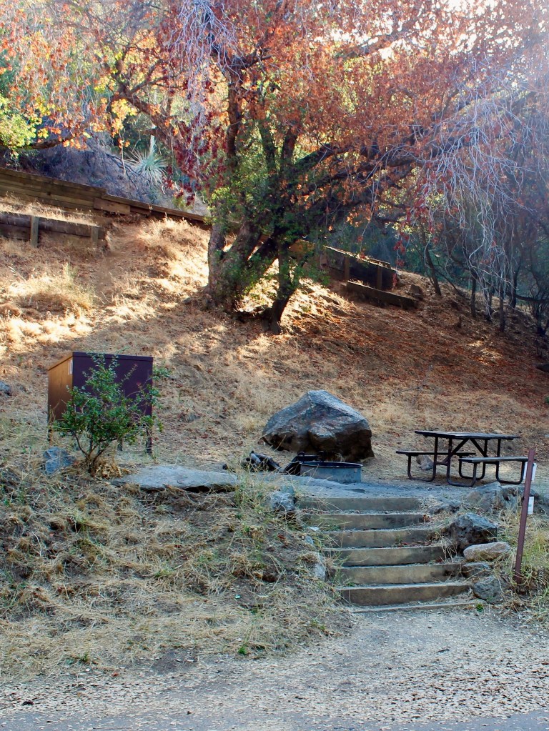
Camp: Potwisha Campground, Sequoia National Park
Potwisha Campground is located just three miles from the park entrance. Because of the curvy park road, vehicles longer than 22 feet are not advised to go past this point. That makes Potwisha the perfect base to set up your trailer and continue the drive into the park by vehicle only. Despite the hot and dry weather, the campground fills up completely in summer and spots should be reserved well in advance.

Day 4: Sequoia National Park
Sequoia’s attractions are scattered along Generals Highway, the only park road. A day is enough to visit the highlights. If you start early, you could continue down the same road to the adjacent Kings Canyon National Park. In summer, free shuttles operate in Sequoia because parking lots fill up very early. You can consult shuttle routes on the NPS website.
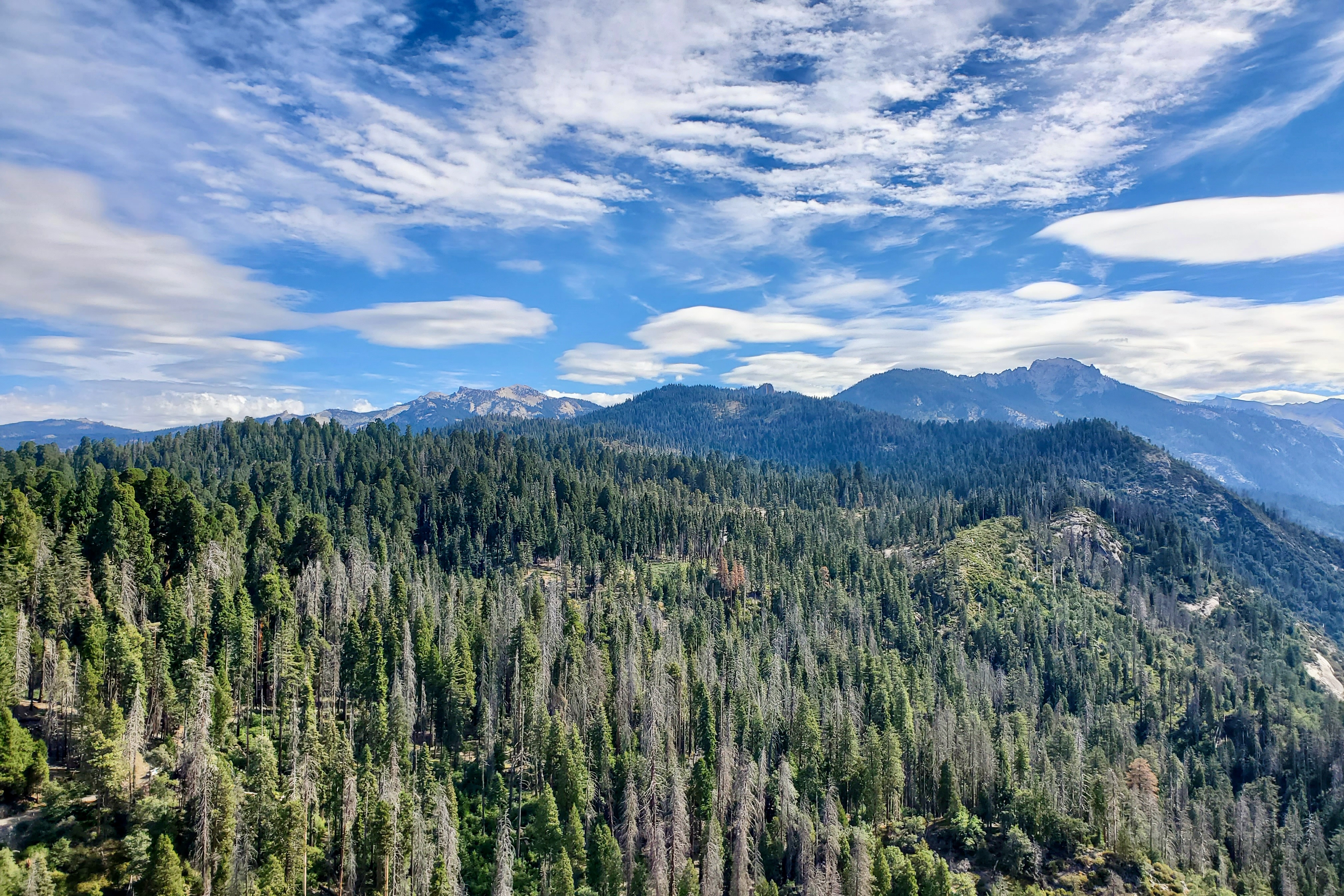
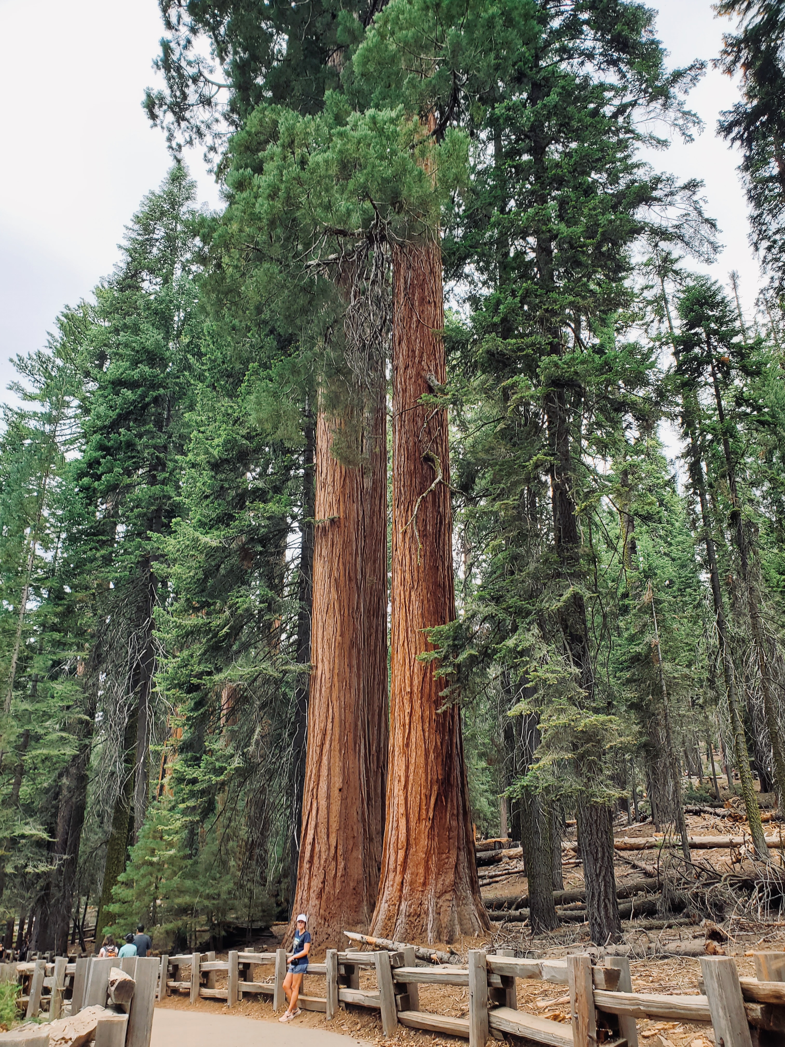
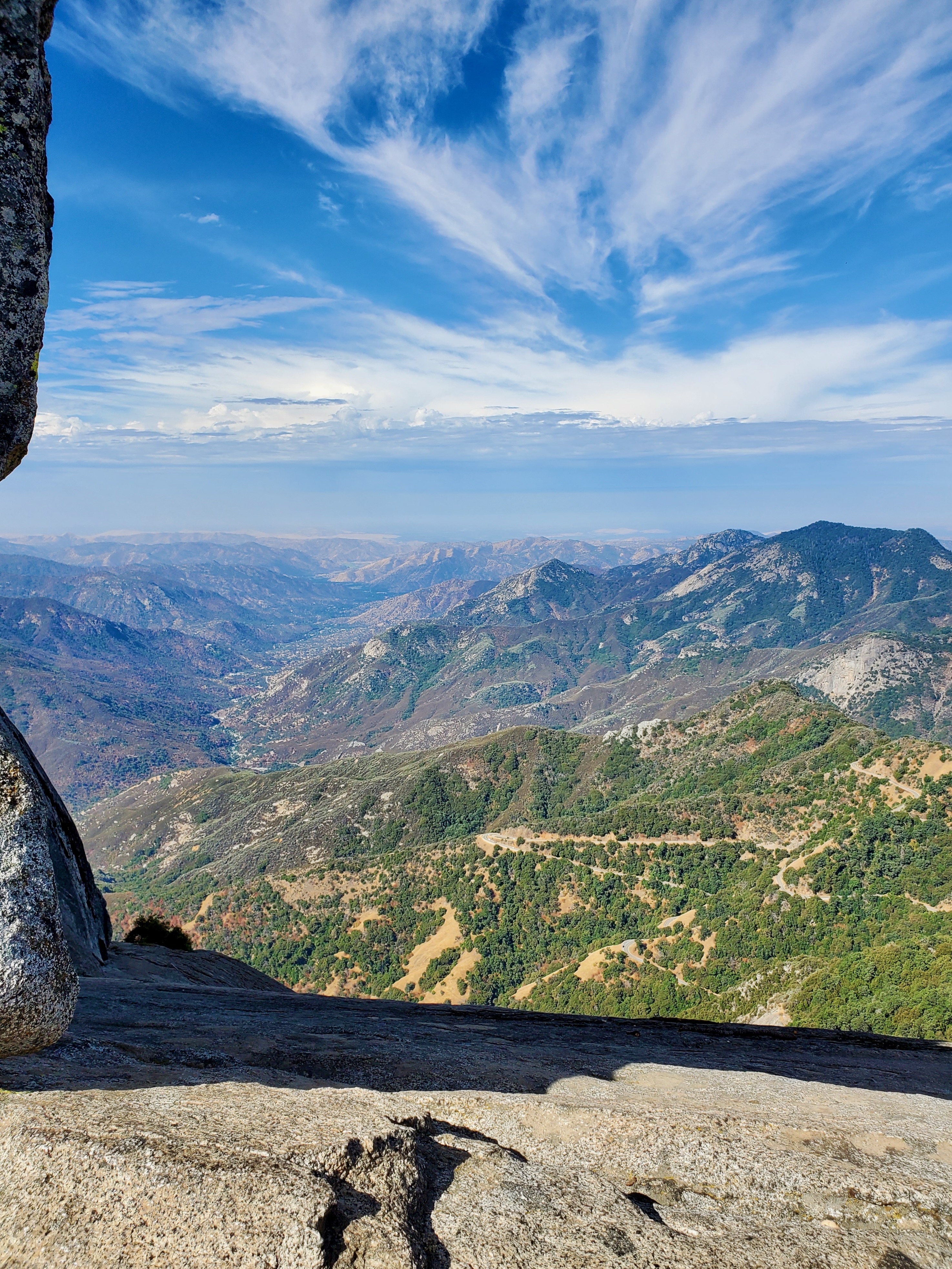
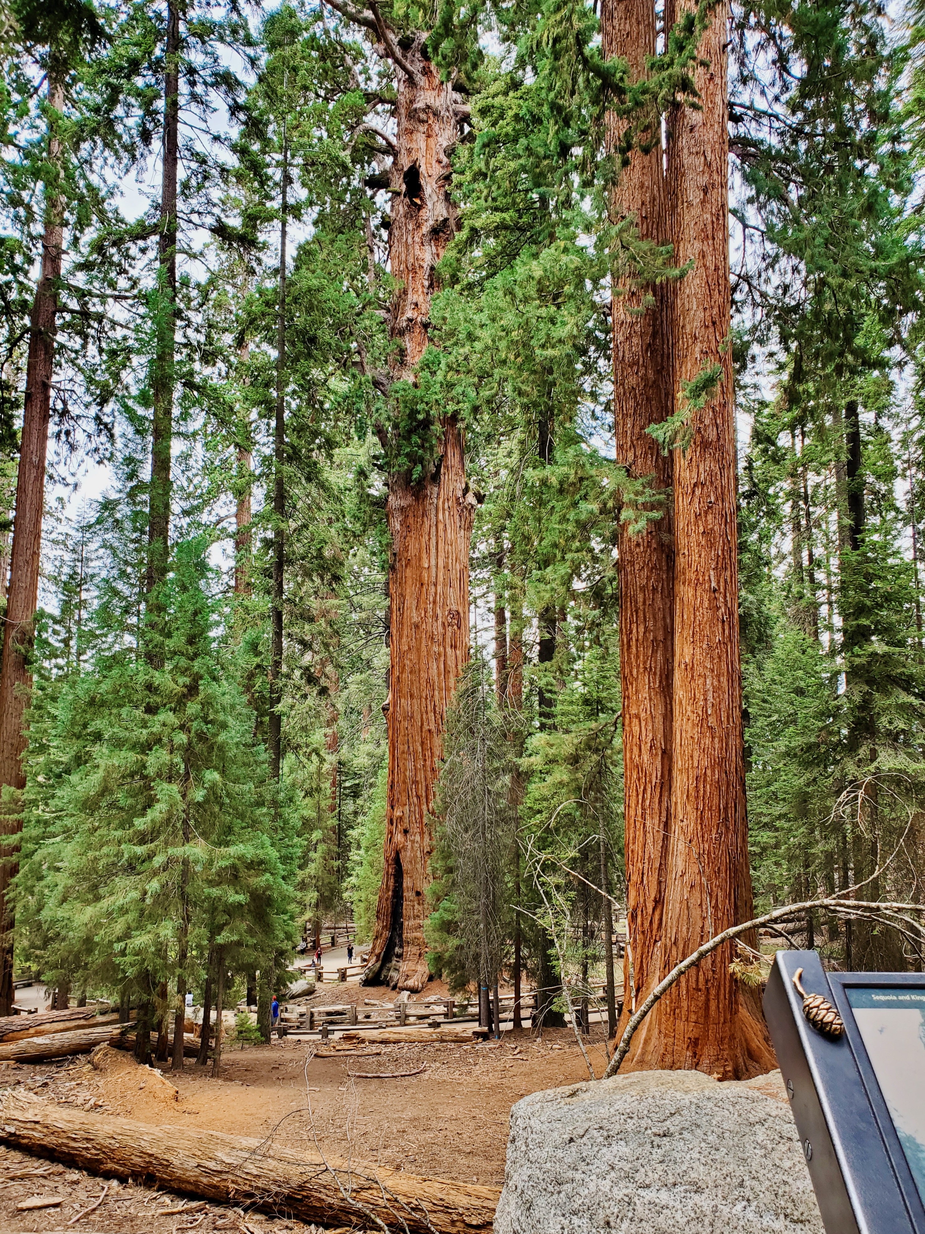
We drove the Generals Highway from Potwisha Campground to Lodgepole. This scenic drive goes through the Giant Forest, home to the largest number of exceptionally large Sequoia trees in the world. Our first stop was Moro Rock Trail, a 0.5-mile stairway that leads up to fantastic views of the park. From Moro Rock, a short drive leads to Tunnel Log, a car tunnel carved into a fallen Sequoia tree.


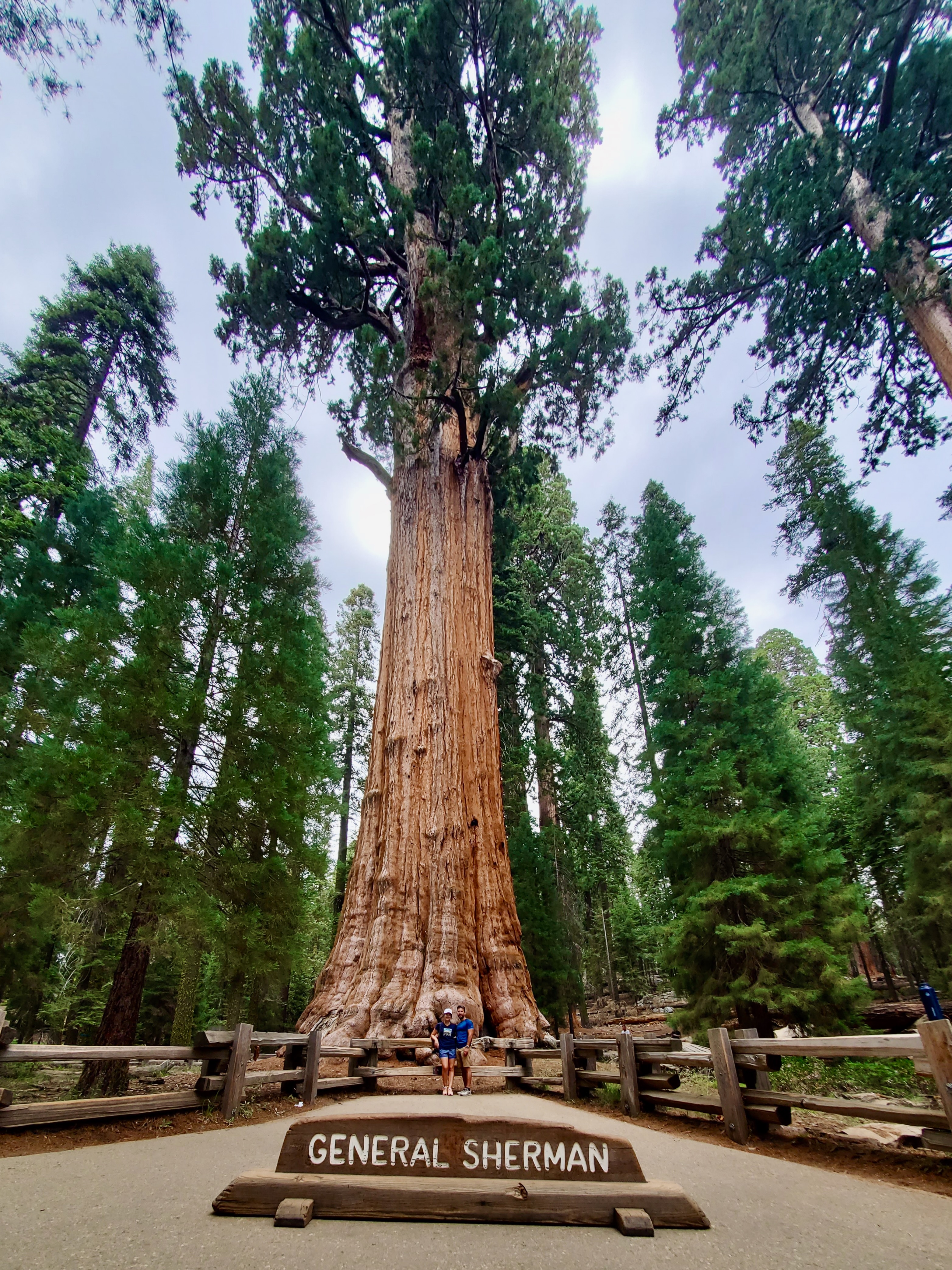
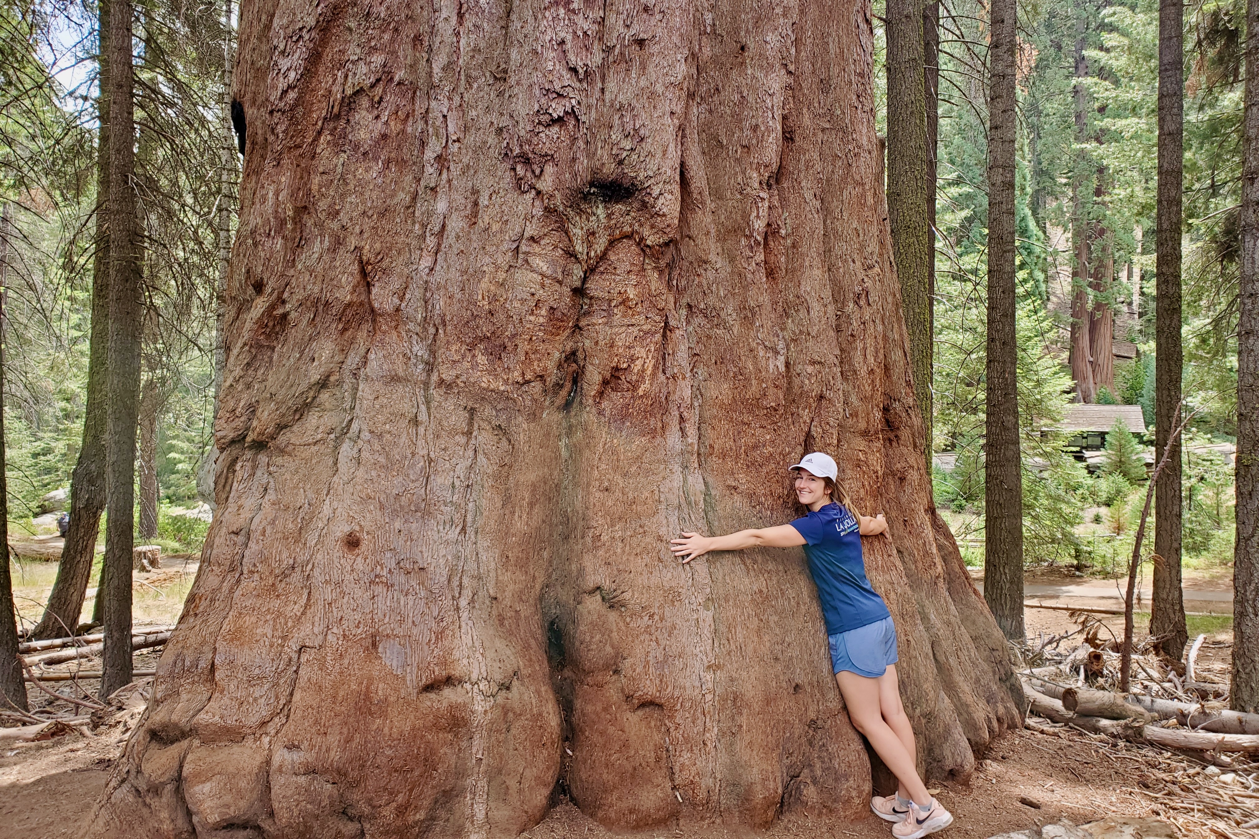
General Sherman is the largest tree in the world by volume of wood in the trunk. A short but impressive 0.5-mile walk leads up to the tree, passing many other giants on the way. You can continue hiking along the Congress and Alta Trails to the Giant Forest Museum to learn all about these giants, and shuttle back to the General Sherman Tree parking lot.
Camp: Potwisha Campground, Sequoia National Park
Day 5: Paso Robles
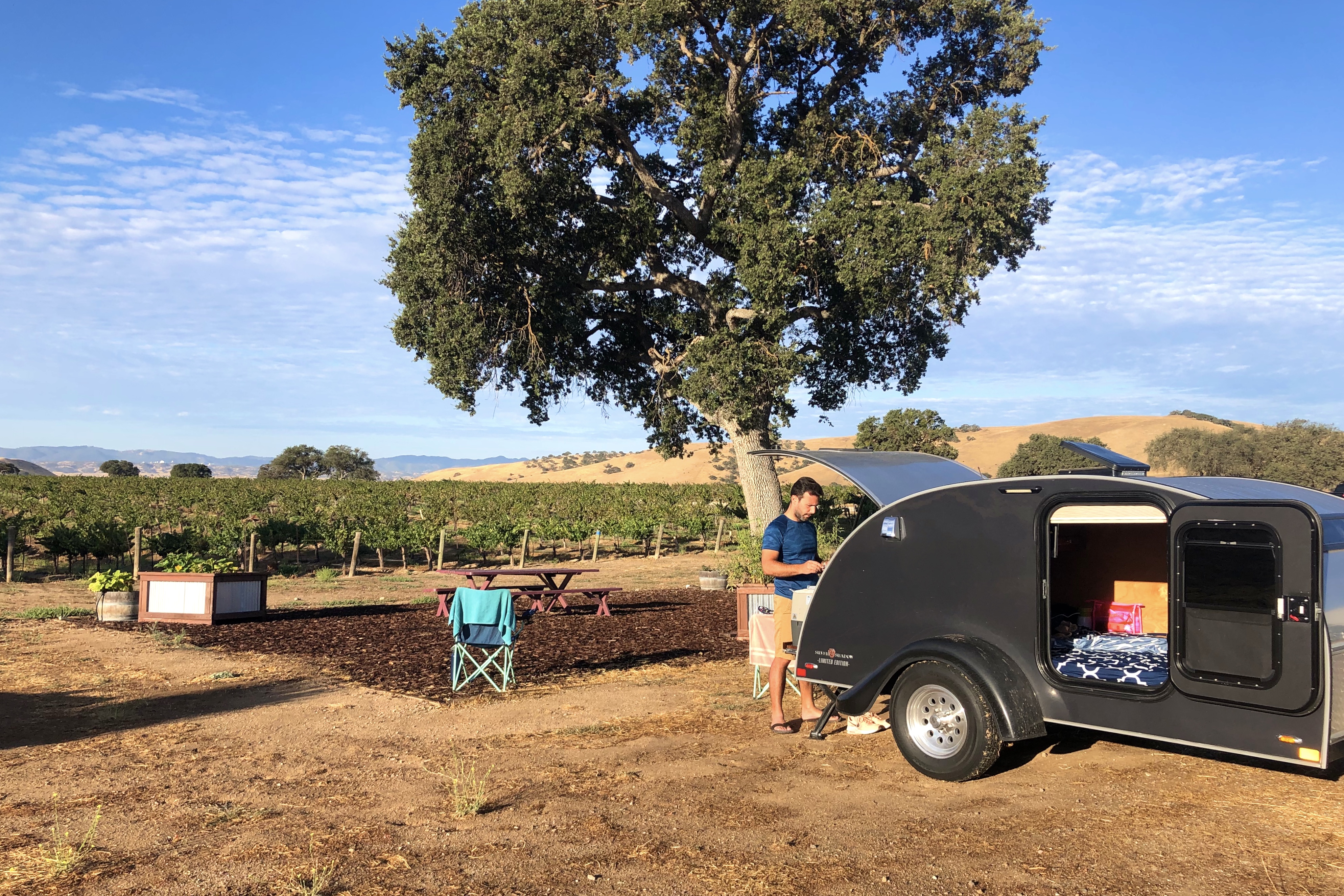
Looking for a taste of California wine country without going as far north as Napa Valley, we visited Paso Robles. This wine region is located in the heart of the Central Coast, halfway between Los Angeles and San Francisco. It is home to over 200 wineries, said to be less pretentious than their Napa and Sonoma counterparts. Downtown Paso Robles houses many tasting rooms from wineries in the region.
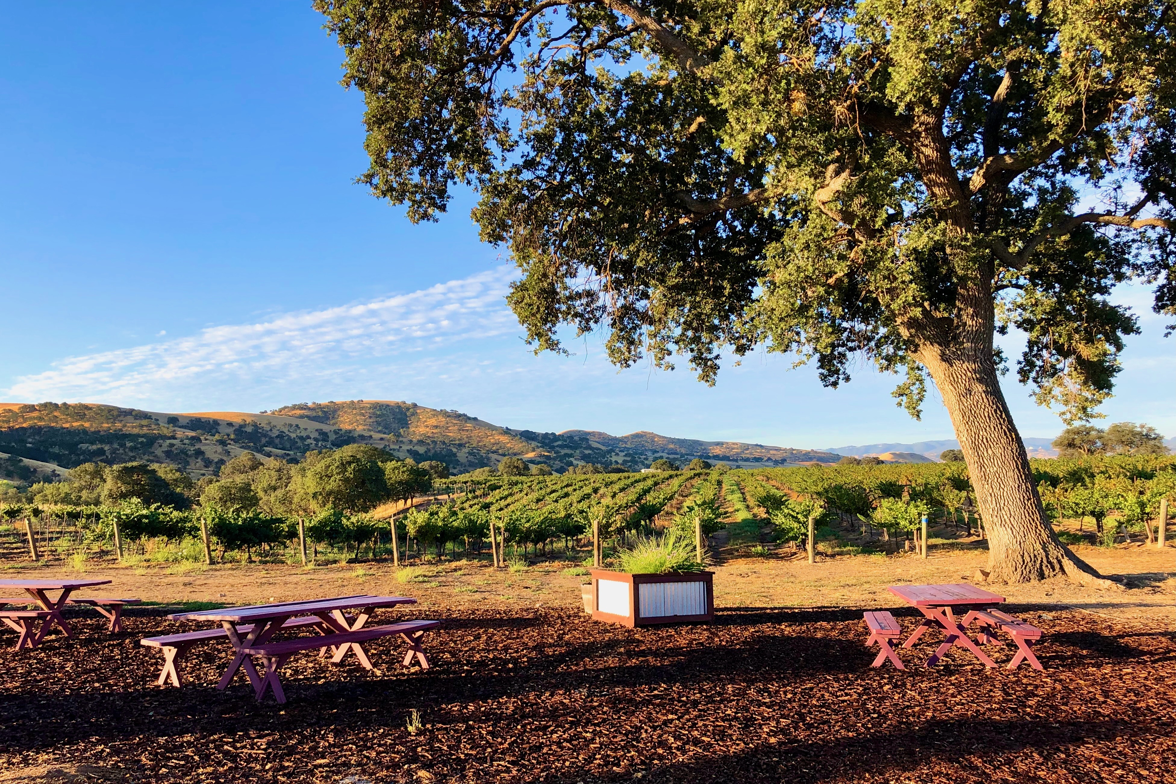
We stayed at a working winery, allowing us to take in the beautiful views until we turned in for the night. Pianetta Ranch & Winery exceeded our expectations with a unique barrel tasting. We enjoyed the wines so much that we ended up with a camper fridge full of wine for the remainder of the trip, to ensure it wouldn’t spoil.
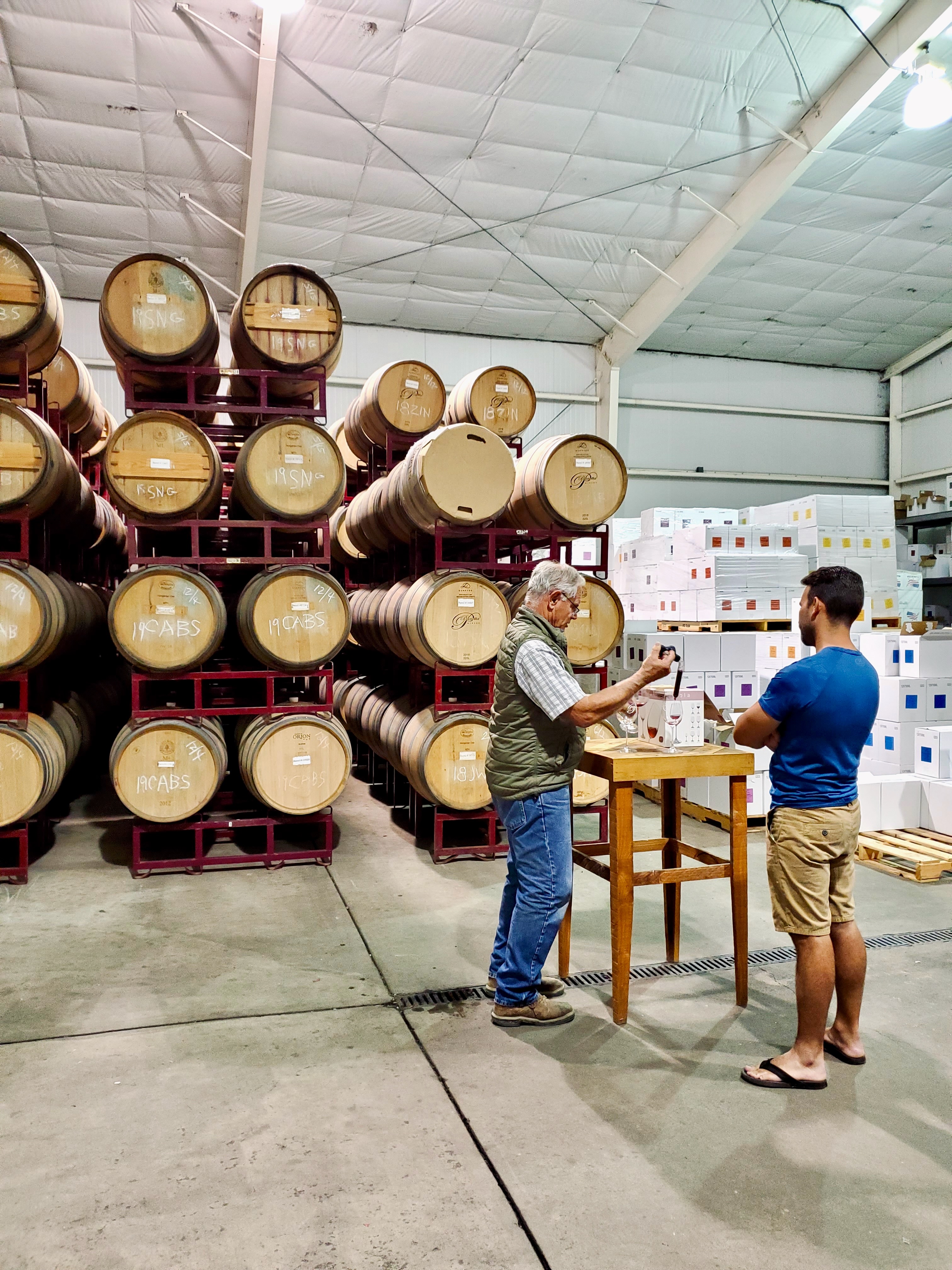

Camp: Pianetta Ranch & Winery, Paso Robles
This unique stay was booked through Hipcamp, but is currently not accepting reservations. Both Hipcamp and Harvest Host include wineries in Paso Robles that allow you to set up camp between the vines. There are also wineries that rent out vintage trailers.
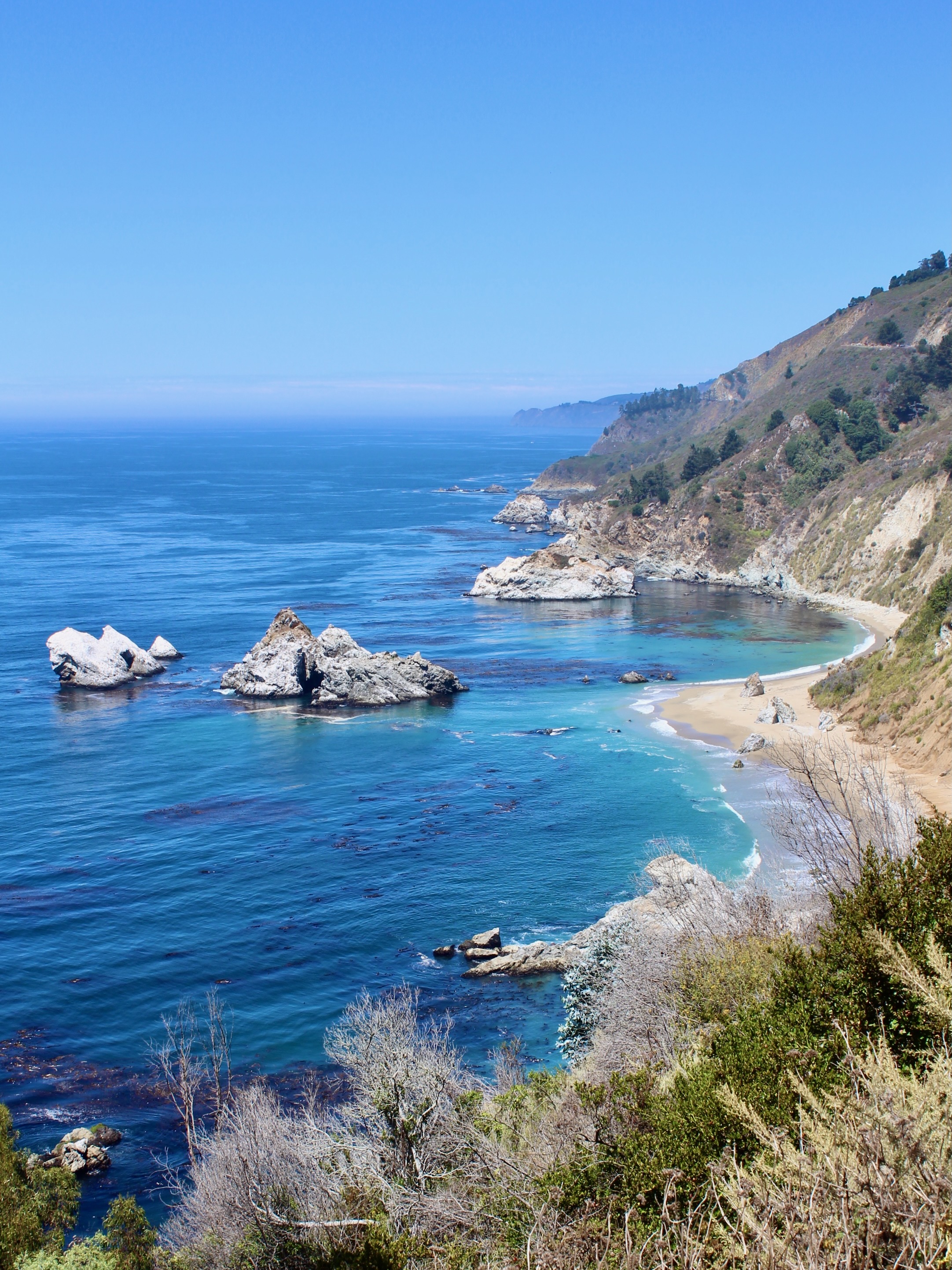
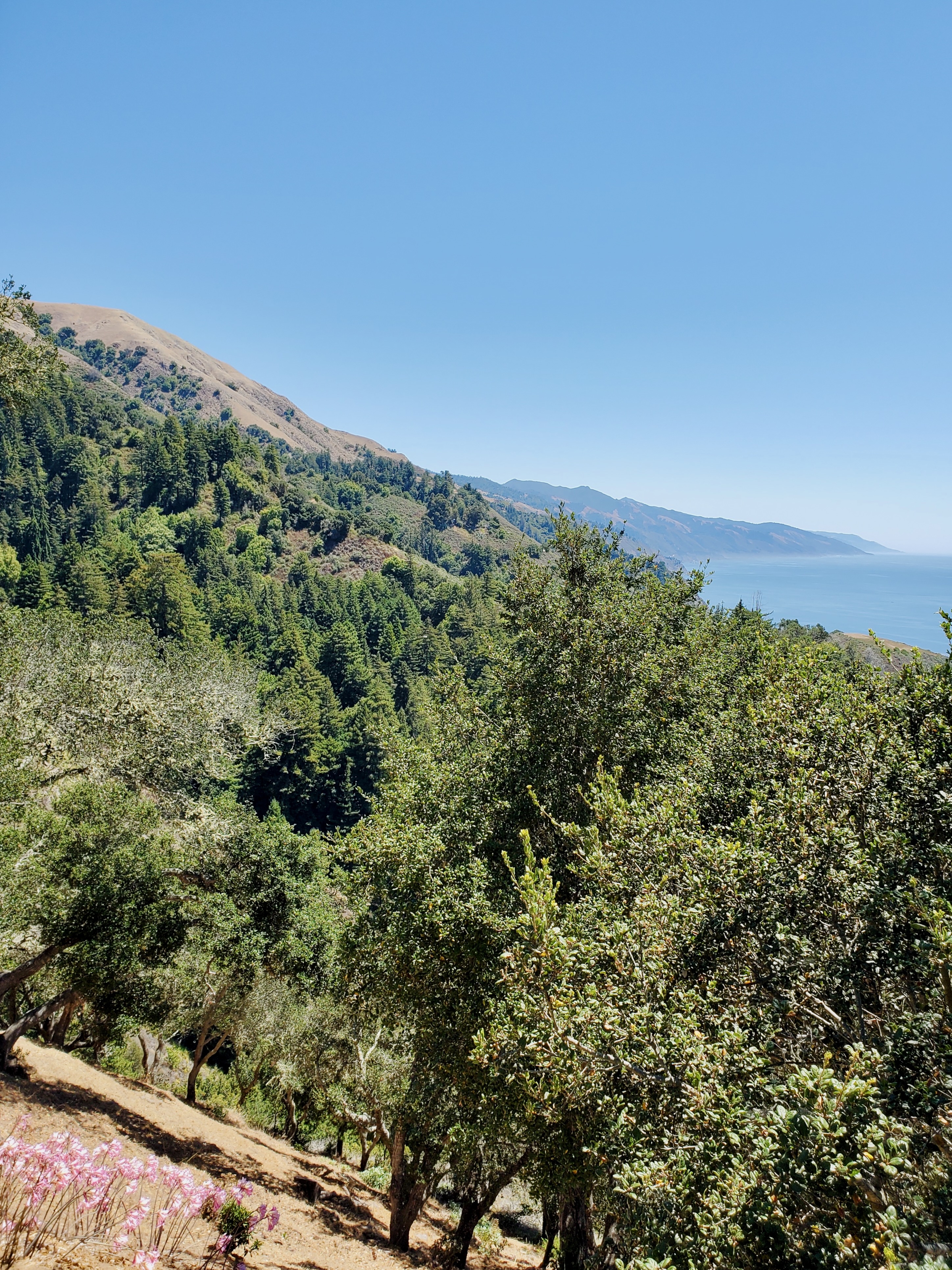
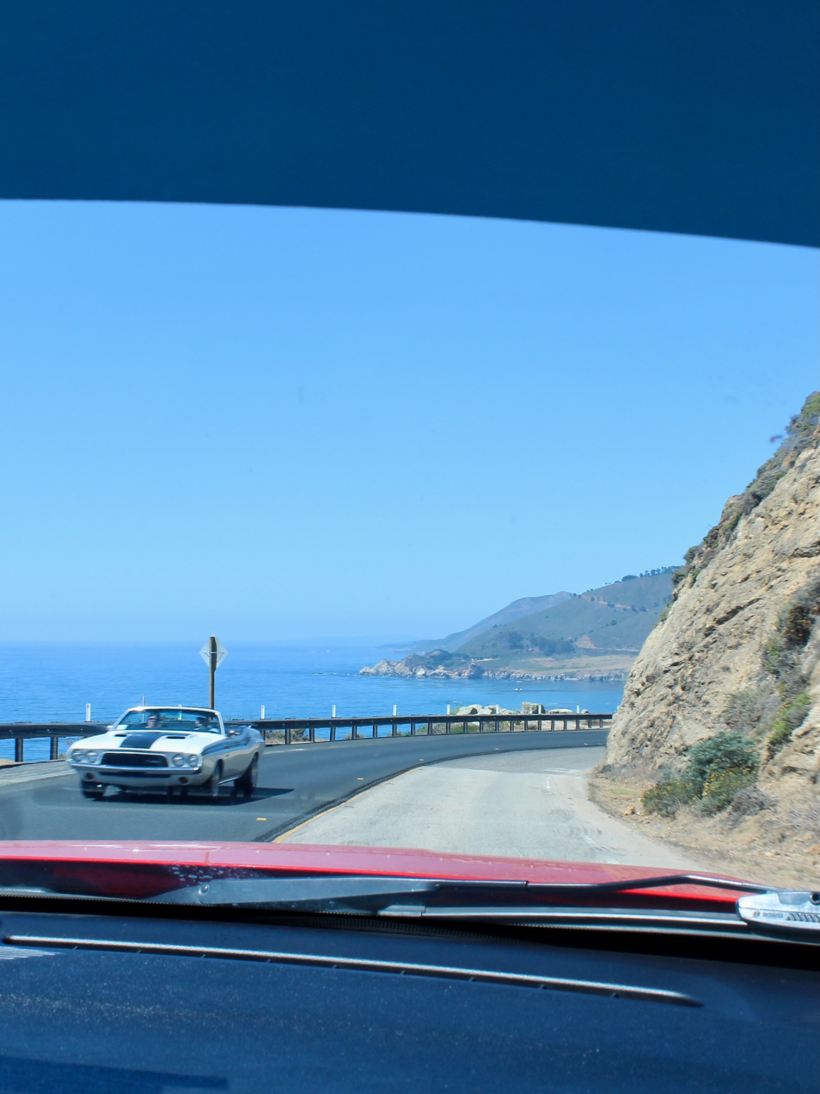
Day 6: California Highway 1
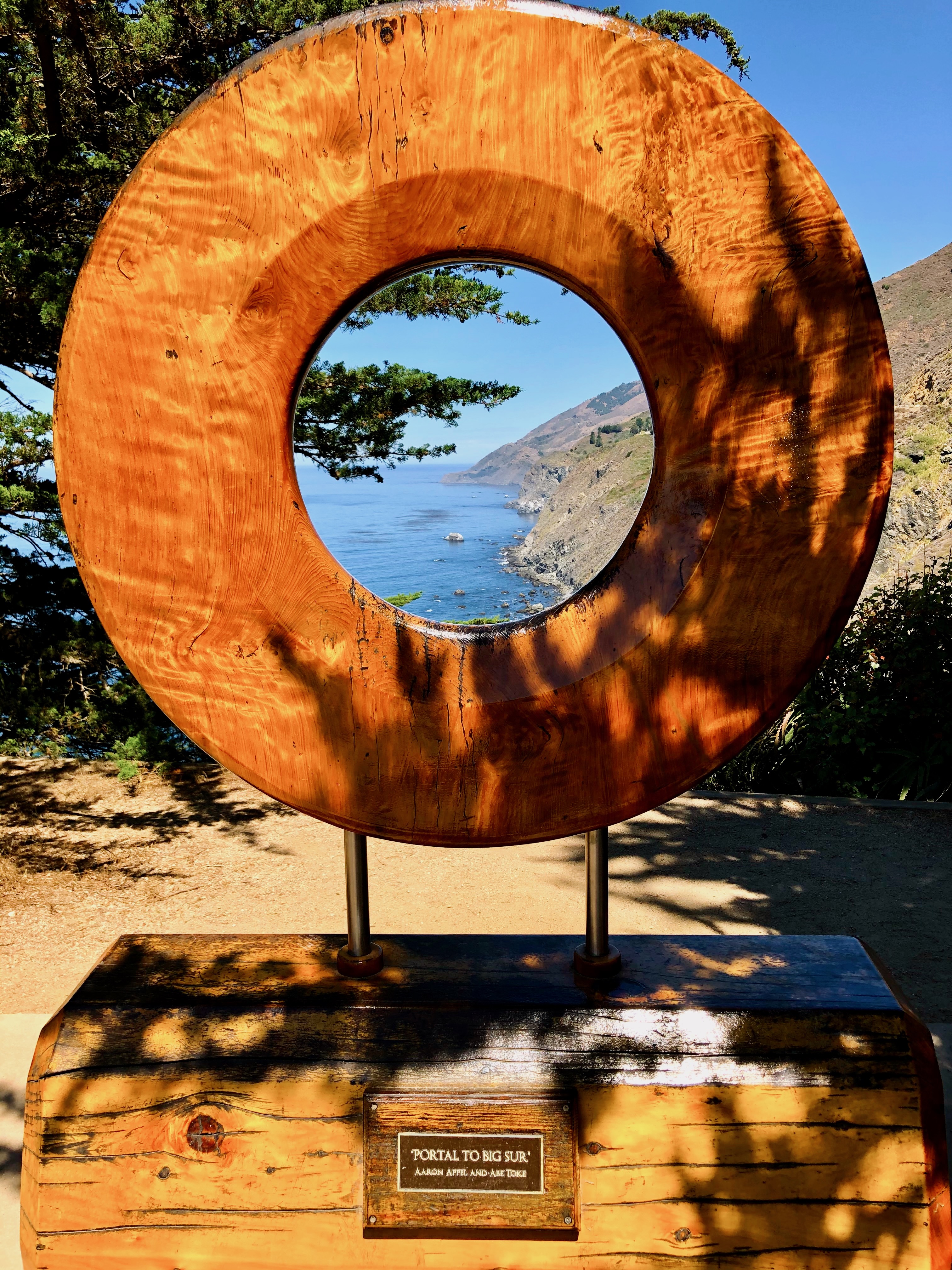
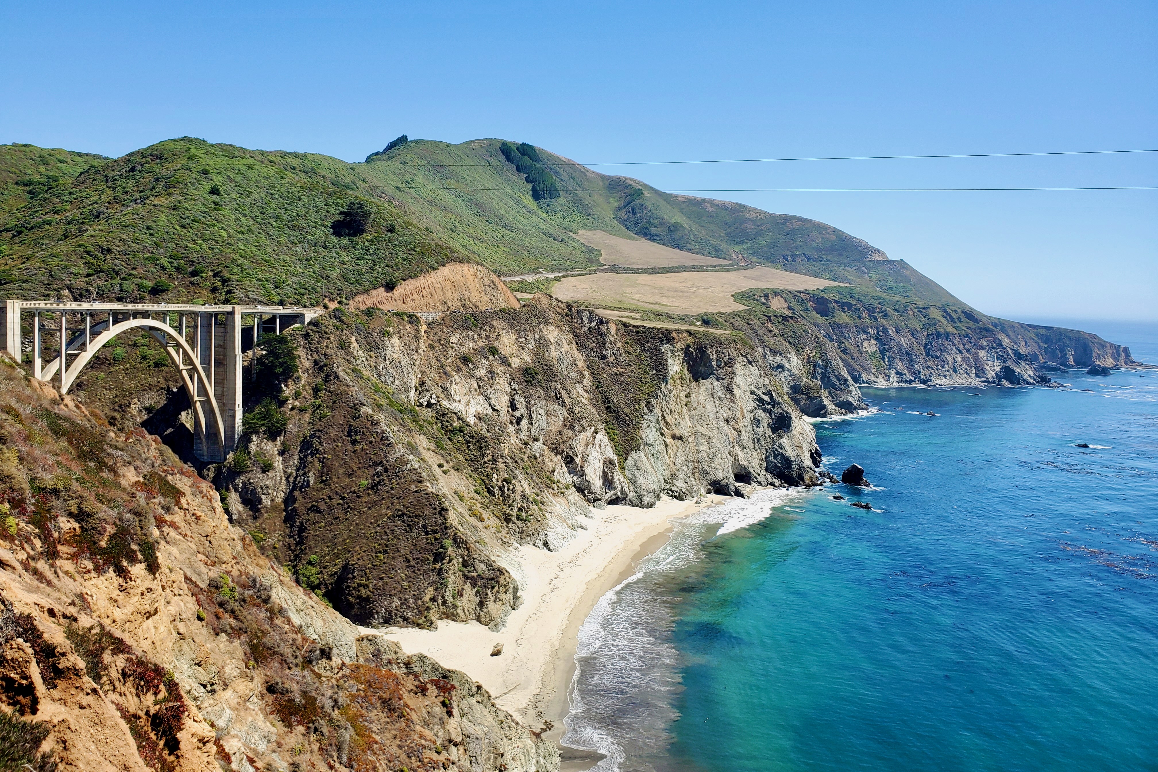
From Paso Robles, it’s a quick drive back to the California coast. The scenic California Highway 1 is known as the Pacific Coast Highway, running along the Pacific Coast for 655 miles between Los Angeles and San Francisco. Mountain views on one side and ocean vistas on the other, it’s not hard to see why this is one of America’s most iconic drives. We entered Highway 1 at Ragged Point, dubbed “the portal to Big Sur”.

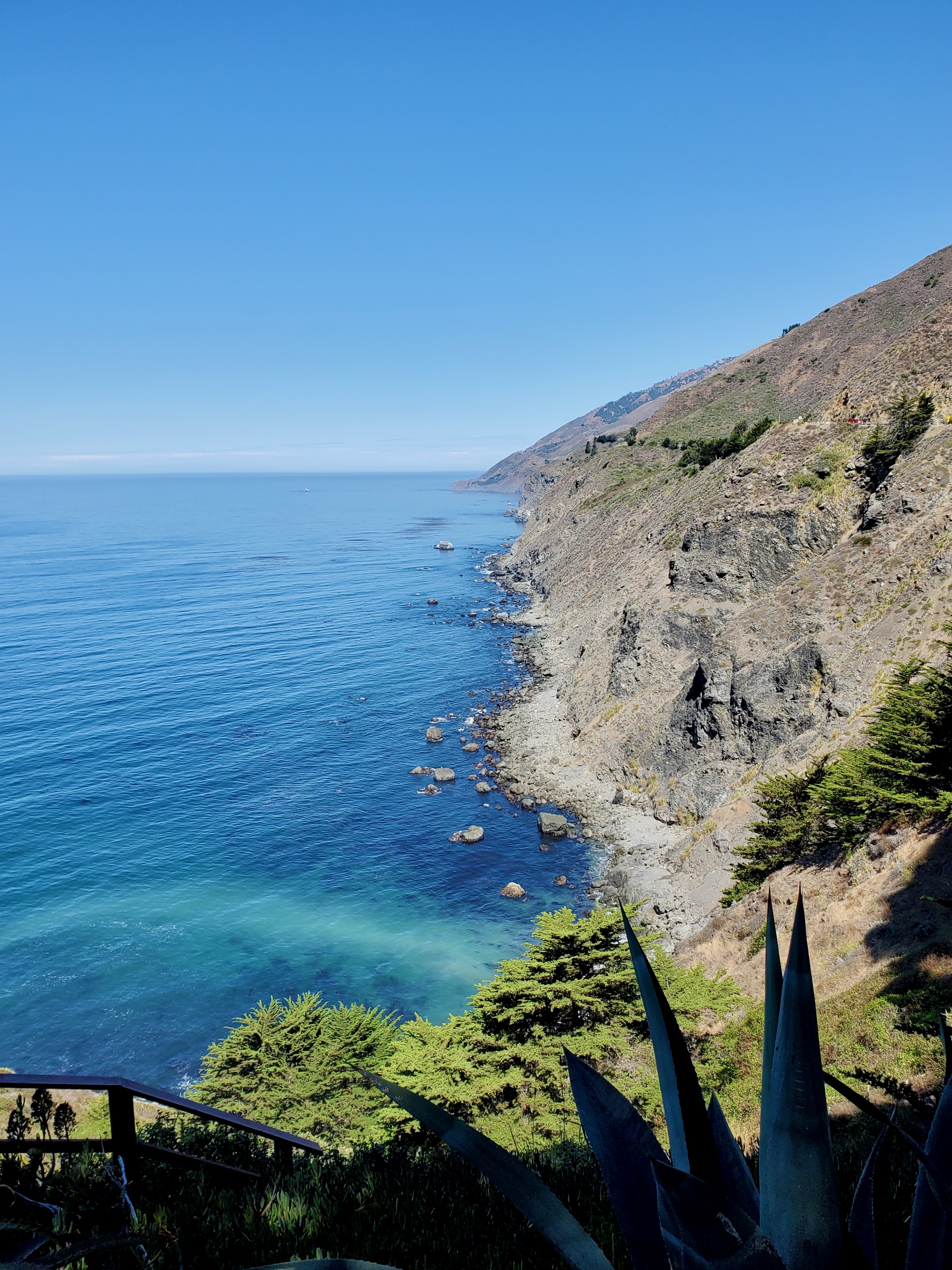

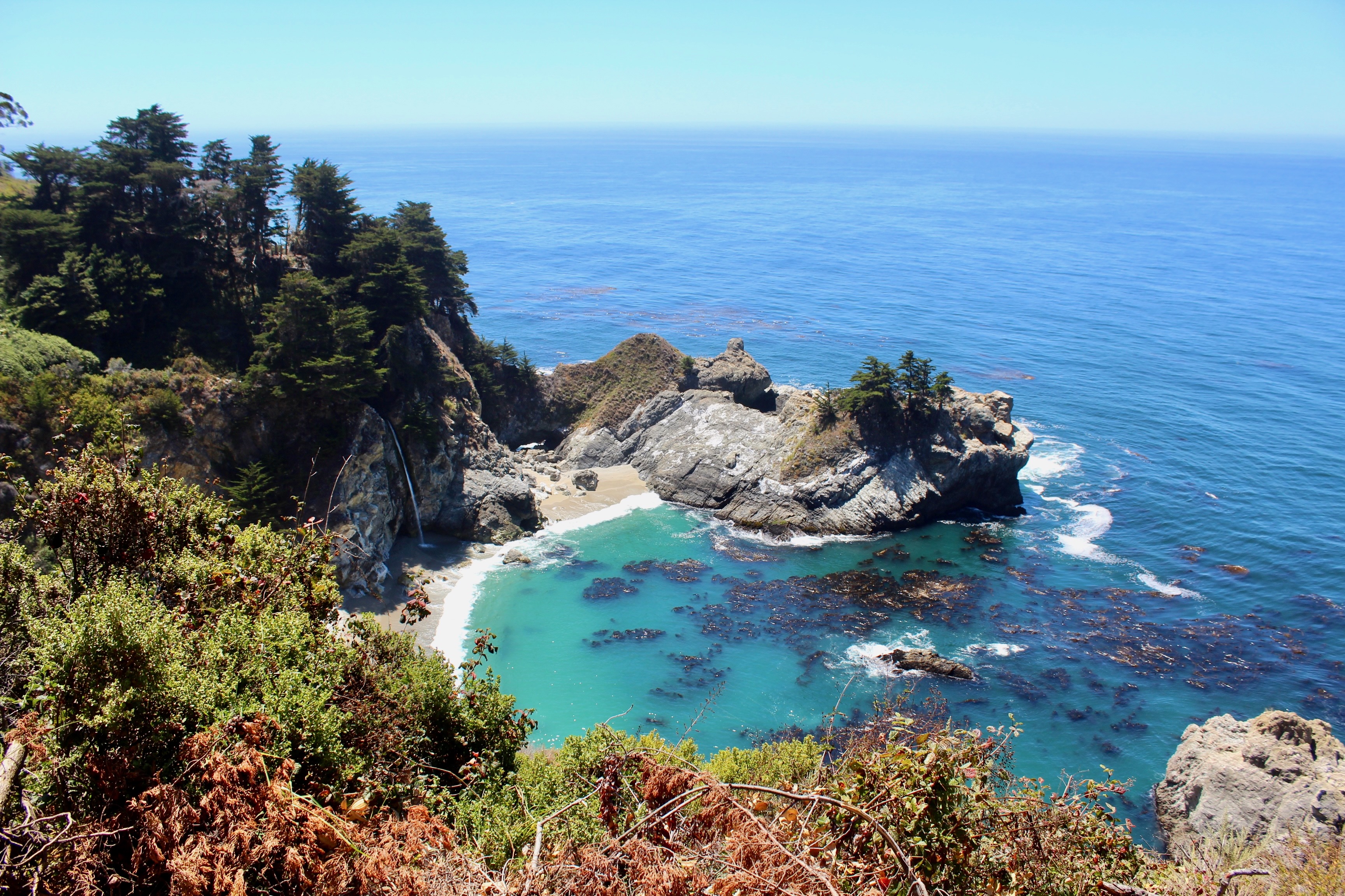
Parking along Highway 1 can be tricky, especially with a trailer in tow. Our first stop was McWay Falls, part of Julia Pfeiffer Burns State Park. As the overlook trail was closed when we visited, we parked along the road and still got a good view of this beautiful waterfall that empties in the ocean. Our lunch at Nepenthe restaurant was served with spectacular views of the Big Sur coastline. Before exiting Highway 1 in Monterrey, we drove over the iconic Bixby Creek Bridge. The best views are on the north side of the bridge, but parking is very limited.

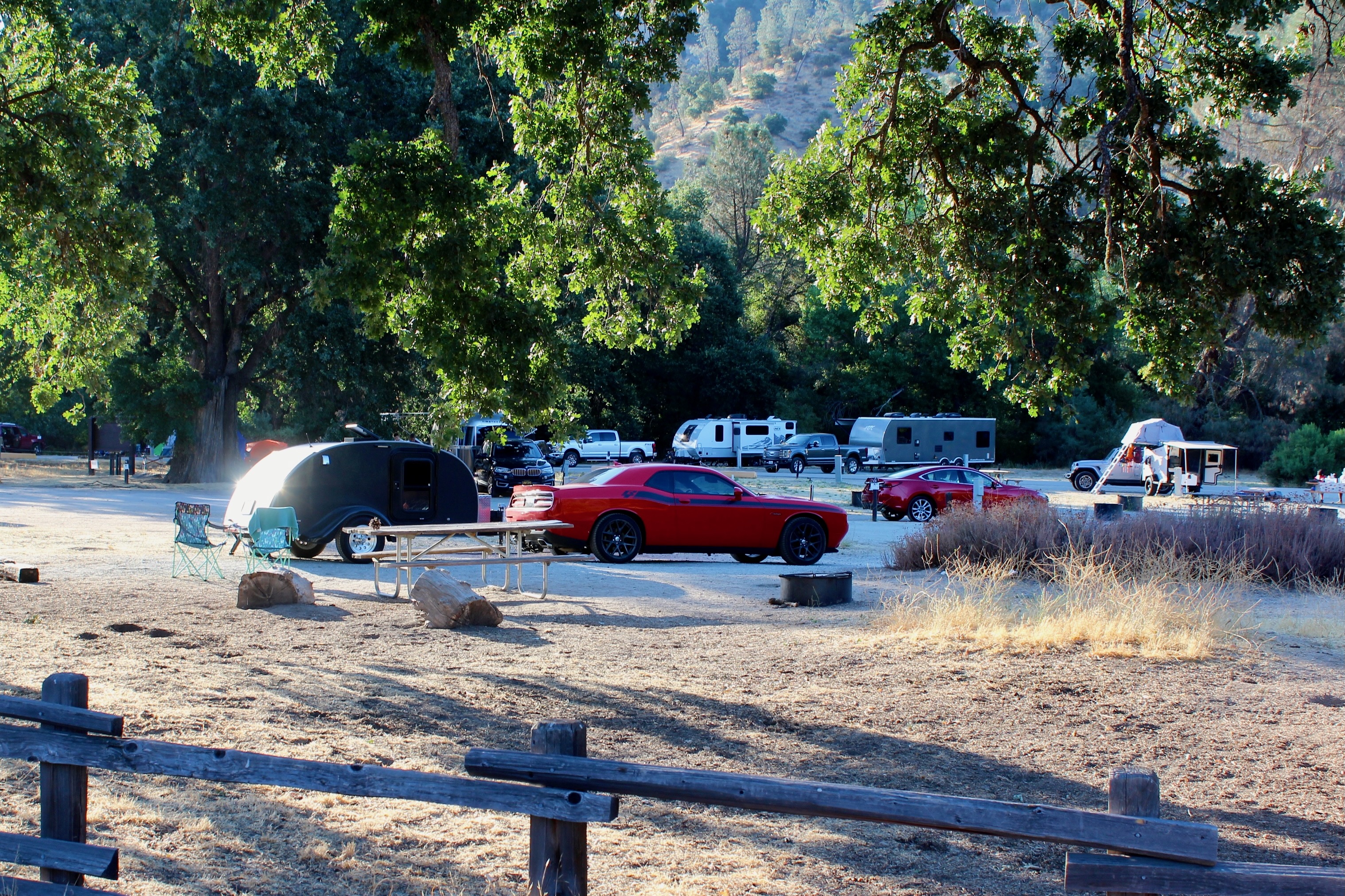
Camp: Pinnacles Campground, Pinnacles National Park
The best option is to camp at the stunning Pfeiffer Big Sur State Park along Highway 1, but the limited RV spots sell out months in advance in high season. Instead of a sea breeze, we got California dry heat in Pinnacles National Park. On the upside, the campground has a swimming pool to cool off in summer. The park is located an hour inland from Monterrey.
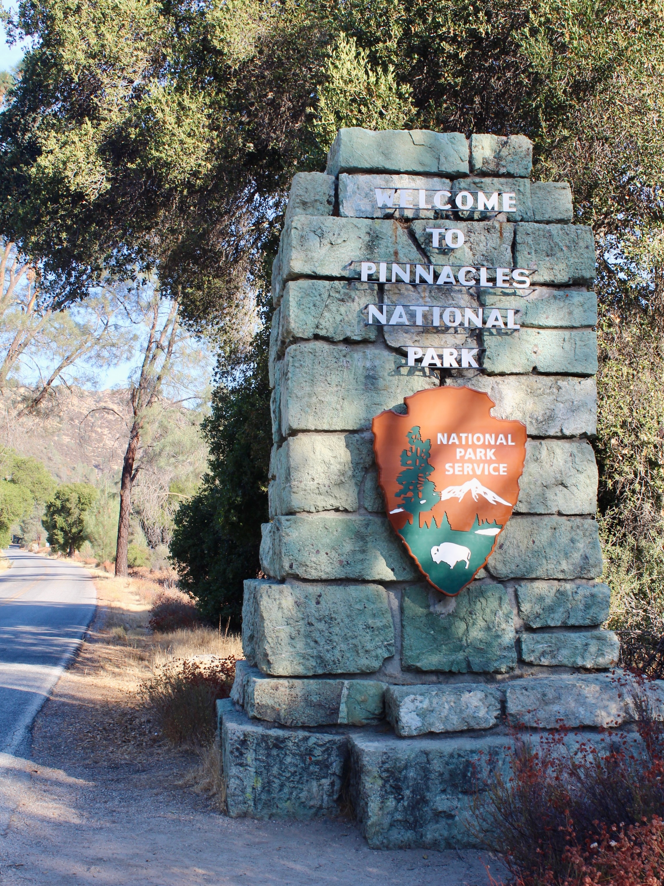
Day 7: Pinnacles National Park & Drive to Yosemite
If hiking in Pinnacles National Park during summer, make sure to start first thing in the morning. We attempted the High Peaks Trail, a popular 5.6-mile loop. Because the two-mile access road was closed for car traffic, we didn’t make it very far into the actual trail.

The drive from Pinnacles to any of the four Yosemite National Park entrances in the west takes around four hours. Campgrounds within the national park fill up months in advance during high season, so we settled for a campground just outside the park’s South Entrance. You can save a lot of driving time if you are able to snatch a camp spot within the park borders, especially in Yosemite Valley, the heart of the park.


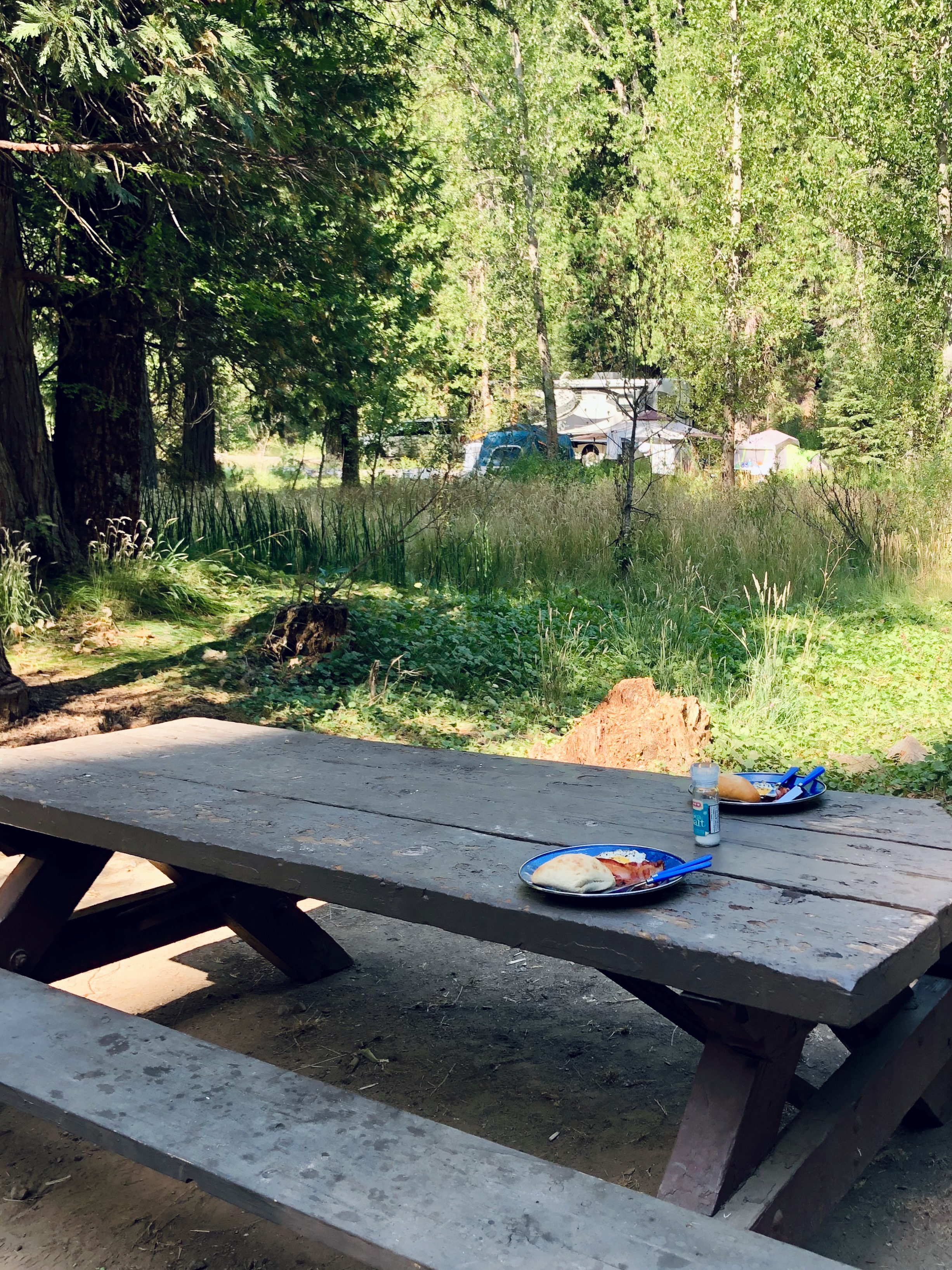
Camp: Summerdale Campground, Sierra National Forest
Just 1.5 miles from Yosemite’s South Entrance, Summerdale Campground offers a welcome break from the Yosemite Valley heat. A creek runs through the campground and trees provide plenty of shade. We gladly returned to our little green oasis after a day of exploring. The campground is located within the Sierra National Forest.

Day 8: Yosemite National Park
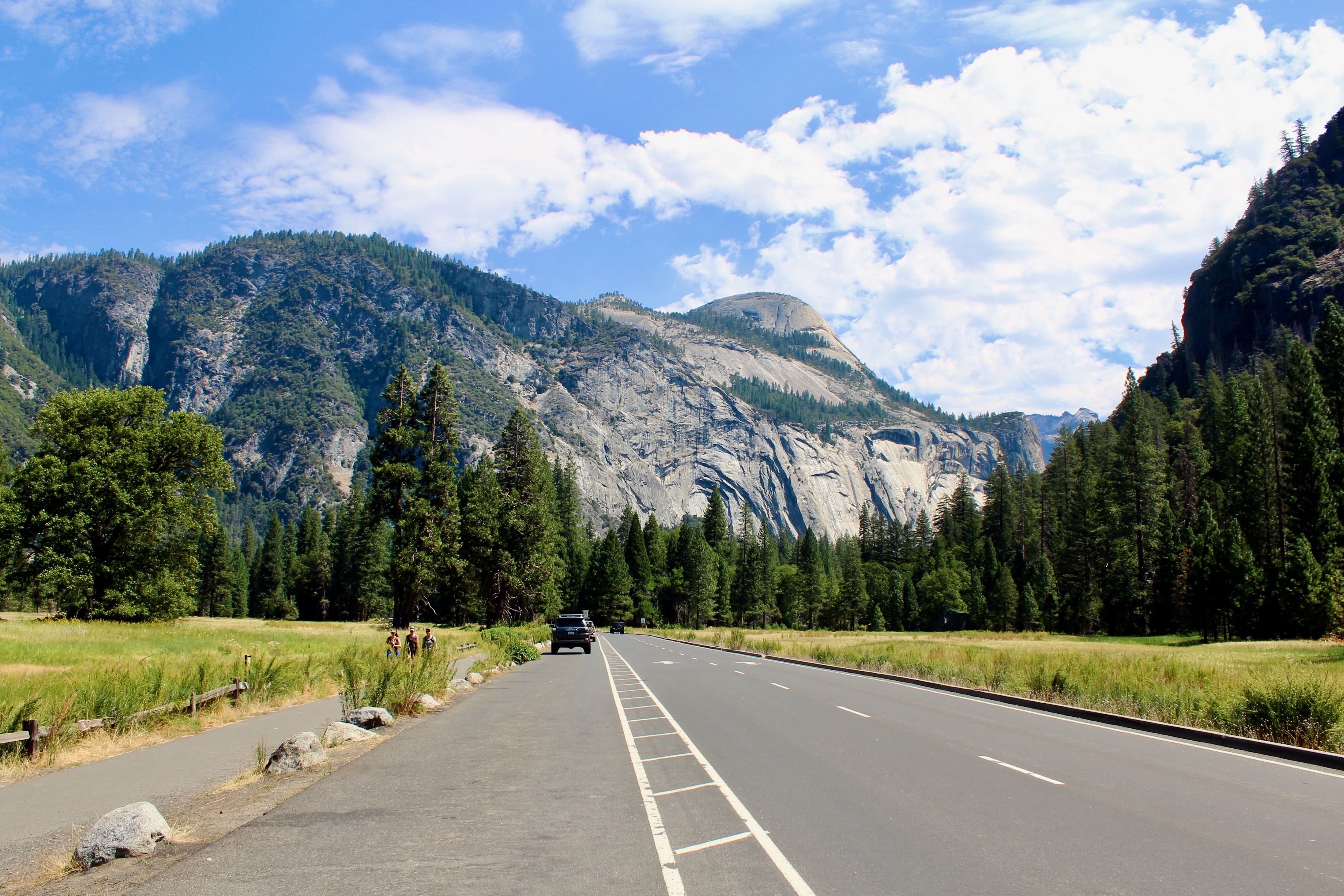
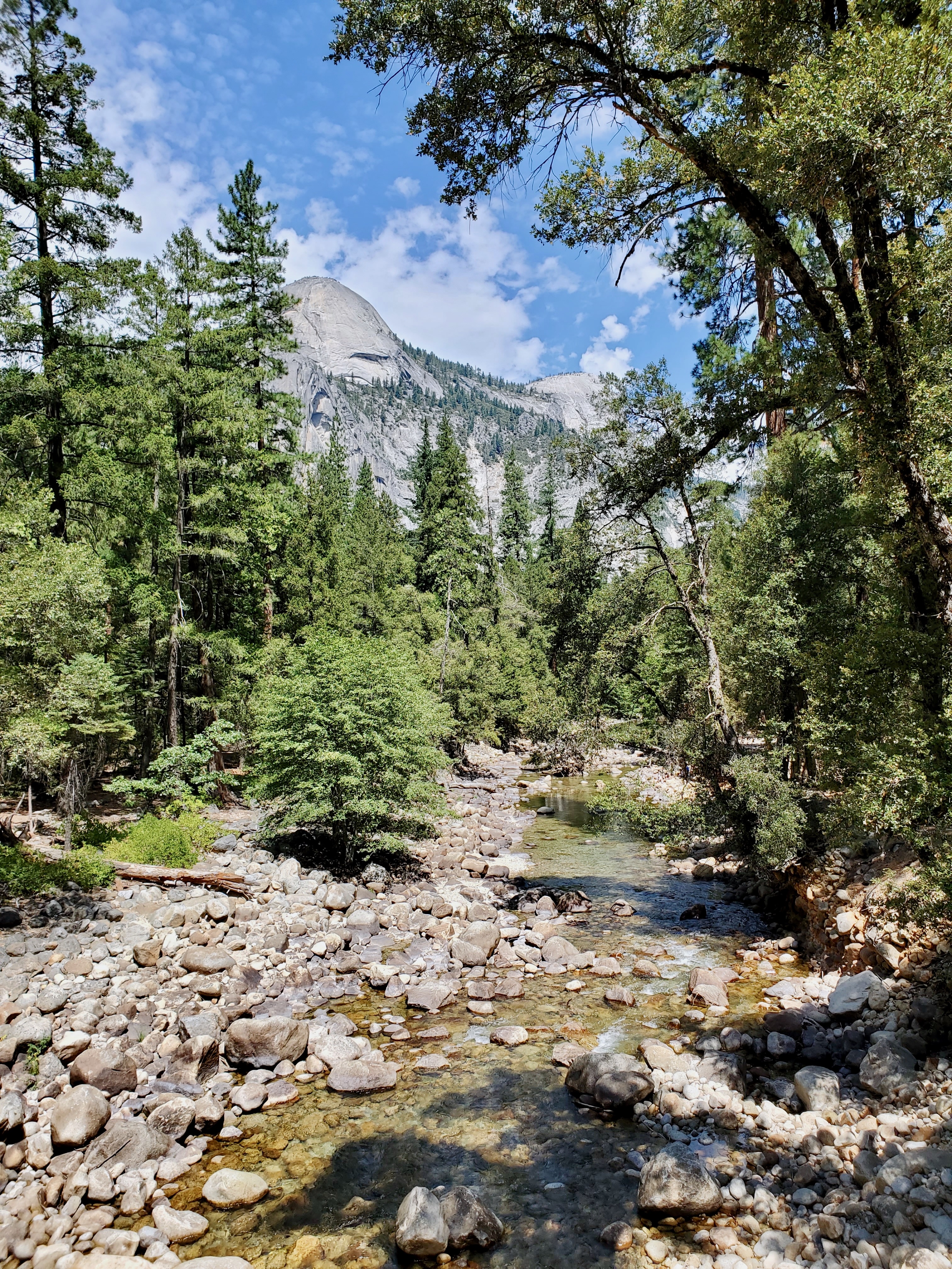
We spent our first day in the park in and around Yosemite Valley. If you only have one day in Yosemite, this itinerary hits the major highlights. Accessing from the South Entrance via Wawona Road, Tunnel View provides a first majestic view of Yosemite’s scenery. Just down the road, you enter the jaw-dropping one-way loop that runs through Yosemite Valley, providing access to many trails and viewpoints.

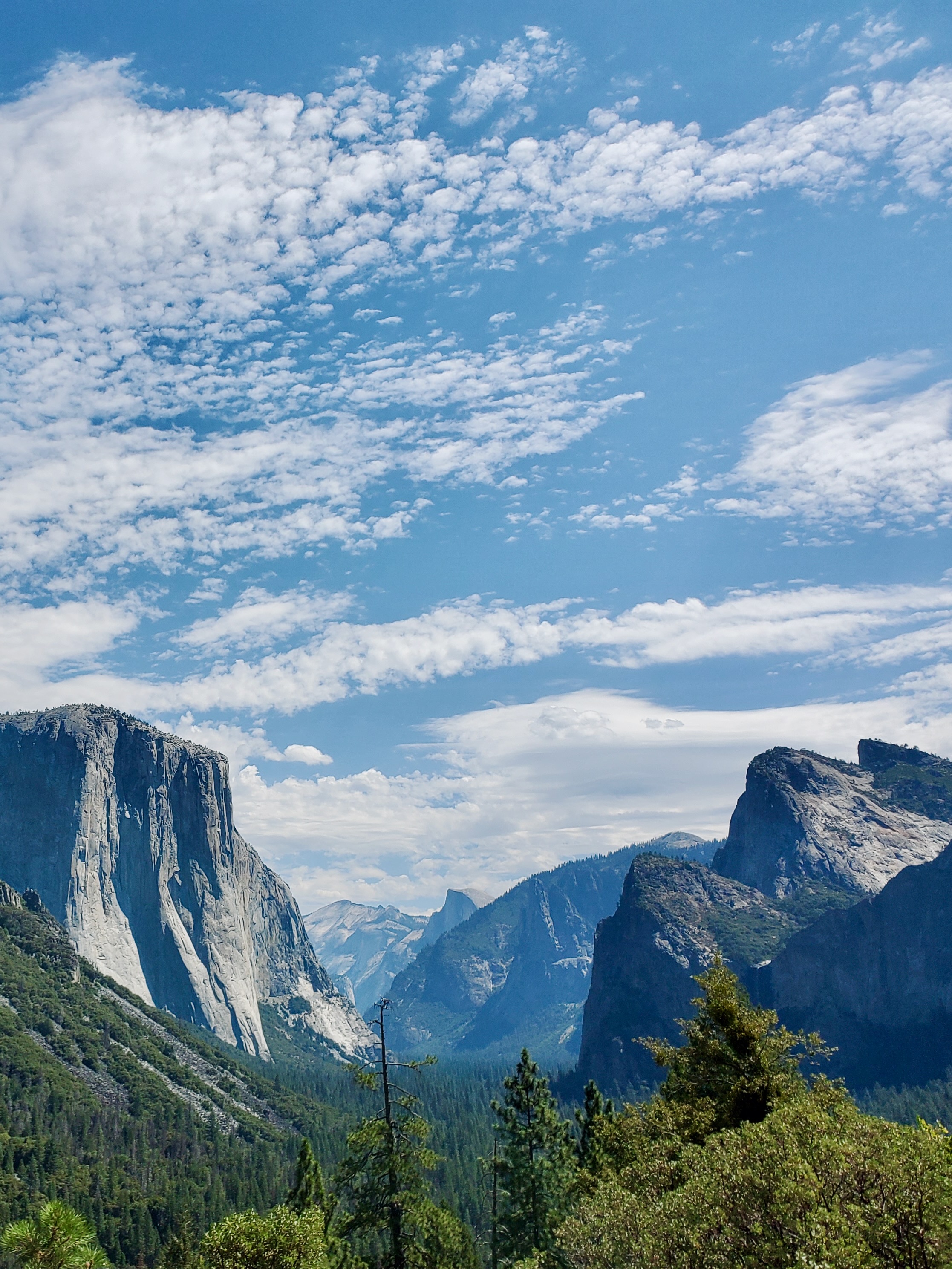

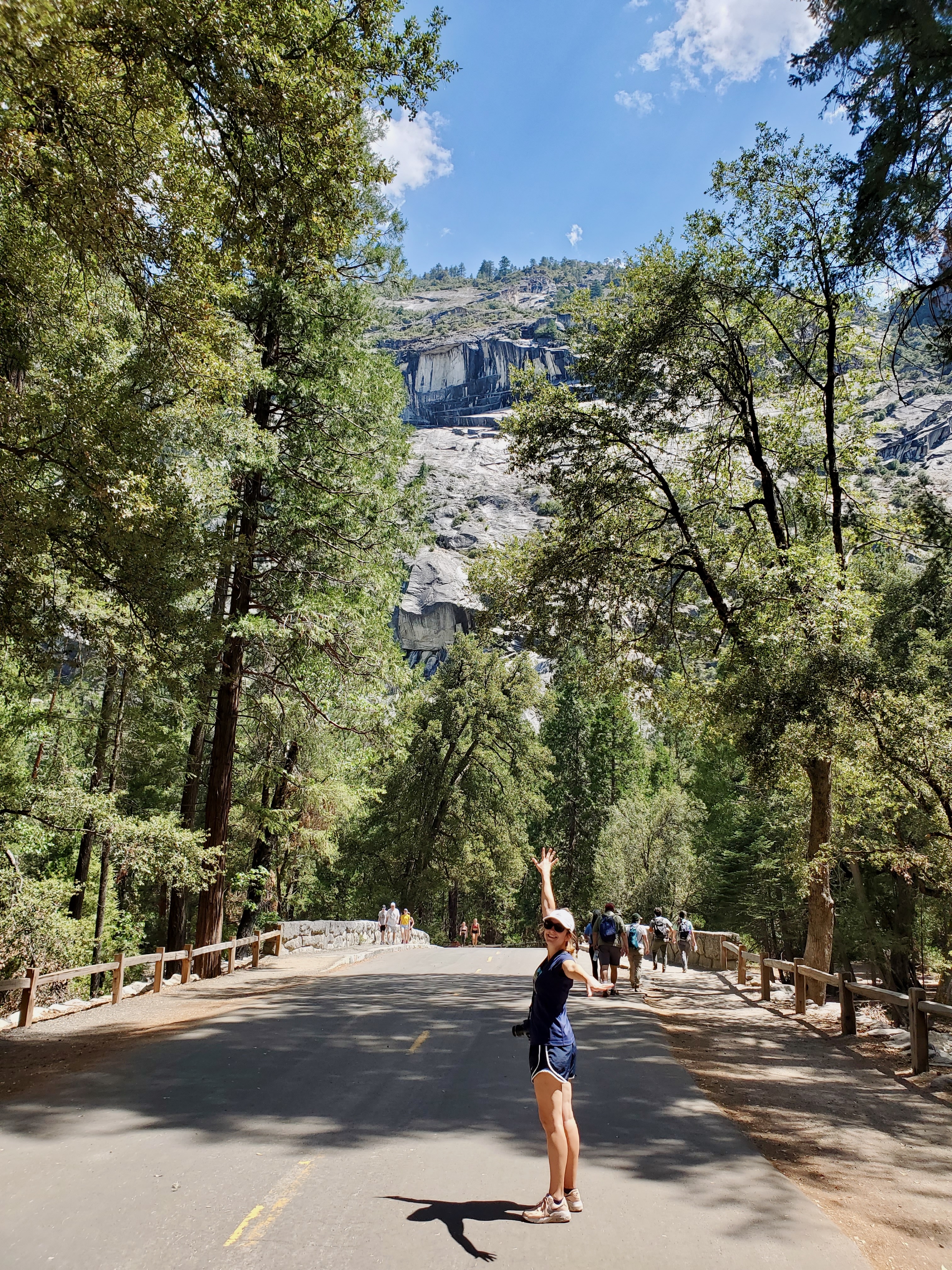
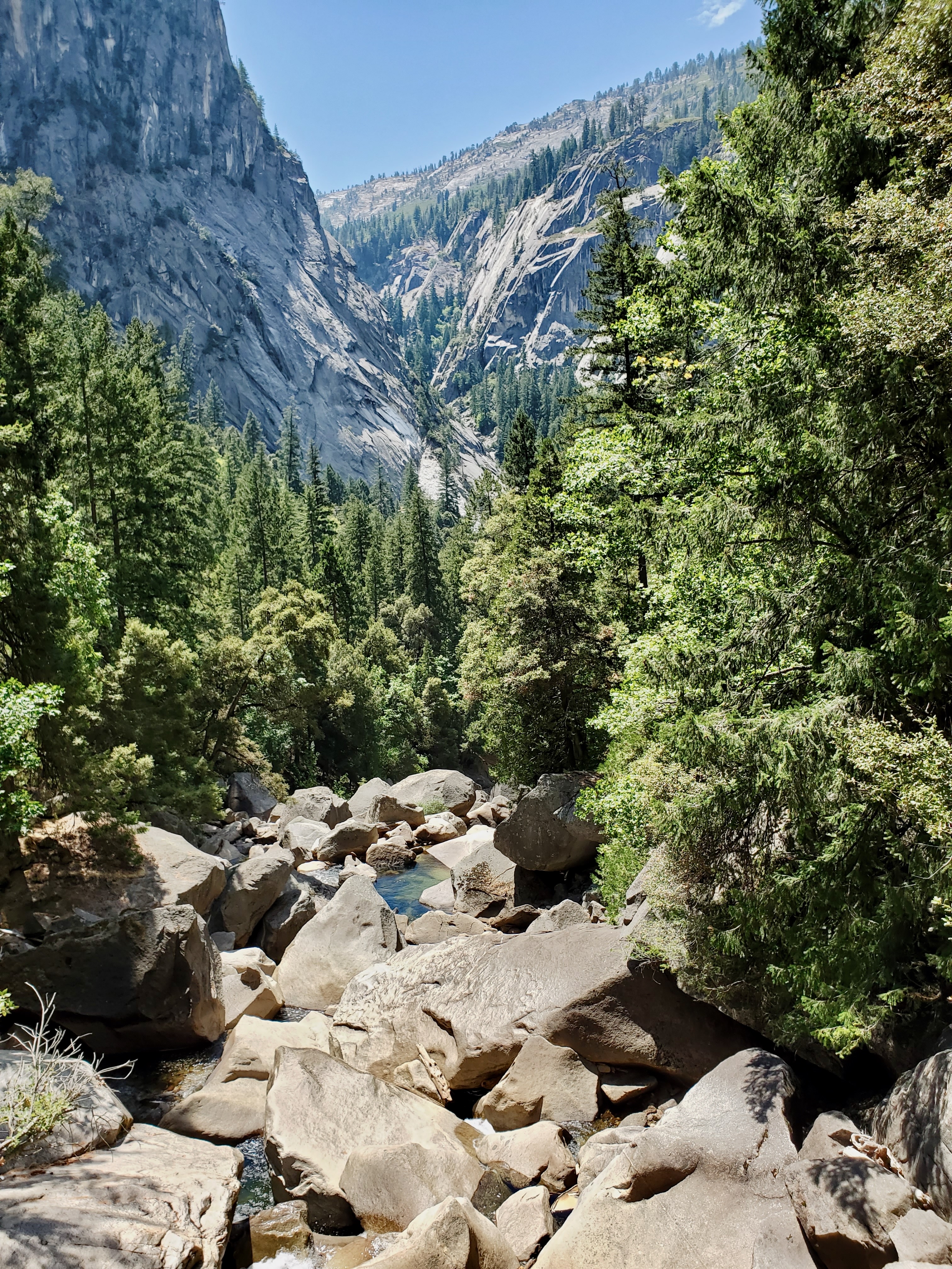
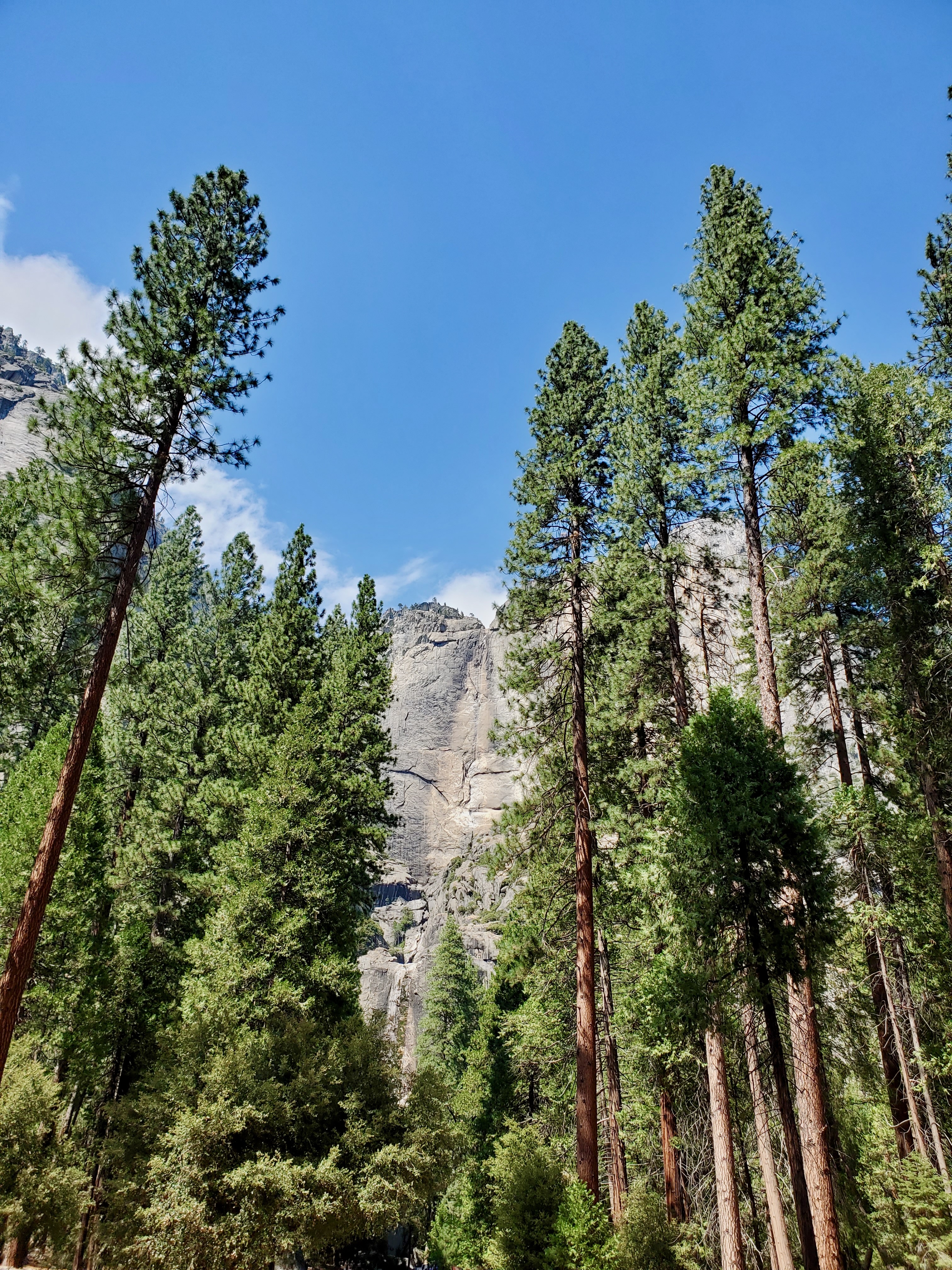
A challenging but highly rewarding hike is the Vernal and Nevada Falls via the Mist Trail, a 7.2-mile loop. We started at noon and only braved the heat until Vernal Falls Foodbridge, but even on the first mile the scenery is stunning. An easy loop is the 1-mile Lower Yosemite Falls Trail to the base of the falls, but they were completely dry in August. Right before exiting the Yosemite Valley Loop, Valley View makes up a perfect picnic spot. From the river bank, you get stunning views of El Capitan and Bridalveil Fall.

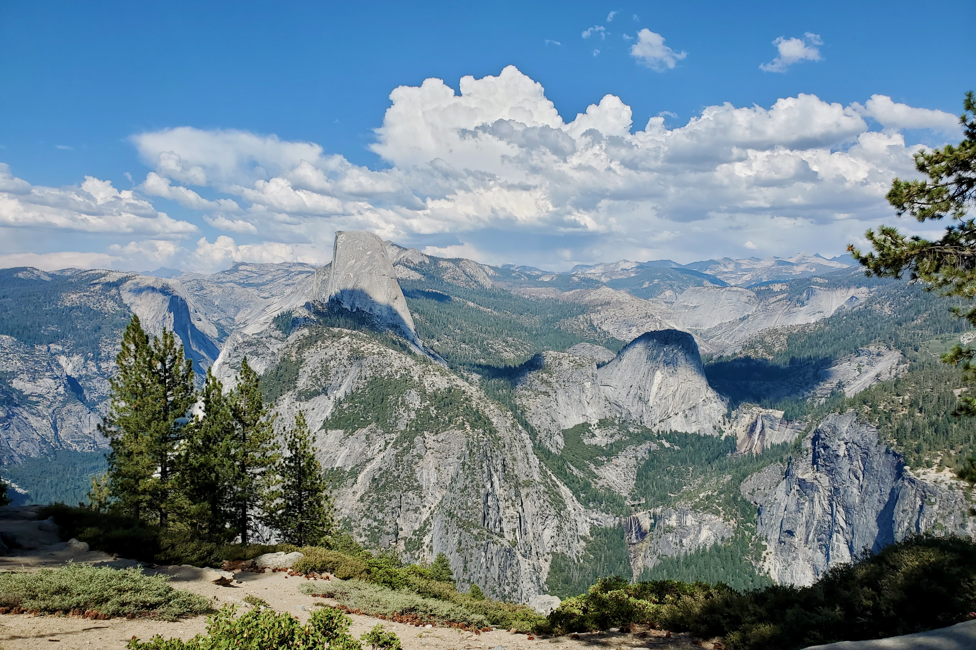
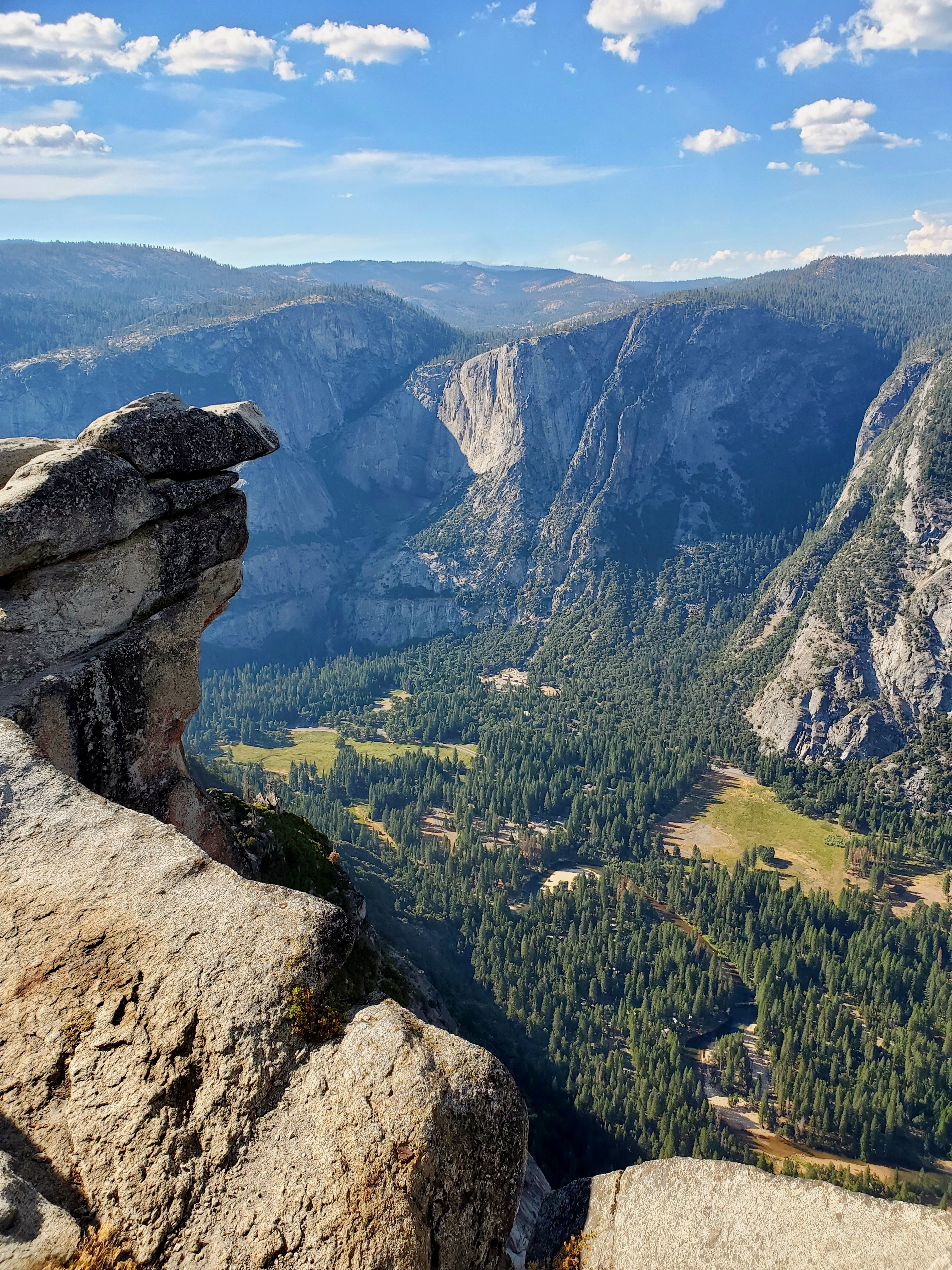
Heading back south on Wawona Road, we took the turnoff to Glacier Point Road. After a one-hour drive up, you reach two spectacular viewpoints at 7,500 feet. Washburn Point reveals Vernal and Nevada Falls from above, while Glacier Point provides a breathtaking overlook over Yosemite Valley and Half Dome.

Camp: Summerdale Campground, Sierra National Forest
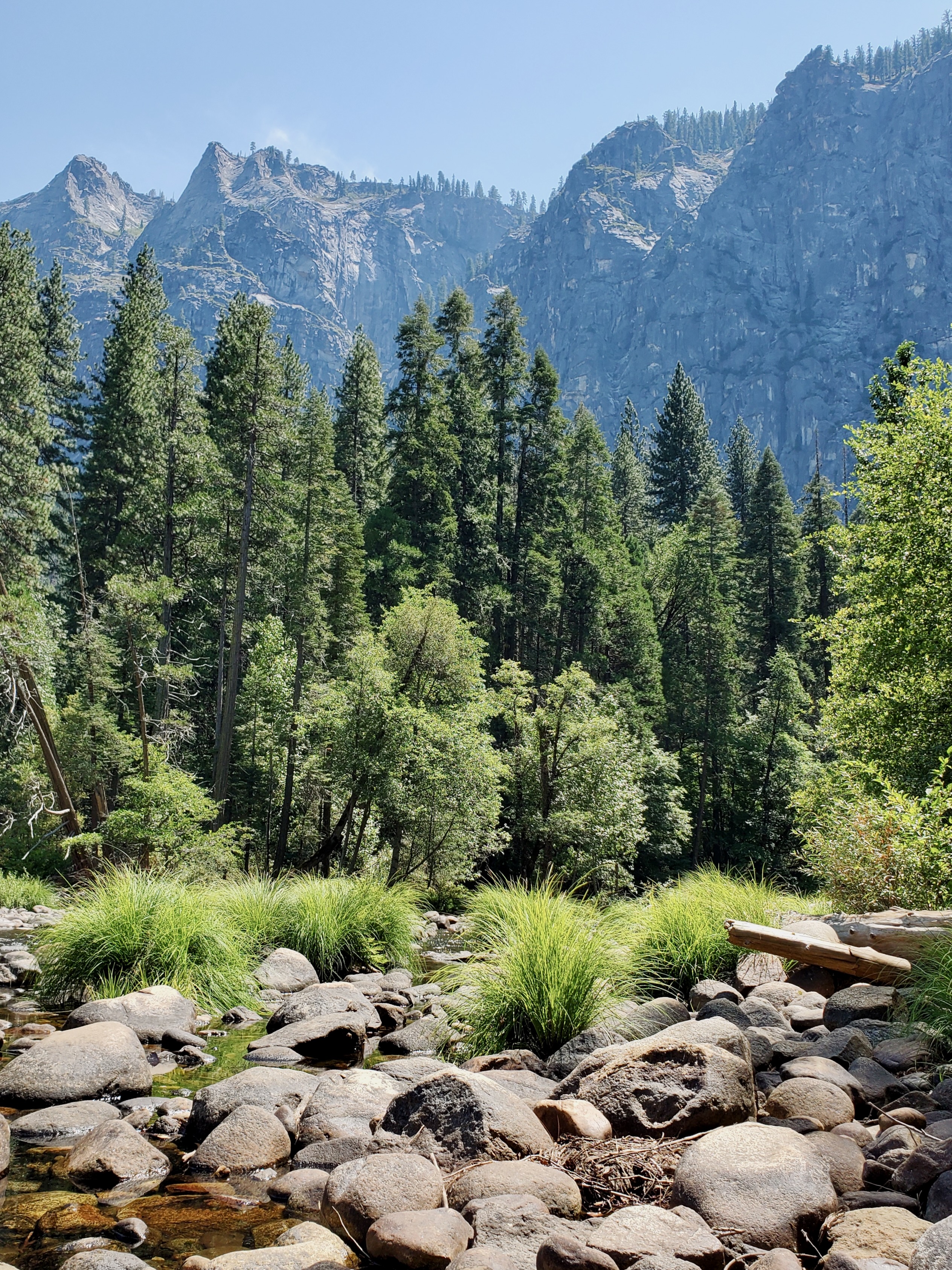
Day 9: Yosemite National Park via Tioga Pass
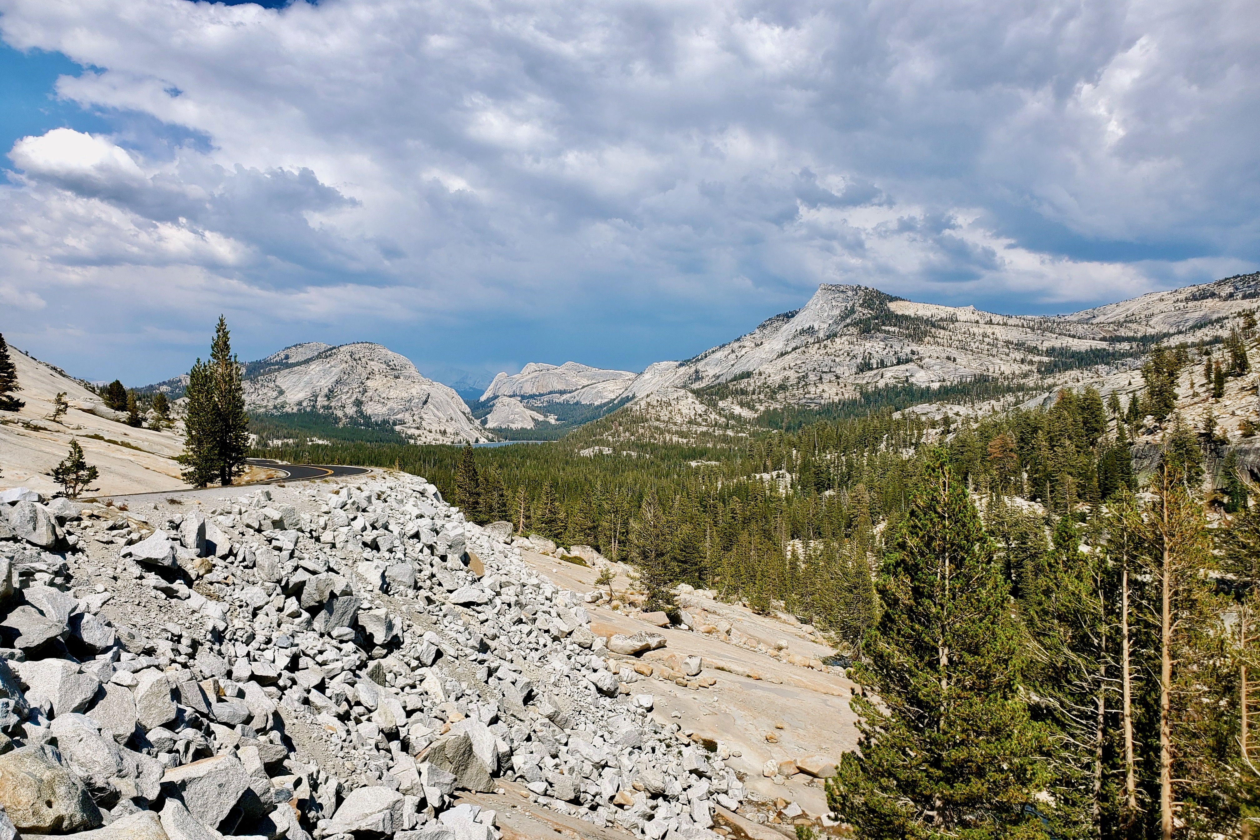
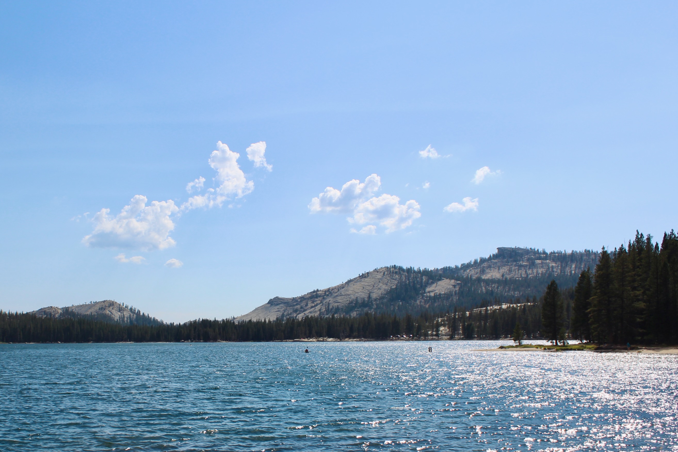
On our second day in Yosemite, we crossed the park from south to north with our trailer in tow. Tioga Road is Yosemite’s number one scenic drive, stretching for 46 miles from the heart of the park until the Tioga Pass Entrance in the east. The northern side of the park shows the valley from a different angle and is definitely worth exploring. We stopped at Olmsted Point and the beautiful Tenaya Lake, while taking in the sweeping views along Tioga Road.


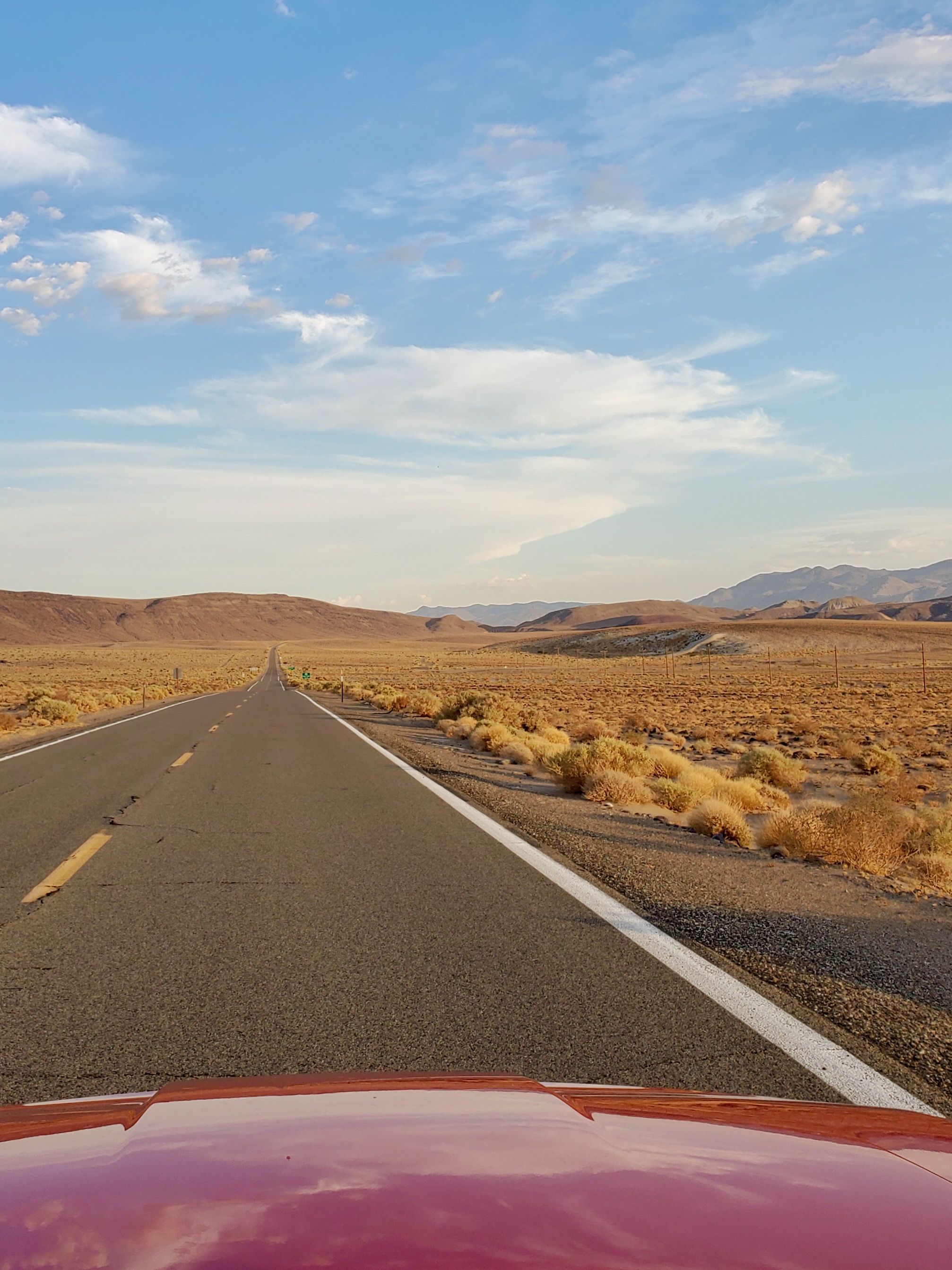
After exiting through the Tioga Pass Entrance, a scenic three-hour drive along US 395 leads to the Death Valley National Park entrance on CA 190. As we drove into the park during golden hour, we stopped at every corner to take pictures of the stunning scenery. Until we realized it was getting dark at record speed and the temperature was going up by the mile. We couldn’t have been happier when we made it to the Stovepipe Wells Hotel and Campground.


Camp: Stovepipe Wells Campground, Death Valley National Park
We were the only campers at Stovepipe Wells in August. Even at 9 PM, the temperature was above a 110 degrees. Luckily, we could use the hotel pool and showers to cool off. Stovepipe Wells is one of three campgrounds in the park that is no longer open in the summer months. The Furnace Creek Campground just around the corner does remain open year-round and offers full RV hookups. Camping without A/C in summer would be mission impossible.


Day 10: Death Valley National Park
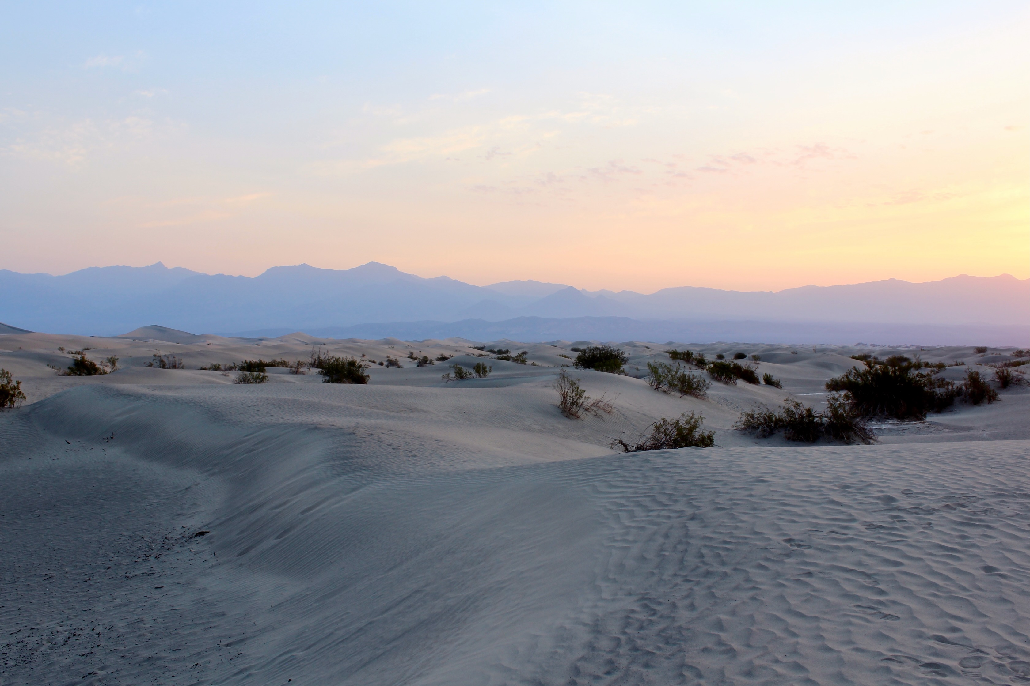
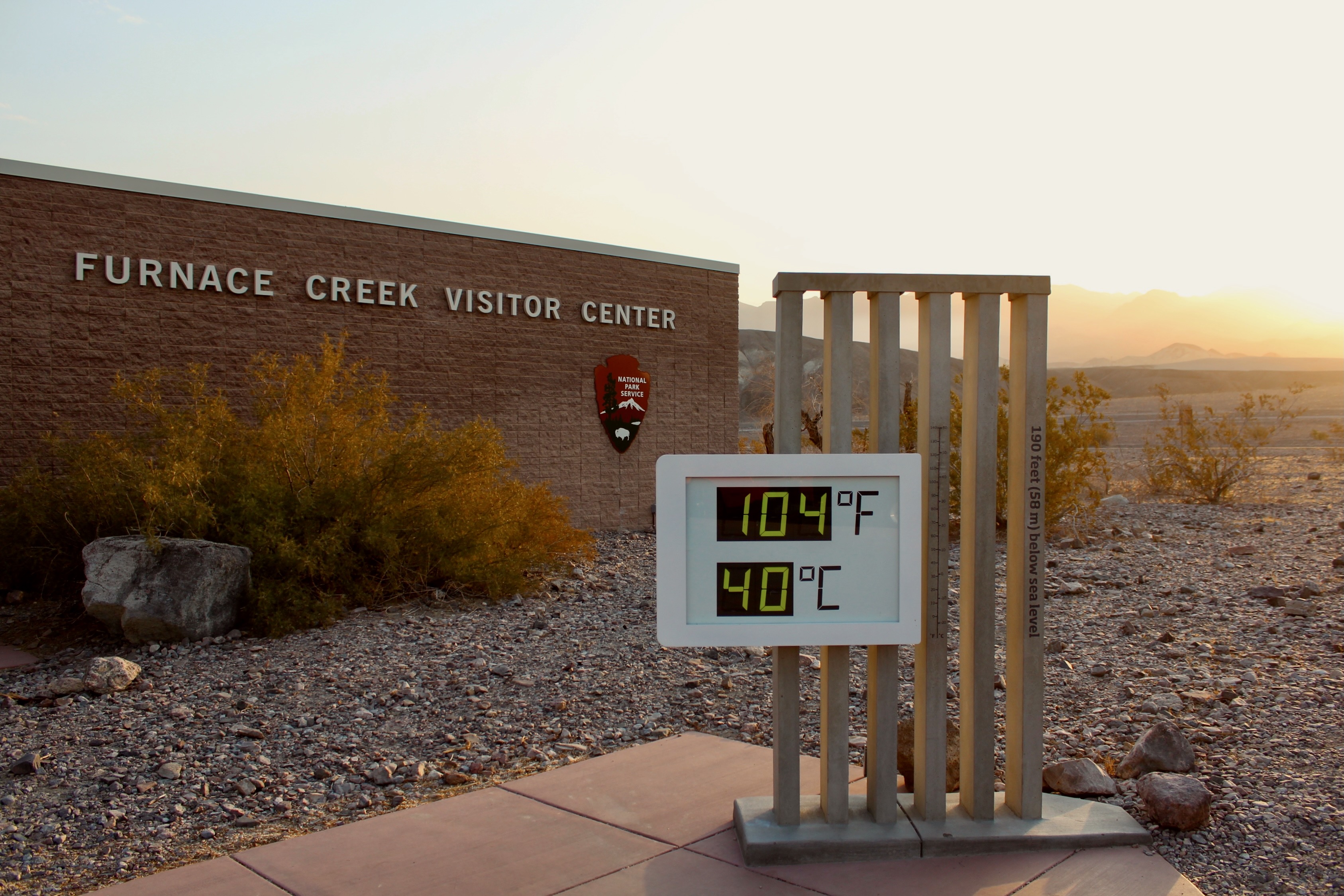
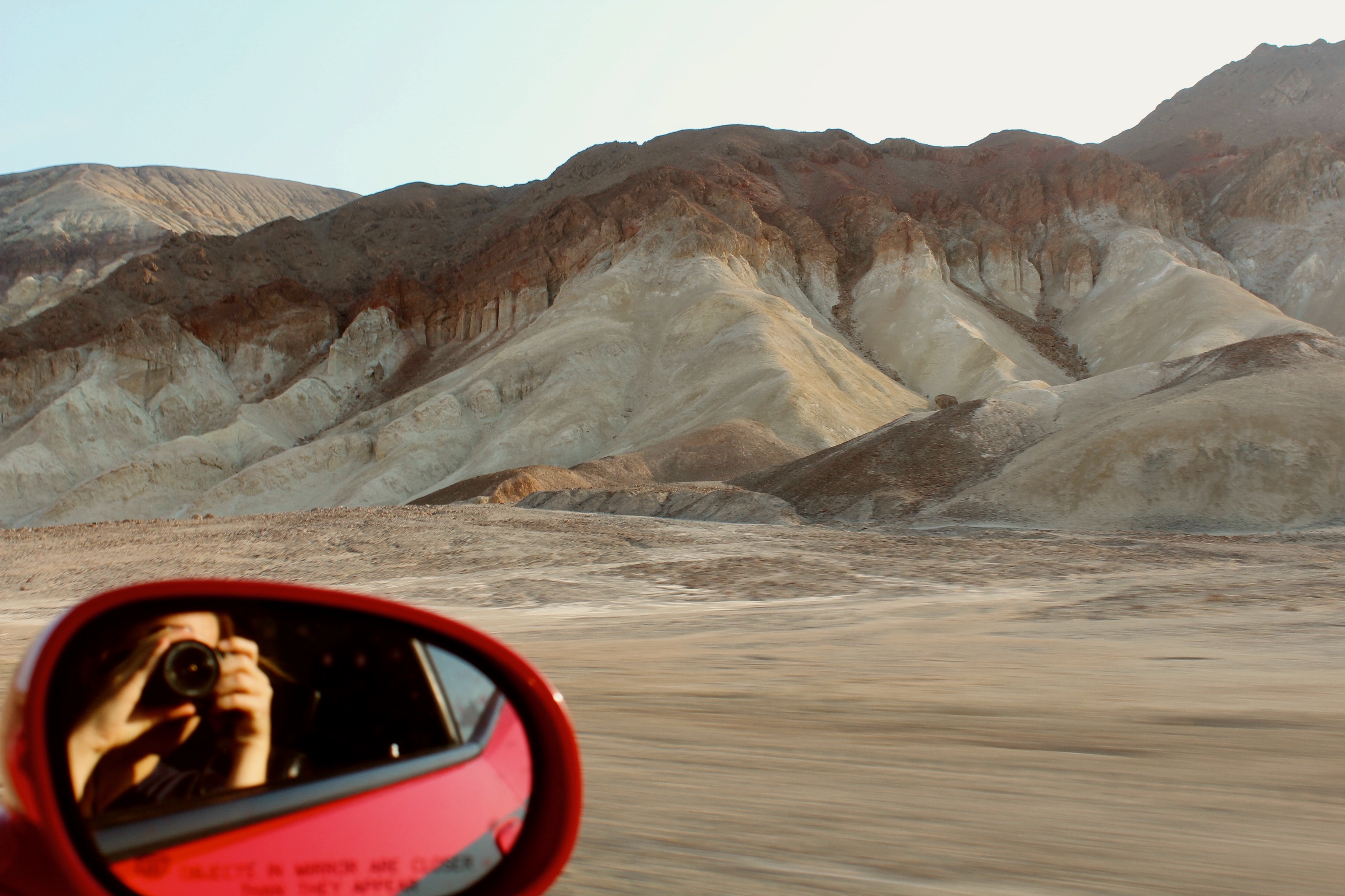
We visited Death Valley the day after the highest temperature on earth since 1931 was recorded, so we had the park practically to ourselves. We woke up at 5 AM with the plan to be out of the park by 10 AM, sticking to easily accessible viewpoints. If you are staying at Stovepipe Wells or Furnace Creek, the Mesquite Flat Sand Dunes are just around the corner. It’s a popular spot to watch the sunrise over the dunes. Death Valley’s thermometer is located next to the Furnace Creek Visitors Center.


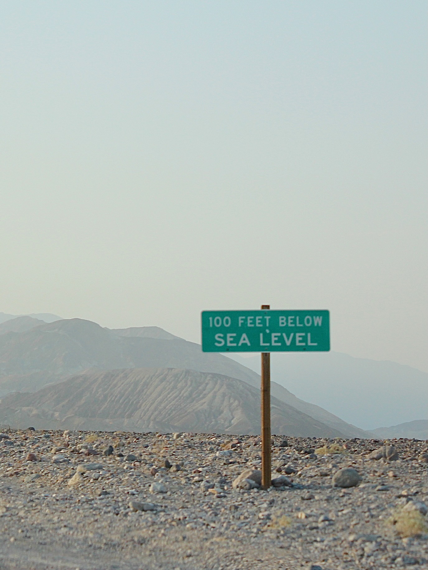
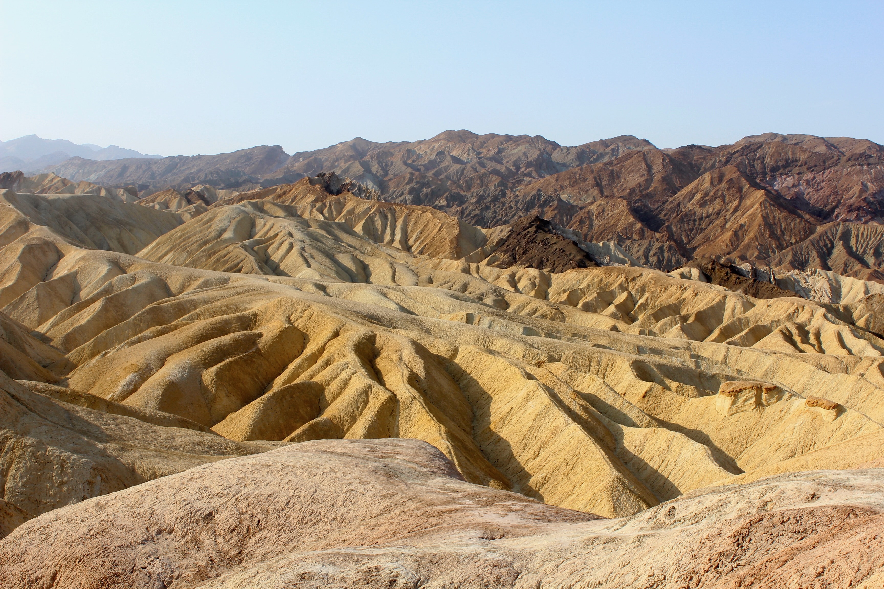
Right after Furnace Creek is the turnoff to Badwater Basin, the lowest point in the US at 282 feet below sea level. You can walk out onto the salt flat, but given the heat we didn’t make it very far. We had to bypass the park’s most scenic route, as Artists Drive is not accessible to vehicles longer than 25 feet. Before exiting the park through the Death Valley Junction, we took in spectacular views over the eroded dunes from Zabriskie Point.

This epic 10-day California itinerary ends on the border with Nevada, less than two hours from Las Vegas. We continued our road trip in the American Southwest. You can find our 7-day itinerary in Nevada, Utah and Arizona here.
Related Posts

Route 66 Road Trip: 10 Unique Stops from Texas to California
This iconic road trip covers 2,500 miles and 10 unique stops on and around Route 66 from Texas to California.

The Essential Southwest USA Road Trip: 7-Day Itinerary from Las Vegas
This 7-day road trip itinerary covers the essentials of Southwest USA, visiting highlights of Utah and Arizona on a loop from Las Vegas.

Las Vegas Road Trip Itinerary: 4 Days In America’s Wild West
Discover some of the best of America’s Wild West on this 4-day road trip from Las Vegas to Arizona and Utah.

Colorado to Utah: 4-Day National Park Road Trip from Denver
Visit three stunning national parks in Colorado and Utah on this 4-day road trip itinerary that starts and ends in Denver.

From Denver to Santa Fe: 4-Day Itinerary in Colorado & New Mexico
This 4-day road trip between Denver and Santa Fe comes with a packed itinerary of natural and man-made wonders.

The Ultimate Texas Road Trip: From Houston to Big Bend
This 5-day road trip travels from Houston to Big Bend, with stops in Austin, Marfa, San Antonio and some ghost towns along the way.

Leave a reply to olga Cancel reply